![](/images/other/stat-length.png)
![Trail Walking Jablines - SM_JABLINES_7.4Km - Photo](https://media.geolcdn.com/t/1900/400/ext.pjpeg?maxdim=2&url=https%3A%2F%2Fmedia.geolcdn.com%2Ff%2Fc8961113-df44-42a9-8e26-efaf3b924948.jpg)
SM_JABLINES_7.4Km
GR77LP
User
![Length](/images/other/stat-length.png)
Length
7.4 km
![Max alt](https://static1.geolcdn.com/siteimages/upload/files/1508320355ic_sort_altitude_max_24dp.png)
Max alt
48 m
![Uphill gradient](https://static1.geolcdn.com/siteimages/upload/files/1508320355ic_sort_den_pos_24dp.png)
Uphill gradient
44 m
![Km-Effort](/images/other/stat-length.png)
Km-Effort
8 km
![Min alt](https://static1.geolcdn.com/siteimages/upload/files/1508320355ic_sort_altitude_min_24dp.png)
Min alt
36 m
![Downhill gradient](https://static1.geolcdn.com/siteimages/upload/files/1508320355ic_sort_den_neg_24dp.png)
Downhill gradient
43 m
![Boucle](https://static1.geolcdn.com/siteimages/upload/files/16400158638029165_repeat_loop_refresh_sync_direction_icon.png)
Boucle
Yes
Creation date :
2019-03-04 12:59:19.56
Updated on :
2023-10-12 18:05:33.881
![Walking](https://static1.geolcdn.com/sitytour/trail-icons/101.png)
1h49
Difficulty : Medium
![Scan this QR Code to open this trail in the SityTrail application](https://capi.geolives.com/qq0zvz2zws4bq2lad0pu/sitytour/trails/905250/qr.png?size=200)
FREE GPS app for hiking
About
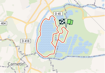
Trail Walking of 7.4 km to be discovered at Ile-de-France, Seine-et-Marne, Jablines. This trail is proposed by GR77LP.
Description
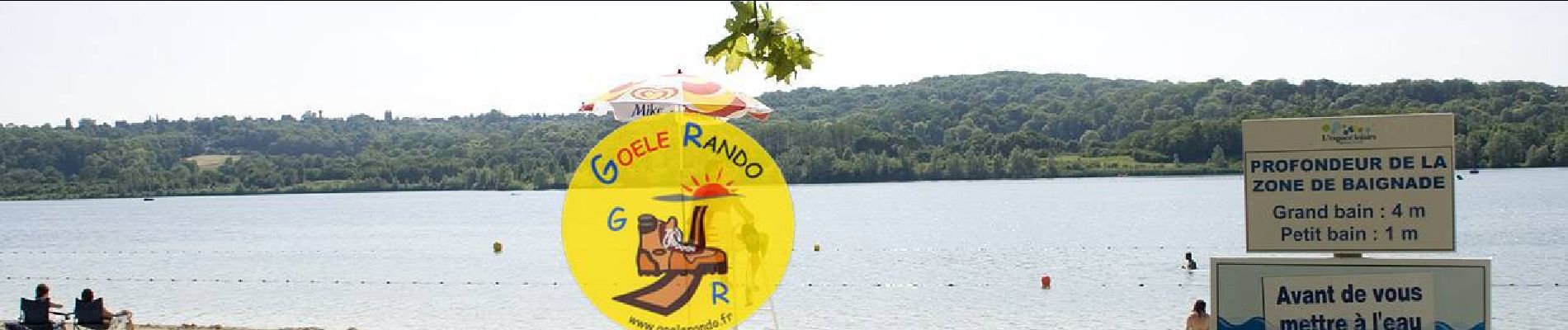
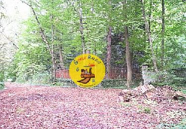
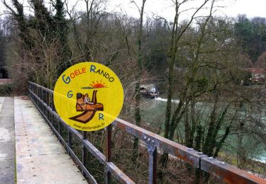
https://www.goelerando.fr/
DAMMARTIN en GOELE 77
Deuxième Parking Gratuit en saison hiver
(https://jablines-annet.iledeloisirs.fr/tarifs-entrees-particuliers.html)
Positioning
Country:
France
Region :
Ile-de-France
Department/Province :
Seine-et-Marne
Municipality :
Jablines
Location:
Unknown
Start:(Dec)
Start:(UTM)
480537 ; 5417976 (31U) N.
Comments
Trails nearby
![Trail Walking Dampmart - SM_DAMPMART-EST_8.1Km - Photo](https://media.geolcdn.com/t/375/260/ext.jpg?maxdim=2&url=https%3A%2F%2Fmedia.geolcdn.com%2Ff%2F6a085e8e-078f-48e9-8394-a9f3cb910770.jpg)
![Walking Walking](https://static1.geolcdn.com/sitytour/trail-icons/101.png)
SM_DAMPMART-EST_8.1Km
Walking
Medium
(3)
Dampmart,
Ile-de-France,
Seine-et-Marne,
France
![](/images/other/stat-length.png)
8.1 km | 9.5 km-effort
2h 9min
![](https://static1.geolcdn.com/siteimages/upload/files/16400158638029165_repeat_loop_refresh_sync_direction_icon.png)
Yes
![Trail Walking Coupvray - SM_COUPVRAY_7.8Km - Photo](https://media.geolcdn.com/t/375/260/ext.jpg?maxdim=2&url=https%3A%2F%2Fmedia.geolcdn.com%2Ff%2F75105a38-25f4-4fb7-9ca5-8fbd77a01d44.jpg)
![Walking Walking](https://static1.geolcdn.com/sitytour/trail-icons/101.png)
SM_COUPVRAY_7.8Km
Walking
Medium
(1)
Coupvray,
Ile-de-France,
Seine-et-Marne,
France
![](/images/other/stat-length.png)
7.8 km | 9.8 km-effort
2h 16min
![](https://static1.geolcdn.com/siteimages/upload/files/16400158638029165_repeat_loop_refresh_sync_direction_icon.png)
Yes
![Trail Walking Dampmart - ASAM Dampmart La Dhuys - Photo](https://media.geolcdn.com/t/375/260/ext.jpg?maxdim=2&url=https%3A%2F%2Fstatic1.geolcdn.com%2Fsiteimages%2Fupload%2Ffiles%2F1553511878bg_sport_marche.png)
![Walking Walking](https://static1.geolcdn.com/sitytour/trail-icons/101.png)
ASAM Dampmart La Dhuys
Walking
Easy
(1)
Dampmart,
Ile-de-France,
Seine-et-Marne,
France
![](/images/other/stat-length.png)
4.5 km | 5.4 km-effort
1h 13min
![](https://static1.geolcdn.com/siteimages/upload/files/16400158638029165_repeat_loop_refresh_sync_direction_icon.png)
Yes
![Trail Walking Dampmart - Dampmart Grand Parcours - Photo](https://media.geolcdn.com/t/375/260/ext.jpg?maxdim=2&url=https%3A%2F%2Fstatic1.geolcdn.com%2Fsiteimages%2Fupload%2Ffiles%2F1553511878bg_sport_marche.png)
![Walking Walking](https://static1.geolcdn.com/sitytour/trail-icons/101.png)
Dampmart Grand Parcours
Walking
Easy
(1)
Dampmart,
Ile-de-France,
Seine-et-Marne,
France
![](/images/other/stat-length.png)
19.5 km | 24 km-effort
5h 9min
![](https://static1.geolcdn.com/siteimages/upload/files/16400158638029165_repeat_loop_refresh_sync_direction_icon.png)
Yes
![Trail Walking Coupvray - Boucle Coupvray - Meaux - Photo](https://media.geolcdn.com/t/375/260/ext.jpg?maxdim=2&url=https%3A%2F%2Fmedia.geolcdn.com%2Ff%2F99914e9a-87b8-42e9-a845-46cbd1aef9bb.jpg)
![Walking Walking](https://static1.geolcdn.com/sitytour/trail-icons/101.png)
Boucle Coupvray - Meaux
Walking
Very difficult
Coupvray,
Ile-de-France,
Seine-et-Marne,
France
![](/images/other/stat-length.png)
30 km | 33 km-effort
6h 9min
![](https://static1.geolcdn.com/siteimages/upload/files/16400158638029165_repeat_loop_refresh_sync_direction_icon.png)
Yes
![Trail Walking Coupvray - Boucle > 30 km Coupvray -Meaux - Photo](https://media.geolcdn.com/t/375/260/ext.jpg?maxdim=2&url=https%3A%2F%2Fmedia.geolcdn.com%2Ff%2F1a6eabe0-97f0-4d36-8738-577eed6cd854.jpg)
![Walking Walking](https://static1.geolcdn.com/sitytour/trail-icons/101.png)
Boucle > 30 km Coupvray -Meaux
Walking
Very difficult
(1)
Coupvray,
Ile-de-France,
Seine-et-Marne,
France
![](/images/other/stat-length.png)
33 km | 37 km-effort
6h 28min
![](https://static1.geolcdn.com/siteimages/upload/files/16400158638029165_repeat_loop_refresh_sync_direction_icon.png)
Yes
![Trail Walking Dampmart - Boucle 23 km Dampmart Annet sur Marne Base de Jabeline - Photo](https://media.geolcdn.com/t/375/260/ext.jpg?maxdim=2&url=https%3A%2F%2Fmedia.geolcdn.com%2Ff%2Fb5b3d0bd-39cc-46d3-b0d4-bbe25a7dde4e.jpg)
![Walking Walking](https://static1.geolcdn.com/sitytour/trail-icons/101.png)
Boucle 23 km Dampmart Annet sur Marne Base de Jabeline
Walking
Medium
Dampmart,
Ile-de-France,
Seine-et-Marne,
France
![](/images/other/stat-length.png)
23 km | 27 km-effort
5h 11min
![](https://static1.geolcdn.com/siteimages/upload/files/16400158638029165_repeat_loop_refresh_sync_direction_icon.png)
Yes
![Trail Walking Dampmart - Boucle autour de Dampmart - Photo](https://media.geolcdn.com/t/375/260/ext.jpg?maxdim=2&url=https%3A%2F%2Fmedia.geolcdn.com%2Ff%2F5feb6ded-9010-40ac-8591-20a068c0f9dc.jpg)
![Walking Walking](https://static1.geolcdn.com/sitytour/trail-icons/101.png)
Boucle autour de Dampmart
Walking
Medium
Dampmart,
Ile-de-France,
Seine-et-Marne,
France
![](/images/other/stat-length.png)
22 km | 25 km-effort
6h 24min
![](https://static1.geolcdn.com/siteimages/upload/files/16400158638029165_repeat_loop_refresh_sync_direction_icon.png)
Yes
![Trail Walking Thorigny-sur-Marne - 8 juil. 2020 10:54:31 - Photo](https://media.geolcdn.com/t/375/260/ext.jpg?maxdim=2&url=https%3A%2F%2Fstatic1.geolcdn.com%2Fsiteimages%2Fupload%2Ffiles%2F1553511878bg_sport_marche.png)
![Walking Walking](https://static1.geolcdn.com/sitytour/trail-icons/101.png)
8 juil. 2020 10:54:31
Walking
Difficult
(1)
Thorigny-sur-Marne,
Ile-de-France,
Seine-et-Marne,
France
![](/images/other/stat-length.png)
15.8 km | 18.3 km-effort
4h 1min
![](https://static1.geolcdn.com/siteimages/upload/files/16400158638029165_repeat_loop_refresh_sync_direction_icon.png)
No
ggggg
Tr es belle randonne