


17,1 km | 25 km-effort


Usuario


Aplicación GPS de excursión GRATIS
 SityTrail
IGN / Institutos geográficos
SityTrail World
El mundo es suyo
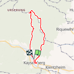
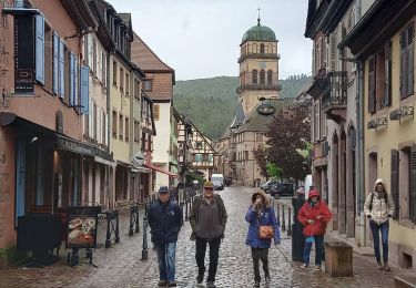
Ruta Senderismo de 11,5 km a descubrir en Gran Este, Alto Rin, Kaysersberg-Vignoble. Esta ruta ha sido propuesta por tracegps.
Circuit proposé par l'Office du Tourisme de la Vallée de Kaysersberg. Le départ se fait depuis le parking de la place Gouraud situé à la sortie de la vieille ville de Kaysersberg. Cette sortie peut se faire à la demi-journée, ou à la journée avec pique-nique ou repas à l’auberge St Alexis. Quel que soit votre choix, partez bien chaussé car le chemin qui descend vers le château de Kaysersberg est relativement difficile. Retrouvez le circuit sur le site de l'Office de Tourisme de Kaysersberg. Dans le massif Vosgien, n’oubliez pas de vous munir de la carte IGN avec le balisage du Club Vosgien.


Senderismo

Senderismo
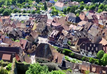
Senderismo
Paseo ecuestre

Senderismo
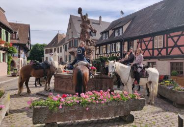
Paseo ecuestre

Senderismo

Senderismo
Senderismo
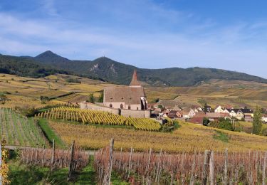
Très belle randonnée pour les amoureux de la forêt