![](/images/other/stat-length.png)
![Excursión Senderismo Gedinne - RB-Na-08 Dans la vallée de la Houille - Photo](https://media.geolcdn.com/t/1900/400/ext.pjpeg?maxdim=2&url=https%3A%2F%2Fservices.sitytrail.com%2FGeolivesWS%2FDownloadMedia.ashx%3FTrailID%3D179634%26Media%3D50c146e4-51ae-4441-b546-c84e45c04bf9.jpg)
RB-Na-08 Dans la vallée de la Houille
GR Rando
Randonnez sur et autour des GR ® wallons (Sentiers de Grande Randonnée). PRO
![Longitud](/images/other/stat-length.png)
![Altitud máxima](https://static1.geolcdn.com/siteimages/upload/files/1508320355ic_sort_altitude_max_24dp.png)
![Desnivel positivo](https://static1.geolcdn.com/siteimages/upload/files/1508320355ic_sort_den_pos_24dp.png)
![Km-Effort](/images/other/stat-length.png)
![Altitud mínima](https://static1.geolcdn.com/siteimages/upload/files/1508320355ic_sort_altitude_min_24dp.png)
![Desnivel negativo](https://static1.geolcdn.com/siteimages/upload/files/1508320355ic_sort_den_neg_24dp.png)
![Boucle](https://static1.geolcdn.com/siteimages/upload/files/16400158638029165_repeat_loop_refresh_sync_direction_icon.png)
![Senderismo](https://static1.geolcdn.com/sitytour/trail-icons/101.png)
6h00
Dificultad : Medio
![Escanee este código QR para abrir la excursión en la aplicación SityTrail](https://capi.geolives.com/qq0zvz2zws4bq2lad0pu/sitytour/trails/179634/qr.png?size=200)
Aplicación GPS de excursión GRATIS
A propósito
Ruta Senderismo de 22 km a descubrir en Valonia, Namur, Gedinne. Esta ruta ha sido propuesta por GR Rando.
Descripción
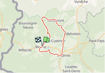
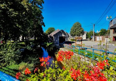
Rienne – Gedinne – Vencimont – Rienne
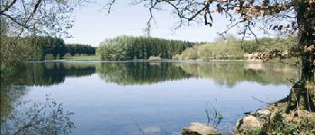
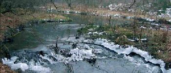
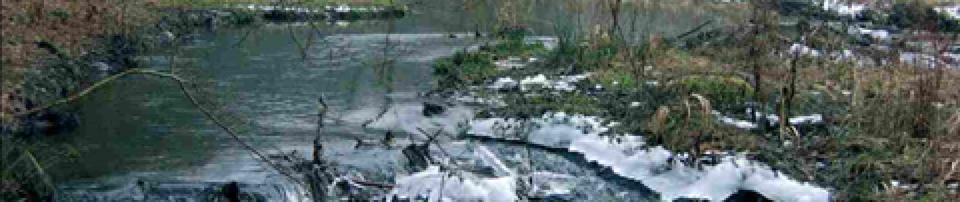
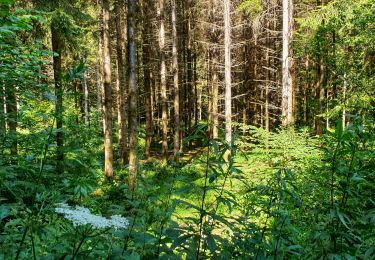
Cet itinéraire vous emmène dans un petit paradis sauvegardé. La Houille et son affluent la Hulle coulent des jours heureux à l’écart des foules touristiques qui hantent les vallées de la Semois, de l’Ourthe et de la Lesse. Dieu soit loué! Leurs vallons sont trop sauvages, trop encaissés pour accueillir les campings qui défigurent trop souvent leurs illustres consœurs. Et c’est tant mieux pour la quiétude des randonneurs ! Cet itinéraire s’articule sur le GR 126 et emprunte un réseau de promenades locales, presque toutes balisées.
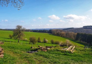
D’autre part, dans ce coin de l’Ardenne namuroise, les dénivelées restent modestes, bien moins ardues que dans la Famenne ou le Condroz !
Cartographie et documentation:
Cartes IGN au 1 : 20 000, 58/7-8 « Felenne – Vencimont » et 63/3-4 « Gedinne ».
Carte des promenades « Gedinne », au 1 : 25 000, éditée par l’Office du Tourisme de Gedinne et réalisée par l’IGN.
Topo-guide du GR 126 « Bruxelles – Namur – Membre-sur-Semois ».
Où se restaurer et se désaltérer :
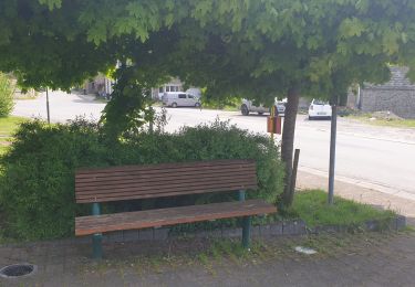
À Gedinne comme à Vencimont, vous trouverez restaurants et cafés à deux pas de l’itinéraire.
Localización
Comentarios
Excursiones cerca
![Excursión Senderismo Gedinne - RB-Na-30-La Croix-Scaille - Photo](https://media.geolcdn.com/t/375/260/ext.jpg?maxdim=2&url=https%3A%2F%2Fmedia.geolcdn.com%2Ff%2Fc32d3fde-8487-45ac-a4a4-b98e33c040a3.JPG)
![Senderismo Senderismo](https://static1.geolcdn.com/sitytour/trail-icons/101.png)
Senderismo
![](/images/other/stat-length.png)
![](https://static1.geolcdn.com/siteimages/upload/files/16400158638029165_repeat_loop_refresh_sync_direction_icon.png)
![Excursión Senderismo Gedinne - Gedinne - Circuit Natura 2000](https://media.geolcdn.com/t/375/260/ext.jpg?maxdim=2&url=https%3A%2F%2Fservices.sitytrail.com%2FGeolivesWS%2FDownloadMedia.ashx%3FTrailID%3D472278%26Media%3Dd7fd7a8f-ff34-456c-92bf-c54889e59e75.jpg)
![Senderismo Senderismo](https://static1.geolcdn.com/sitytour/trail-icons/101.png)
Senderismo
![](/images/other/stat-length.png)
![](https://static1.geolcdn.com/siteimages/upload/files/16400158638029165_repeat_loop_refresh_sync_direction_icon.png)
![Excursión Senderismo Gedinne - La vallée de la Houille - Rienne - Photo](https://media.geolcdn.com/t/375/260/ext.jpg?maxdim=2&url=https%3A%2F%2Fstatic1.geolcdn.com%2Fsiteimages%2Fupload%2Ffiles%2F1553511878bg_sport_marche.png)
![Senderismo Senderismo](https://static1.geolcdn.com/sitytour/trail-icons/101.png)
Senderismo
![](/images/other/stat-length.png)
![](https://static1.geolcdn.com/siteimages/upload/files/16400158638029165_repeat_loop_refresh_sync_direction_icon.png)
![Excursión Senderismo Gedinne - Balade à Willerzie - Gedinne - Photo](https://media.geolcdn.com/t/375/260/ext.jpg?maxdim=2&url=https%3A%2F%2Fmedia.geolcdn.com%2Ff%2F5ec22972-002a-40e1-b0ee-bd3232993f27.jpeg)
![Senderismo Senderismo](https://static1.geolcdn.com/sitytour/trail-icons/101.png)
Senderismo
![](/images/other/stat-length.png)
![](https://static1.geolcdn.com/siteimages/upload/files/16400158638029165_repeat_loop_refresh_sync_direction_icon.png)
![Excursión Senderismo Gedinne - Marche Adeps à Gedinne - Photo](https://media.geolcdn.com/t/375/260/ext.jpg?maxdim=2&url=https%3A%2F%2Fmedia.geolcdn.com%2Ff%2Fb2e3f402-523c-4b23-a693-153835da4cba.jpeg)
![Senderismo Senderismo](https://static1.geolcdn.com/sitytour/trail-icons/101.png)
Senderismo
![](/images/other/stat-length.png)
![](https://static1.geolcdn.com/siteimages/upload/files/16400158638029165_repeat_loop_refresh_sync_direction_icon.png)
![Excursión Senderismo Gedinne - Balade à Bourseigne-Neuve - Gedinne - Photo](https://media.geolcdn.com/t/375/260/ext.jpg?maxdim=2&url=https%3A%2F%2Fmedia.geolcdn.com%2Ff%2Ff19f68c3-6956-44c1-8199-6f68e99309b9.jpeg)
![Senderismo Senderismo](https://static1.geolcdn.com/sitytour/trail-icons/101.png)
Senderismo
![](/images/other/stat-length.png)
![](https://static1.geolcdn.com/siteimages/upload/files/16400158638029165_repeat_loop_refresh_sync_direction_icon.png)
![Excursión Senderismo Gedinne - Balade à Gedinne - Photo](https://media.geolcdn.com/t/375/260/ext.jpg?maxdim=2&url=https%3A%2F%2Fmedia.geolcdn.com%2Ff%2F92091b90-2951-4f34-a96b-1298e851235d.jpg)
![Senderismo Senderismo](https://static1.geolcdn.com/sitytour/trail-icons/101.png)
Senderismo
![](/images/other/stat-length.png)
![](https://static1.geolcdn.com/siteimages/upload/files/16400158638029165_repeat_loop_refresh_sync_direction_icon.png)
![Excursión Senderismo Gedinne - Balade de Bourseigne-Vieille à Vencimont - Photo](https://media.geolcdn.com/t/375/260/ext.jpg?maxdim=2&url=https%3A%2F%2Fmedia.geolcdn.com%2Ff%2F25a96cf8-0350-40e1-8c90-b4807b7178ca.jpeg)
![Senderismo Senderismo](https://static1.geolcdn.com/sitytour/trail-icons/101.png)
Senderismo
![](/images/other/stat-length.png)
![](https://static1.geolcdn.com/siteimages/upload/files/16400158638029165_repeat_loop_refresh_sync_direction_icon.png)
![Excursión Senderismo Gedinne - Balade de Vencimont à Sart-Custine - Photo](https://media.geolcdn.com/t/375/260/ext.jpg?maxdim=2&url=https%3A%2F%2Fmedia.geolcdn.com%2Ff%2F28bbf734-8e3f-4dce-b6d5-c49208a2184e.jpg)
![Senderismo Senderismo](https://static1.geolcdn.com/sitytour/trail-icons/101.png)
Senderismo
![](/images/other/stat-length.png)
![](https://static1.geolcdn.com/siteimages/upload/files/16400158638029165_repeat_loop_refresh_sync_direction_icon.png)
C'est bien à 7
Mooie vallei van de Houille maar teveel verharde stukken, zelfs de chemin touristique tussen Gedinne en Vincimont gaat nog een stuk over grote baan... Jammer 😢
71.435
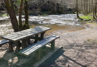
Beau parcours dommage pour les quelques tronçons de bitume