


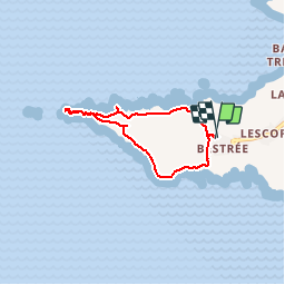

4,1 km | 5 km-effort


Usuario GUIDE


Aplicación GPS de excursión GRATIS
 SityTrail
IGN / Institutos geográficos
SityTrail World
El mundo es suyo
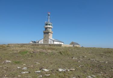
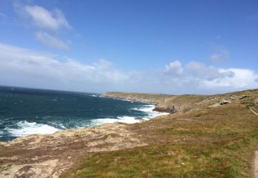
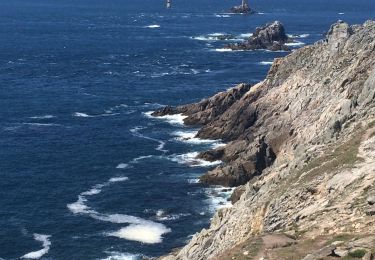
Ruta Senderismo de 5,3 km a descubrir en Bretaña, Finisterre, Plogoff. Esta ruta ha sido propuesta por amiral13.
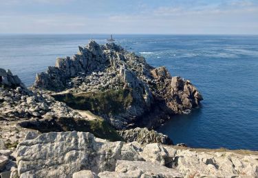
attention après le belvédère officiel un sentier difficile mène jusqu'à la pointe (utilisation des mains nécessaire par endroit) à vos risques et périls. A proscrire les jours de mauvais temps.


Senderismo
Senderismo
Senderismo
Senderismo
Senderismo
Senderismo
A pie
Senderismo