![](/images/other/stat-length.png)
![Excursión Senderismo Plogoff - TREK RCY GR34 J4 2022 Pointe du Raz/ baie des trépassés - Photo](https://media.geolcdn.com/t/1900/400/ext.pjpeg?maxdim=2&url=https%3A%2F%2Fmedia.geolcdn.com%2Ff%2F5d2c6731-b703-4e85-be24-5e5d9a1ced82.jpg)
TREK RCY GR34 J4 2022 Pointe du Raz/ baie des trépassés
chessyca
Usuario
![Longitud](/images/other/stat-length.png)
Longitud
13,9 km
![Altitud máxima](https://static1.geolcdn.com/siteimages/upload/files/1508320355ic_sort_altitude_max_24dp.png)
Altitud máxima
74 m
![Desnivel positivo](https://static1.geolcdn.com/siteimages/upload/files/1508320355ic_sort_den_pos_24dp.png)
Desnivel positivo
326 m
![Km-Effort](/images/other/stat-length.png)
Km-Effort
18,3 km
![Altitud mínima](https://static1.geolcdn.com/siteimages/upload/files/1508320355ic_sort_altitude_min_24dp.png)
Altitud mínima
0 m
![Desnivel negativo](https://static1.geolcdn.com/siteimages/upload/files/1508320355ic_sort_den_neg_24dp.png)
Desnivel negativo
332 m
![Boucle](https://static1.geolcdn.com/siteimages/upload/files/16400158638029165_repeat_loop_refresh_sync_direction_icon.png)
Boucle
No
Fecha de creación :
2022-06-04 09:13:22.267
Última modificación :
2022-06-09 16:43:44.519
![Senderismo](https://static1.geolcdn.com/sitytour/trail-icons/101.png)
3h42
Dificultad : Fácil
![Escanee este código QR para abrir la excursión en la aplicación SityTrail](https://capi.geolives.com/qq0zvz2zws4bq2lad0pu/sitytour/trails/3269572/qr.png?size=200)
Aplicación GPS de excursión GRATIS
A propósito
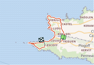
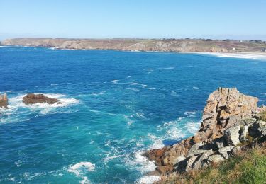
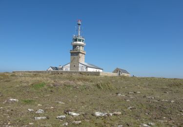
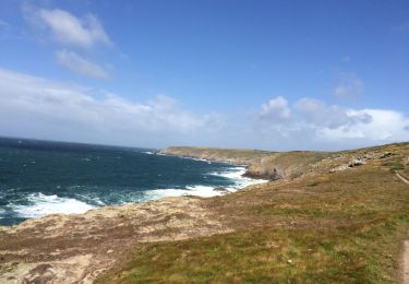
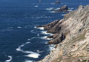
Ruta Senderismo de 13,9 km a descubrir en Bretaña, Finisterre, Plogoff. Esta ruta ha sido propuesta por chessyca.
Descripción
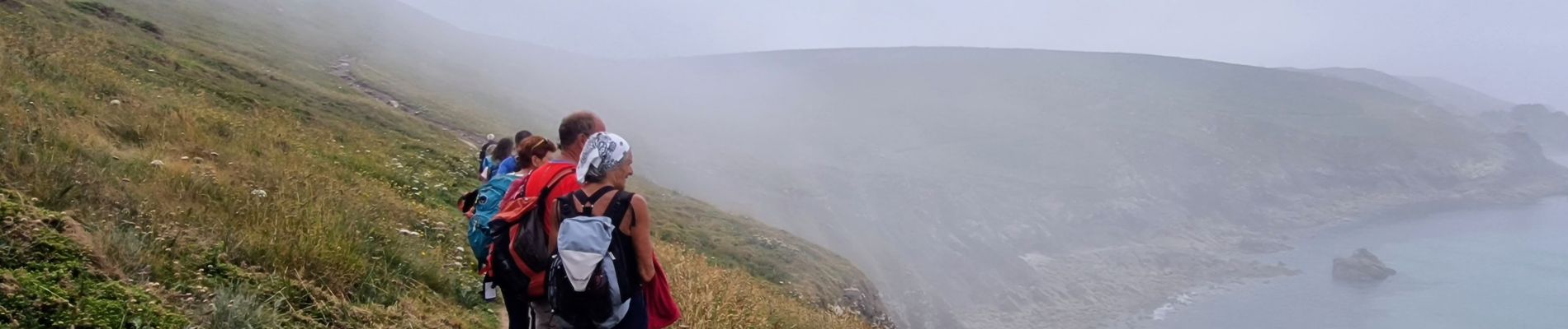
4ème jour du périple
étape un peu écourtée compte tenu des difficultés de coordination avec les horaires de bus et nos impératifs
Localización
País:
France
Región :
Bretaña
Departamento/provincia :
Finisterre
Municipio :
Plogoff
Localidad:
Unknown
Salida:(Dec)
Salida:(UTM)
373412 ; 5322140 (30U) N.
Comentarios
Excursiones cerca
![Excursión Senderismo Plogoff - la pointe du Raz - Photo](https://media.geolcdn.com/t/375/260/ext.jpg?maxdim=2&url=https%3A%2F%2Fmedia.geolcdn.com%2Ff%2F106b0dee-166f-4747-926b-7aeac04a59f3.jpg)
![Senderismo Senderismo](https://static1.geolcdn.com/sitytour/trail-icons/101.png)
la pointe du Raz
Senderismo
Difícil
Plogoff,
Bretaña,
Finisterre,
France
![](/images/other/stat-length.png)
5,3 km | 7 km-effort
2h 56min
![](https://static1.geolcdn.com/siteimages/upload/files/16400158638029165_repeat_loop_refresh_sync_direction_icon.png)
Sí
![Excursión Senderismo Plogoff - plogoff loual - Photo](https://media.geolcdn.com/t/375/260/ext.jpg?maxdim=2&url=https%3A%2F%2Fstatic1.geolcdn.com%2Fsiteimages%2Fupload%2Ffiles%2F1553511878bg_sport_marche.png)
![Senderismo Senderismo](https://static1.geolcdn.com/sitytour/trail-icons/101.png)
plogoff loual
Senderismo
Fácil
(1)
Plogoff,
Bretaña,
Finisterre,
France
![](/images/other/stat-length.png)
4,1 km | 5 km-effort
1h 8min
![](https://static1.geolcdn.com/siteimages/upload/files/16400158638029165_repeat_loop_refresh_sync_direction_icon.png)
Sí
![Excursión Senderismo Plogoff - la pointe du raz Bretagne - Photo](https://media.geolcdn.com/t/375/260/ext.jpg?maxdim=2&url=https%3A%2F%2Fstatic1.geolcdn.com%2Fsiteimages%2Fupload%2Ffiles%2F1553511878bg_sport_marche.png)
![Senderismo Senderismo](https://static1.geolcdn.com/sitytour/trail-icons/101.png)
la pointe du raz Bretagne
Senderismo
Muy fácil
(1)
Plogoff,
Bretaña,
Finisterre,
France
![](/images/other/stat-length.png)
6,8 km | 9 km-effort
2h 19min
![](https://static1.geolcdn.com/siteimages/upload/files/16400158638029165_repeat_loop_refresh_sync_direction_icon.png)
Sí
![Excursión Senderismo Cléden-Cap-Sizun - point du van - Photo](https://media.geolcdn.com/t/375/260/ext.jpg?maxdim=2&url=https%3A%2F%2Fstatic1.geolcdn.com%2Fsiteimages%2Fupload%2Ffiles%2F1553511878bg_sport_marche.png)
![Senderismo Senderismo](https://static1.geolcdn.com/sitytour/trail-icons/101.png)
point du van
Senderismo
Medio
(1)
Cléden-Cap-Sizun,
Bretaña,
Finisterre,
France
![](/images/other/stat-length.png)
10,6 km | 13,9 km-effort
Desconocido
![](https://static1.geolcdn.com/siteimages/upload/files/16400158638029165_repeat_loop_refresh_sync_direction_icon.png)
Sí
![Excursión Senderismo Cléden-Cap-Sizun - POINTE DU RAZ - Photo](https://media.geolcdn.com/t/375/260/ext.jpg?maxdim=2&url=https%3A%2F%2Fmedia.geolcdn.com%2Ff%2F50bf8e99-98ae-4340-8c1b-eb502686b93f.jpg)
![Senderismo Senderismo](https://static1.geolcdn.com/sitytour/trail-icons/101.png)
POINTE DU RAZ
Senderismo
Fácil
Cléden-Cap-Sizun,
Bretaña,
Finisterre,
France
![](/images/other/stat-length.png)
15,7 km | 20 km-effort
4h 38min
![](https://static1.geolcdn.com/siteimages/upload/files/16400158638029165_repeat_loop_refresh_sync_direction_icon.png)
Sí
![Excursión Senderismo Plogoff - pointe du Raz - Photo](https://media.geolcdn.com/t/375/260/ext.jpg?maxdim=2&url=https%3A%2F%2Fmedia.geolcdn.com%2Ff%2Ff0356271-982d-47aa-a59e-15ed79828940.jpg)
![Senderismo Senderismo](https://static1.geolcdn.com/sitytour/trail-icons/101.png)
pointe du Raz
Senderismo
Medio
Plogoff,
Bretaña,
Finisterre,
France
![](/images/other/stat-length.png)
6,4 km | 8,6 km-effort
2h 18min
![](https://static1.geolcdn.com/siteimages/upload/files/16400158638029165_repeat_loop_refresh_sync_direction_icon.png)
Sí
![Excursión A pie Plogoff - Circuit de la Pointe du Raz - Photo](https://media.geolcdn.com/t/375/260/ext.jpg?maxdim=2&url=https%3A%2F%2Fmedia.geolcdn.com%2Ff%2Fcfdf131d-62e2-4c50-8c6c-90ebd1a764c6.jpeg)
![A pie A pie](https://static1.geolcdn.com/sitytour/trail-icons/100.png)
Circuit de la Pointe du Raz
A pie
Fácil
(1)
Plogoff,
Bretaña,
Finisterre,
France
![](/images/other/stat-length.png)
8,8 km | 11,8 km-effort
2h 40min
![](https://static1.geolcdn.com/siteimages/upload/files/16400158638029165_repeat_loop_refresh_sync_direction_icon.png)
Sí
![Excursión Senderismo Plogoff - Fumoir - Photo](https://media.geolcdn.com/t/375/260/ext.jpg?maxdim=2&url=https%3A%2F%2Fmedia.geolcdn.com%2Ff%2Fcbfa4c2d-55b9-415e-a7a1-c92d7ac9f643.jpg)
![Senderismo Senderismo](https://static1.geolcdn.com/sitytour/trail-icons/101.png)
![Excursión Senderismo Cléden-Cap-Sizun - Pointe du van pointe du raz - Photo](https://media.geolcdn.com/t/375/260/ext.jpg?maxdim=2&url=https%3A%2F%2Fmedia.geolcdn.com%2Ff%2F1857f5ad-9770-4cbe-b7ed-d51ffcd87210.jpg)
![Senderismo Senderismo](https://static1.geolcdn.com/sitytour/trail-icons/101.png)
Pointe du van pointe du raz
Senderismo
Muy fácil
Cléden-Cap-Sizun,
Bretaña,
Finisterre,
France
![](/images/other/stat-length.png)
11,5 km | 15,4 km-effort
4h 48min
![](https://static1.geolcdn.com/siteimages/upload/files/16400158638029165_repeat_loop_refresh_sync_direction_icon.png)
No