![](/images/other/stat-length.png)
![Excursión Senderismo Saint-Germain-en-Laye - GRP CV-IDF 2023 - Photo](https://media.geolcdn.com/t/1900/400/ext.pjpeg?maxdim=2&url=https%3A%2F%2Fmedia.geolcdn.com%2Ff%2F9864db54-c566-4b60-8ec4-15499d0119f8.jpg)
GRP CV-IDF 2023
clalaur
Usuario
![Longitud](/images/other/stat-length.png)
Longitud
16,5 km
![Altitud máxima](https://static1.geolcdn.com/siteimages/upload/files/1508320355ic_sort_altitude_max_24dp.png)
Altitud máxima
135 m
![Desnivel positivo](https://static1.geolcdn.com/siteimages/upload/files/1508320355ic_sort_den_pos_24dp.png)
Desnivel positivo
209 m
![Km-Effort](/images/other/stat-length.png)
Km-Effort
19,1 km
![Altitud mínima](https://static1.geolcdn.com/siteimages/upload/files/1508320355ic_sort_altitude_min_24dp.png)
Altitud mínima
13 m
![Desnivel negativo](https://static1.geolcdn.com/siteimages/upload/files/1508320355ic_sort_den_neg_24dp.png)
Desnivel negativo
161 m
![Boucle](https://static1.geolcdn.com/siteimages/upload/files/16400158638029165_repeat_loop_refresh_sync_direction_icon.png)
Boucle
No
Fecha de creación :
2023-08-23 16:43:13.517
Última modificación :
2023-11-25 08:35:03.866
![Senderismo](https://static1.geolcdn.com/sitytour/trail-icons/101.png)
4h21
Dificultad : Muy difícil
![Escanee este código QR para abrir la excursión en la aplicación SityTrail](https://capi.geolives.com/qq0zvz2zws4bq2lad0pu/sitytour/trails/3782399/qr.png?size=200)
Aplicación GPS de excursión GRATIS
A propósito
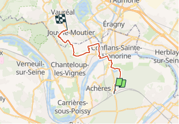
Ruta Senderismo de 16,5 km a descubrir en Isla de Francia, Yvelines, Saint-Germain-en-Laye. Esta ruta ha sido propuesta por clalaur.
Descripción
Rando faite le dans la matinée du vendredi 13 octobre 2023. Départ : Gare d'Achères - Grand-Cormier (RER A) : Arrivée : Arrêt Les Tremblays- (Bus STIVO 34)
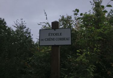
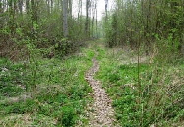
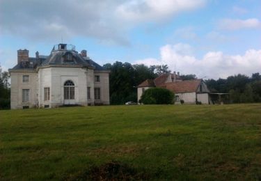
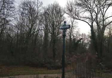
Localización
País:
France
Región :
Isla de Francia
Departamento/provincia :
Yvelines
Municipio :
Saint-Germain-en-Laye
Localidad:
Saint-Germain-en-Laye
Salida:(Dec)
Salida:(UTM)
433520 ; 5422865 (31U) N.
Comentarios
Excursiones cerca
![Excursión Senderismo Saint-Germain-en-Laye - circuit MA 271019 - Photo](https://media.geolcdn.com/t/375/260/ext.jpg?maxdim=2&url=https%3A%2F%2Fmedia.geolcdn.com%2Ff%2Fec0c3cc2-4262-481e-ac4c-e608d5354784.jpg)
![Senderismo Senderismo](https://static1.geolcdn.com/sitytour/trail-icons/101.png)
circuit MA 271019
Senderismo
Muy fácil
(1)
Saint-Germain-en-Laye,
Isla de Francia,
Yvelines,
France
![](/images/other/stat-length.png)
4,7 km | 5,2 km-effort
1h 3min
![](https://static1.geolcdn.com/siteimages/upload/files/16400158638029165_repeat_loop_refresh_sync_direction_icon.png)
Sí
![Excursión Senderismo Maisons-Laffitte - Forêt de Saint Germain en Laye - Photo](https://media.geolcdn.com/t/375/260/ext.jpg?maxdim=2&url=https%3A%2F%2Fservices.sitytrail.com%2FGeolivesWS%2FDownloadMedia.ashx%3FTrailID%3D110160%26Media%3D5360_1.jpg)
![Senderismo Senderismo](https://static1.geolcdn.com/sitytour/trail-icons/101.png)
Forêt de Saint Germain en Laye
Senderismo
Difícil
(2)
Maisons-Laffitte,
Isla de Francia,
Yvelines,
France
![](/images/other/stat-length.png)
22 km | 25 km-effort
4h 30min
![](https://static1.geolcdn.com/siteimages/upload/files/16400158638029165_repeat_loop_refresh_sync_direction_icon.png)
Sí
![Excursión Senderismo Saint-Germain-en-Laye - D'Achères Grand Cormier à Maison Laffitte - Photo](https://media.geolcdn.com/t/375/260/ext.jpg?maxdim=2&url=https%3A%2F%2Fservices.sitytrail.com%2FGeolivesWS%2FDownloadMedia.ashx%3FTrailID%3D106827%26Media%3D11535_2.jpg)
![Senderismo Senderismo](https://static1.geolcdn.com/sitytour/trail-icons/101.png)
D'Achères Grand Cormier à Maison Laffitte
Senderismo
Medio
(1)
Saint-Germain-en-Laye,
Isla de Francia,
Yvelines,
France
![](/images/other/stat-length.png)
12,9 km | 14,4 km-effort
3h 0min
![](https://static1.geolcdn.com/siteimages/upload/files/16400158638029165_repeat_loop_refresh_sync_direction_icon.png)
No
![Excursión Senderismo Saint-Germain-en-Laye - 20230824 5S 5KM - Photo](https://media.geolcdn.com/t/375/260/ext.jpg?maxdim=2&url=https%3A%2F%2Fstatic1.geolcdn.com%2Fsiteimages%2Fupload%2Ffiles%2F1553511878bg_sport_marche.png)
![Senderismo Senderismo](https://static1.geolcdn.com/sitytour/trail-icons/101.png)
20230824 5S 5KM
Senderismo
Medio
(1)
Saint-Germain-en-Laye,
Isla de Francia,
Yvelines,
France
![](/images/other/stat-length.png)
5,5 km | 6,3 km-effort
1h 25min
![](https://static1.geolcdn.com/siteimages/upload/files/16400158638029165_repeat_loop_refresh_sync_direction_icon.png)
Sí
![Excursión Senderismo Saint-Germain-en-Laye - SityTrail - 202230519 RS 5km - Photo](https://media.geolcdn.com/t/375/260/ext.jpg?maxdim=2&url=https%3A%2F%2Fstatic1.geolcdn.com%2Fsiteimages%2Fupload%2Ffiles%2F1553511878bg_sport_marche.png)
![Senderismo Senderismo](https://static1.geolcdn.com/sitytour/trail-icons/101.png)
SityTrail - 202230519 RS 5km
Senderismo
Fácil
(1)
Saint-Germain-en-Laye,
Isla de Francia,
Yvelines,
France
![](/images/other/stat-length.png)
5 km | 5,6 km-effort
1h 16min
![](https://static1.geolcdn.com/siteimages/upload/files/16400158638029165_repeat_loop_refresh_sync_direction_icon.png)
Sí
![Excursión Senderismo Maisons-Laffitte - 20220909 RS - Photo](https://media.geolcdn.com/t/375/260/ext.jpg?maxdim=2&url=https%3A%2F%2Fstatic1.geolcdn.com%2Fsiteimages%2Fupload%2Ffiles%2F1553511878bg_sport_marche.png)
![Senderismo Senderismo](https://static1.geolcdn.com/sitytour/trail-icons/101.png)
20220909 RS
Senderismo
Medio
(1)
Maisons-Laffitte,
Isla de Francia,
Yvelines,
France
![](/images/other/stat-length.png)
5,7 km | 6,4 km-effort
1h 26min
![](https://static1.geolcdn.com/siteimages/upload/files/16400158638029165_repeat_loop_refresh_sync_direction_icon.png)
Sí
![Excursión Senderismo Saint-Germain-en-Laye - 20220220 Petite boucle en forêt de Sy Germain - Photo](https://media.geolcdn.com/t/375/260/ext.jpg?maxdim=2&url=https%3A%2F%2Fstatic1.geolcdn.com%2Fsiteimages%2Fupload%2Ffiles%2F1553511878bg_sport_marche.png)
![Senderismo Senderismo](https://static1.geolcdn.com/sitytour/trail-icons/101.png)
20220220 Petite boucle en forêt de Sy Germain
Senderismo
Fácil
(1)
Saint-Germain-en-Laye,
Isla de Francia,
Yvelines,
France
![](/images/other/stat-length.png)
8,2 km | 9,2 km-effort
50min
![](https://static1.geolcdn.com/siteimages/upload/files/16400158638029165_repeat_loop_refresh_sync_direction_icon.png)
Sí
![Excursión Senderismo Saint-Germain-en-Laye - Circuit MA 151219 - Photo](https://media.geolcdn.com/t/375/260/ext.jpg?maxdim=2&url=https%3A%2F%2Fmedia.geolcdn.com%2Ff%2F569e8f34-02aa-4776-807c-cdcab1bc2616.jpg)
![Senderismo Senderismo](https://static1.geolcdn.com/sitytour/trail-icons/101.png)
Circuit MA 151219
Senderismo
Muy fácil
(1)
Saint-Germain-en-Laye,
Isla de Francia,
Yvelines,
France
![](/images/other/stat-length.png)
6,7 km | 7,5 km-effort
1h 26min
![](https://static1.geolcdn.com/siteimages/upload/files/16400158638029165_repeat_loop_refresh_sync_direction_icon.png)
Sí
![Excursión Marcha nórdica Saint-Germain-en-Laye - SityTrail - MN CDN 14 KM MARE AUX CANES - Photo](https://media.geolcdn.com/t/375/260/ext.jpg?maxdim=2&url=https%3A%2F%2Fstatic1.geolcdn.com%2Fsiteimages%2Fupload%2Ffiles%2F1545311037marcheuse_200dpi.jpg)
![Marcha nórdica Marcha nórdica](https://static1.geolcdn.com/sitytour/trail-icons/102.png)
SityTrail - MN CDN 14 KM MARE AUX CANES
Marcha nórdica
Muy fácil
(1)
Saint-Germain-en-Laye,
Isla de Francia,
Yvelines,
France
![](/images/other/stat-length.png)
13,9 km | 15,6 km-effort
2h 0min
![](https://static1.geolcdn.com/siteimages/upload/files/16400158638029165_repeat_loop_refresh_sync_direction_icon.png)
No