![](/images/other/stat-length.png)
![Excursión Senderismo Notre-Dame-de-Londres - garrigues de Saint martin de Londres - pont de Masclac - ravin des Arcs - rive gauche - Photo](https://media.geolcdn.com/t/1900/400/ext.pjpeg?maxdim=2&url=https%3A%2F%2Fstatic1.geolcdn.com%2Fsiteimages%2Fupload%2Ffiles%2F1553511878bg_sport_marche.png)
garrigues de Saint martin de Londres - pont de Masclac - ravin des Arcs - rive gauche
vertygo
Usuario
![Longitud](/images/other/stat-length.png)
Longitud
4,1 km
![Altitud máxima](https://static1.geolcdn.com/siteimages/upload/files/1508320355ic_sort_altitude_max_24dp.png)
Altitud máxima
245 m
![Desnivel positivo](https://static1.geolcdn.com/siteimages/upload/files/1508320355ic_sort_den_pos_24dp.png)
Desnivel positivo
156 m
![Km-Effort](/images/other/stat-length.png)
Km-Effort
6,1 km
![Altitud mínima](https://static1.geolcdn.com/siteimages/upload/files/1508320355ic_sort_altitude_min_24dp.png)
Altitud mínima
151 m
![Desnivel negativo](https://static1.geolcdn.com/siteimages/upload/files/1508320355ic_sort_den_neg_24dp.png)
Desnivel negativo
148 m
![Boucle](https://static1.geolcdn.com/siteimages/upload/files/16400158638029165_repeat_loop_refresh_sync_direction_icon.png)
Boucle
Sí
Fecha de creación :
2017-05-29 00:00:00.0
Última modificación :
2017-05-29 00:00:00.0
![Senderismo](https://static1.geolcdn.com/sitytour/trail-icons/101.png)
1h16
Dificultad : Fácil
![Escanee este código QR para abrir la excursión en la aplicación SityTrail](https://capi.geolives.com/qq0zvz2zws4bq2lad0pu/sitytour/trails/754079/qr.png?size=200)
Aplicación GPS de excursión GRATIS
A propósito
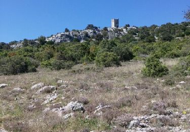
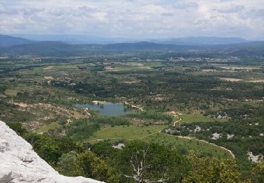
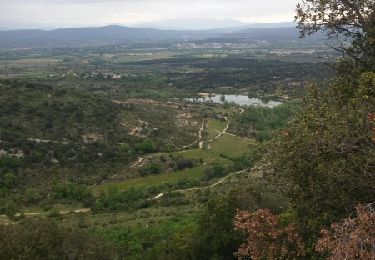
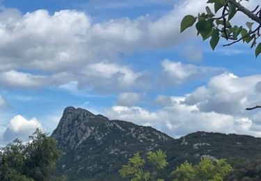
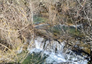
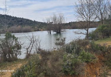
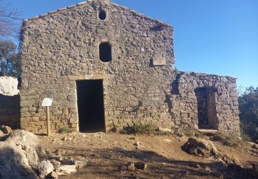
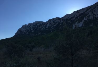
Ruta Senderismo de 4,1 km a descubrir en Occitania, Hérault, Notre-Dame-de-Londres. Esta ruta ha sido propuesta por vertygo.
Descripción
cliquer pour <a href=https://goo.gl/photos/GgefAzu6XfY5fEeD7 target=_blank>voir des photos</a> - d'autres parcours sur <a href='http://www.vertygo.org' target=_blank> www.vertygo.org</a>
Localización
País:
France
Región :
Occitania
Departamento/provincia :
Hérault
Municipio :
Notre-Dame-de-Londres
Localidad:
Unknown
Salida:(Dec)
Salida:(UTM)
559665 ; 4851246 (31T) N.
Comentarios
Excursiones cerca
![Excursión Senderismo Cazevieille - le tour du pic st loup - Photo](https://media.geolcdn.com/t/375/260/ext.jpg?maxdim=2&url=https%3A%2F%2Fservices.sitytrail.com%2FGeolivesWS%2FDownloadMedia.ashx%3FTrailID%3D564155%26Media%3Dfix__20160505154449.jpg)
![Senderismo Senderismo](https://static1.geolcdn.com/sitytour/trail-icons/101.png)
le tour du pic st loup
Senderismo
Medio
(1)
Cazevieille,
Occitania,
Hérault,
France
![](/images/other/stat-length.png)
11,4 km | 19,8 km-effort
4h 34min
![](https://static1.geolcdn.com/siteimages/upload/files/16400158638029165_repeat_loop_refresh_sync_direction_icon.png)
Sí
![Excursión Senderismo Cazevieille - cazevieille-pic st loup-lac fe la jasse - Photo](https://media.geolcdn.com/t/375/260/ext.jpg?maxdim=2&url=https%3A%2F%2Fservices.sitytrail.com%2FGeolivesWS%2FDownloadMedia.ashx%3FTrailID%3D579300%26Media%3Dfix__20160604134108.jpg)
![Senderismo Senderismo](https://static1.geolcdn.com/sitytour/trail-icons/101.png)
cazevieille-pic st loup-lac fe la jasse
Senderismo
Difícil
(2)
Cazevieille,
Occitania,
Hérault,
France
![](/images/other/stat-length.png)
14,7 km | 23 km-effort
5h 21min
![](https://static1.geolcdn.com/siteimages/upload/files/16400158638029165_repeat_loop_refresh_sync_direction_icon.png)
Sí
![Excursión Marcha nórdica Cazevieille - cazevieille + lac de la jasse - Photo](https://media.geolcdn.com/t/375/260/ext.jpg?maxdim=2&url=https%3A%2F%2Fservices.sitytrail.com%2FGeolivesWS%2FDownloadMedia.ashx%3FTrailID%3D565622%26Media%3Dfix__20160508095919.jpg)
![Marcha nórdica Marcha nórdica](https://static1.geolcdn.com/sitytour/trail-icons/102.png)
cazevieille + lac de la jasse
Marcha nórdica
Medio
(1)
Cazevieille,
Occitania,
Hérault,
France
![](/images/other/stat-length.png)
9,5 km | 13,6 km-effort
2h 32min
![](https://static1.geolcdn.com/siteimages/upload/files/16400158638029165_repeat_loop_refresh_sync_direction_icon.png)
Sí
![Excursión Senderismo Notre-Dame-de-Londres - Ravin des Arc 01 - Photo](https://media.geolcdn.com/t/375/260/ext.jpg?maxdim=2&url=https%3A%2F%2Fstatic1.geolcdn.com%2Fsiteimages%2Fupload%2Ffiles%2F1553511878bg_sport_marche.png)
![Senderismo Senderismo](https://static1.geolcdn.com/sitytour/trail-icons/101.png)
Ravin des Arc 01
Senderismo
Medio
(3)
Notre-Dame-de-Londres,
Occitania,
Hérault,
France
![](/images/other/stat-length.png)
5,9 km | 8,6 km-effort
1h 53min
![](https://static1.geolcdn.com/siteimages/upload/files/16400158638029165_repeat_loop_refresh_sync_direction_icon.png)
Sí
![Excursión Senderismo Mas-de-Londres - La Jasse Cazevieille par l’ubac - Photo](https://media.geolcdn.com/t/375/260/ext.jpg?maxdim=2&url=https%3A%2F%2Fmedia.geolcdn.com%2Ff%2F9a13e1f3-2499-4387-bf75-45d970603d81.jpg)
![Senderismo Senderismo](https://static1.geolcdn.com/sitytour/trail-icons/101.png)
La Jasse Cazevieille par l’ubac
Senderismo
Medio
Mas-de-Londres,
Occitania,
Hérault,
France
![](/images/other/stat-length.png)
12,6 km | 16 km-effort
3h 43min
![](https://static1.geolcdn.com/siteimages/upload/files/16400158638029165_repeat_loop_refresh_sync_direction_icon.png)
Sí
![Excursión Senderismo Notre-Dame-de-Londres - ND-de-Londres_Chutes_Lamalou - Photo](https://media.geolcdn.com/t/375/260/ext.jpg?maxdim=2&url=https%3A%2F%2Fmedia.geolcdn.com%2Ff%2Fcc86ec54-6797-4ec2-b4ff-89965130e43a.jpg)
![Senderismo Senderismo](https://static1.geolcdn.com/sitytour/trail-icons/101.png)
ND-de-Londres_Chutes_Lamalou
Senderismo
Medio
Notre-Dame-de-Londres,
Occitania,
Hérault,
France
![](/images/other/stat-length.png)
11,5 km | 14,2 km-effort
3h 30min
![](https://static1.geolcdn.com/siteimages/upload/files/16400158638029165_repeat_loop_refresh_sync_direction_icon.png)
Sí
![Excursión Senderismo Saint-Martin-de-Londres - Saint-Martin-de-Londres-la-jasse - Photo](https://media.geolcdn.com/t/375/260/ext.jpg?maxdim=2&url=https%3A%2F%2Fmedia.geolcdn.com%2Ff%2F42714f9a-1fe4-412e-91c6-2e130dc1d617.jpg)
![Senderismo Senderismo](https://static1.geolcdn.com/sitytour/trail-icons/101.png)
Saint-Martin-de-Londres-la-jasse
Senderismo
Medio
Saint-Martin-de-Londres,
Occitania,
Hérault,
France
![](/images/other/stat-length.png)
14,4 km | 17,1 km-effort
4h 16min
![](https://static1.geolcdn.com/siteimages/upload/files/16400158638029165_repeat_loop_refresh_sync_direction_icon.png)
Sí
![Excursión Senderismo Cazevieille - Pic St Loup + Crête 16.12.23 - Photo](https://media.geolcdn.com/t/375/260/ext.jpg?maxdim=2&url=https%3A%2F%2Fmedia.geolcdn.com%2Ff%2Fbfdaf89a-9773-4f5d-a083-c292c0cb02a4.jpg)
![Senderismo Senderismo](https://static1.geolcdn.com/sitytour/trail-icons/101.png)
Pic St Loup + Crête 16.12.23
Senderismo
Difícil
Cazevieille,
Occitania,
Hérault,
France
![](/images/other/stat-length.png)
6,7 km | 11,6 km-effort
4h 15min
![](https://static1.geolcdn.com/siteimages/upload/files/16400158638029165_repeat_loop_refresh_sync_direction_icon.png)
Sí
![Excursión Senderismo Mas-de-Londres - tour du Pic St Loup - Photo](https://media.geolcdn.com/t/375/260/ext.jpg?maxdim=2&url=https%3A%2F%2Fmedia.geolcdn.com%2Ff%2F454f4453-86c9-48a0-8b22-c42a379f5d4f.jpg)
![Senderismo Senderismo](https://static1.geolcdn.com/sitytour/trail-icons/101.png)
tour du Pic St Loup
Senderismo
Medio
Mas-de-Londres,
Occitania,
Hérault,
France
![](/images/other/stat-length.png)
14,8 km | 23 km-effort
4h 30min
![](https://static1.geolcdn.com/siteimages/upload/files/16400158638029165_repeat_loop_refresh_sync_direction_icon.png)
Sí