


12,8 km | 15,8 km-effort
Charleroi : découvrez les meilleures randonnées : 10 a pied, 264 marche, 53 marche nordique, 5 course à pied et 3 trail. Tous ces circuits, parcours, itinéraires et activités en plein air sont disponibles dans nos applications SityTrail pour smartphones et tablettes.
Marche


• Cette balade est une version raccourcie de la boucle noire du GR 412.Cette balade offre des paysages contrastés mais ...
Marche
• La Maison du Tourisme du Pays de Charleroi vous propose la promenade du bois de Heigne, elle emprunte un chemin pavé...
Marche
• Le château de Monceau-sur-Sambre est entouré d’un parc de 67 hectares et abrite un arboretum qui permet de découvrir ...
Marche
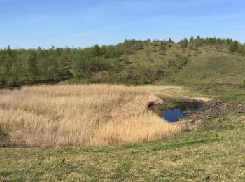
• Un « pays noir » s’est métamorphosé en « pays vert » ! Tout proche de la cité industrielle, la traversée d’un chapele...
Marche
• 3 terrils...fléchage rectangle rouge...dur
Marche
• Un « pays noir » s’est métamorphosé en « pays vert » ! Tout proche de la cité industrielle, la traversée d’un chapele...
Marche
• boucle dans le quartier

Marche
• Détails de la rando sur TraceGPS.com http://www.tracegps.com/fr/parcours/circuit11743.htm
Marche
• Détails de la rando sur TraceGPS.com http://www.tracegps.com/fr/parcours/circuit11706.htm
Marche
• Rando en boucle au départ de la Place Frédérique à Roux (au pied des terrils du Martinet), par le le petit terril du ...
Marche
• Rando en boucle au départ de la Place Frédérique à Roux (au pied des terrils du Martinet), par le le petit terril du ...
Marche
• Départ : Place Frédérique à Roux (au pied des terrils du Martinet) Rando en ligne : sommet du grand terril du Martine...

A pied
• Randonnée créée par Pays de Charleroi. Cette promenade dévoile les différents visages typiques d'une ancienne com...

A pied
• Randonnée créée par Pays de Charleroi. Quelques dizaines de mètres après le parking, c'est un tout autre Charlero...
A pied
• Randonnée créée par Pays de Charleroi. Un tronçon de pré-RAVeL permet de vous échauffer avant d'être propulsé sur...
Marche
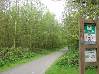
• Du Métro Moulin au Métro Piges sur la Boucle Noire via les mini-terrils (buttes) du Parc de Monceau et via la borne d...
Marche
• Pays de Charleroi Départ: Centre social de délassement
Marche
• Marche Jumet
Marche
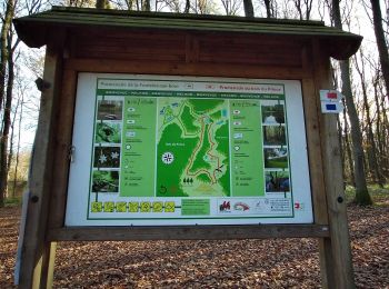
• La Maison du Tourisme du Pays de Charleroi vous propose cette magnifiques promenade dans la plus grande zone boisée d...
Marche
• bois
20 randonnées affichées sur 334
Application GPS de randonnée GRATUITE
 SityTrail
IGN / Instituts géographiques
SityTrail World
Le monde est à vous