Tautavel, Pyrénées-Orientales, A pied : Les meilleures randonnées, itinéraires, parcours, balades et promenades

5 commentaires

Tautavel : découvrez les meilleures randonnées : 1 a pied et 21 marche. Tous ces circuits, parcours, itinéraires et activités en plein air sont disponibles dans nos applications SityTrail pour smartphones et tablettes.


Les meilleurs parcours (22)

Randonnée Marche Tautavel - Tautavel chemin des bacs - Photo
Marche 9.469
Km

Marche

Facile
(3)
Tautavel, Occitanie, Pyrénées-Orientales, France
9,5 km | 12,4 km-effort
2h 30min
218 m
218 m
Oui
jcmartin

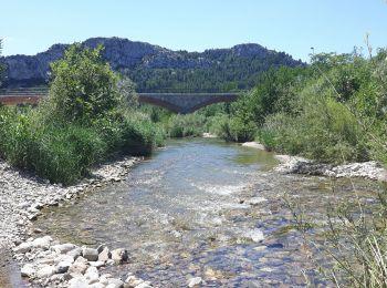
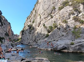
• Sentier de randonnée balisé en jaune au départ de Tautavel qui longe le ruisseau du Verdouble jusqu'aux gorges de Gou...

Randonnée Marche Tautavel - les gorges . tautavel par les vignes  ..  retour par la vallée - Photo
Marche 8.222
Km
GUIDE

Marche

Facile
Tautavel, Occitanie, Pyrénées-Orientales, France
8,2 km | 11 km-effort
2h 57min
214 m
202 m
Non
stef789

Randonnée Marche Tautavel - TAUTAVEL la Tour del Far A/R - Photo
Marche 6.267
Km

Marche

Moyen
Tautavel, Occitanie, Pyrénées-Orientales, France
6,3 km | 11,4 km-effort
3h 55min
383 m
385 m
Oui
MarieFrancoise

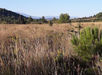
• Très jolie rando avec de beaux panoramas Départ du parking de la cavé prendre les escaliers jusqu au musée de la préh...

Randonnée Marche Tautavel - Tautavel -Torre del Far - Photo
Marche 9.477
Km

Marche

Moyen
(2)
Tautavel, Occitanie, Pyrénées-Orientales, France
9,5 km | 15,4 km-effort
3h 1min
444 m
446 m
Oui
robertperello

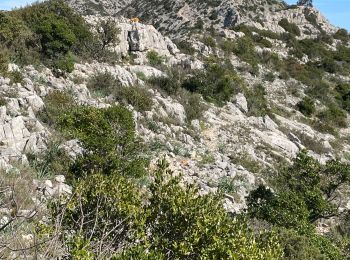
• Montée raide et caillouteuse

Randonnée Marche Tautavel - La torre del far Tautavel - Photo
Marche 9.603
Km

Marche

Tautavel, Occitanie, Pyrénées-Orientales, France
9,6 km | 15,6 km-effort
3h 11min
447 m
444 m
Oui
ombrabella

• Boucle

Randonnée Marche Tautavel - tautavel - Photo
Marche 14.584
Km

Marche

Très facile
Tautavel, Occitanie, Pyrénées-Orientales, France
14,6 km | 19,4 km-effort
8h 5min
359 m
358 m
Oui
fournieralain

• belle randonnée.

Randonnée Marche Tautavel - mas amiel - Photo
Marche 18.963
Km

Marche

Très facile
Tautavel, Occitanie, Pyrénées-Orientales, France
19 km | 24 km-effort
6h 15min
415 m
416 m
Oui
Fildesir

• comité

Randonnée A pied Tautavel - tautavel vingrau 16 km - Photo
A pied 14.974
Km

A pied

Facile
Tautavel, Occitanie, Pyrénées-Orientales, France
15 km | 19,6 km-effort
4h 27min
346 m
348 m
Oui
jeanic63

• départ Tautavel parking rue de la république

Randonnée Marche Tautavel - Tautavel, tour del Mir, contournement de la carrière,  retour côté château et parking.  - Photo
Marche 9.962
Km

Marche

Moyen
Tautavel, Occitanie, Pyrénées-Orientales, France
10 km | 16,2 km-effort
3h 30min
464 m
465 m
Oui
Santblasi

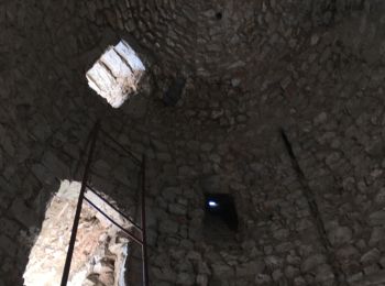
• château, tour, vue à 360 degrés.

Randonnée Marche Tautavel - tourde far de tautavel cave coop . thym romarin 379 m 6km  - Photo
Marche 6.293
Km

Marche

Moyen
Tautavel, Occitanie, Pyrénées-Orientales, France
6,3 km | 11,3 km-effort
2h 20min
379 m
377 m
Oui
Erius

• thym romarin chateau vue

Randonnée Marche Tautavel - Tautavel - Tour Del Far - Photo
Marche 70.751
Km

Marche

Moyen
Tautavel, Occitanie, Pyrénées-Orientales, France
71 km | 90 km-effort
5h 53min
1485 m
1254 m
Non
ThonyM

• Une randonnée DNS le brouillard mais quand même agréable. Pas de difficulté majeure. Attention Xu pierres et racines ...

Randonnée Marche Tautavel - tautavel - Photo
Marche 14.196
Km

Marche

Très difficile
Tautavel, Occitanie, Pyrénées-Orientales, France
14,2 km | 23 km-effort
6h 59min
676 m
676 m
Oui
michcoq

Randonnée Marche Tautavel - 66_tautavel_gouleyrou_j6 - Photo
Marche 8.109
Km

Marche

Moyen
Tautavel, Occitanie, Pyrénées-Orientales, France
8,1 km | 10,8 km-effort
2h 26min
200 m
199 m
Oui
jab31

Randonnée Marche Tautavel - 66_tautavel_tour du Far_j6 - Photo
Marche 8.79
Km

Marche

Moyen
Tautavel, Occitanie, Pyrénées-Orientales, France
8,8 km | 14,9 km-effort
3h 23min
457 m
464 m
Oui
jab31

Randonnée Marche Tautavel - Du Capfrance Torre del Far au Cône de l'Arago par rive Drte du Verdouble et retour  - Photo
Marche 6.302
Km

Marche

Moyen
Tautavel, Occitanie, Pyrénées-Orientales, France
6,3 km | 7,7 km-effort
1h 45min
106 m
106 m
Oui
Domi1953

Randonnée Marche Tautavel - Latour dei far - Photo
Marche 15.31
Km

Marche

Moyen
Tautavel, Occitanie, Pyrénées-Orientales, France
15,3 km | 26 km-effort
5h 54min
800 m
802 m
Oui
patio

Randonnée Marche Tautavel - la croix taitavel - Photo
Marche 18.929
Km

Marche

Difficile
Tautavel, Occitanie, Pyrénées-Orientales, France
18,9 km | 26 km-effort
5h 27min
545 m
546 m
Oui
patio

Randonnée Marche Tautavel - Tautavel, les gorges - Photo
Marche 8.17
Km

Marche

Très facile
Tautavel, Occitanie, Pyrénées-Orientales, France
8,2 km | 11,1 km-effort
1h 57min
215 m
224 m
Non
Didier343434

Randonnée Marche Tautavel - caune de l'Arago - Photo
Marche 3.484
Km

Marche

Très facile
Tautavel, Occitanie, Pyrénées-Orientales, France
3,5 km | 3,8 km-effort
43min
27 m
18 m
Non
yoyo1966

Randonnée Marche Tautavel - Mas Amiel - Photo
Marche 13.23
Km

Marche

Très facile
Tautavel, Occitanie, Pyrénées-Orientales, France
13,2 km | 16,8 km-effort
4h 0min
269 m
271 m
Oui
ACEZAT

20 randonnées affichées sur 22

Application GPS de randonnée GRATUITE

Logo SityTrail SityTrail

IGN / Instituts géographiques

Télécharger SityTrail sur l'App Store Télécharger SityTrail sur Google Play

Logo SityTrail SityTrail World

Le monde est à vous

Télécharger SityTrail sur l'App Store Télécharger SityTrail sur Google Play Télécharger SityTrail sur Huawei AppGallery

Activités

Fermer
Mes abonnements