


11,5 km | 13,8 km-effort
Saint-Martin-de-Boscherville : découvrez les meilleures randonnées : 1 a pied, 44 marche et 1 marche nordique. Tous ces circuits, parcours, itinéraires et activités en plein air sont disponibles dans nos applications SityTrail pour smartphones et tablettes.
Marche


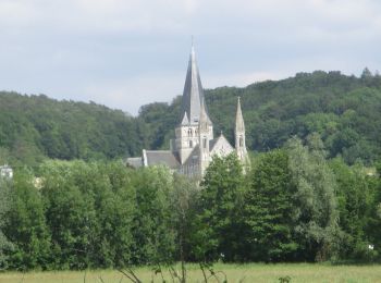
• Circuit le long d'une boucle de la Seine Normande puis montée sur les coteaux de St Martin de Boscherville.
Marche
• Chemins forestiers essentiellement .
Marche
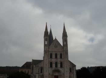
• Boucle A-R au départ de l'Abbaye
Marche
• Boucle A-R au départ de l'Abbaye
Marche
• Boucle A-R au départ de l'Abbatiale

Marche
Marche
• départ parking abbaye

A pied
• départ de l'abbaye de saint martin de bocherville
Marche
• belle rando facile
Marche
• Le Génétey : Petite randonnée 6,5KM Départ au lieu dit le château Blanc ; point altitude 84, prendre le chemin St Gor...
Marche
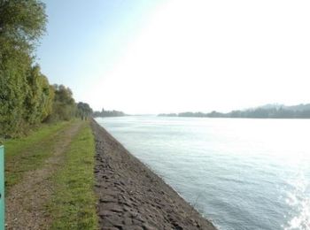
• Randonnée variée alternant bord de Seine et forêt. Points de vue sur la vallée de la Seine
Marche
• Randonnée agréable en Forêt Domaniale de Roumare permettant de découvrir également de très belles bâtisses et monumen...

Marche
Marche
• Parcours facile très plat. Sauf, après avoir traversé la D982, sur les derniers 1500 m avec un dénivelé de 125 m (8%...
Marche
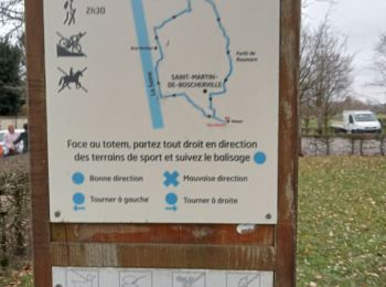
• Départ rue Chaussée Saint-Georges près de l'ABBAYE (ou PKG des cars), se diriger vers la Seine. AD Chemin de Halage, ...
Marche
• Départ rue Chaussée Saint-Georges près de l'ABBAYE (ou PKG des cars), se diriger vers la Seine. AD Chemin de Halage, ...
Marche
• Parcours facile très plat. Sauf, après avoir traversé la D982, sur les derniers 1500 m avec un dénivelé de 125 m (8%...

Marche
Marche
• Départ du parking du carrefour du chêne à Leu en direction de la route forestière de St. Georges
Marche
• depert de l'abbaye
20 randonnées affichées sur 46
Application GPS de randonnée GRATUITE
 SityTrail
IGN / Instituts géographiques
SityTrail World
Le monde est à vous