![](/images/other/stat-length.png)
- Randonnées
- Cheval
- France
- Bretagne
- Morbihan
- Tréhorenteuc
Tréhorenteuc, Morbihan, Cheval : Les meilleures randonnées, itinéraires, parcours, balades et promenades
2 commentaires
Tréhorenteuc : découvrez les meilleures randonnées : 2 cheval et 1 randonnée équestre. Tous ces circuits, parcours, itinéraires et activités en plein air sont disponibles dans nos applications SityTrail pour smartphones et tablettes.
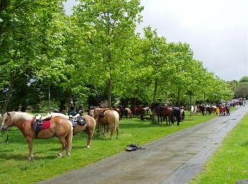
Les meilleurs parcours (3)
![Randonnée Cheval Tréhorenteuc - Tréhorenteuc - Leslan - Equibreizh - Photo](https://media.geolcdn.com/t/350/260/ext.jpg?maxdim=2&url=https%3A%2F%2Fservices.sitytrail.com%2FGeolivesWS%2FDownloadMedia.ashx%3FTrailID%3D108660%26Media%3D1689_1.jpg)
![Cheval Cheval](https://static1.geolcdn.com/sitytour/trail-icons/300.png)
Km
#1 - Tréhorenteuc - Leslan - Equibreizh
Cheval
Difficile
Tréhorenteuc,
Bretagne,
Morbihan,
France
![](/images/other/stat-length.png)
21 km | 25 km-effort
2h 0min
![](https://static1.geolcdn.com/siteimages/upload/files/1508320355ic_sort_den_pos_24dp.png)
321 m
![](https://static1.geolcdn.com/siteimages/upload/files/1508320355ic_sort_den_neg_24dp.png)
358 m
![](https://static1.geolcdn.com/siteimages/upload/files/16400158638029165_repeat_loop_refresh_sync_direction_icon.png)
Non
tracegps
• Balade présentée par l’Association des Amis du Cheval d'Ille et Vilaine D’autres informations sont disponibles sur le...
![Randonnée Randonnée équestre Tréhorenteuc - randonnée broceliande trehorenteuc chêne guillotin - Photo](https://media.geolcdn.com/t/350/260/ext.jpg?maxdim=2&url=https%3A%2F%2Fstatic1.geolcdn.com%2Fsiteimages%2Fupload%2Ffiles%2F1524743154cheval.jpg)
![Randonnée équestre Randonnée équestre](https://static1.geolcdn.com/sitytour/trail-icons/301.png)
Km
#2 - randonnée broceliande trehorenteuc chêne guillotin
Randonnée équestre
Moyen
Tréhorenteuc,
Bretagne,
Morbihan,
France
![](/images/other/stat-length.png)
13,2 km | 15,7 km-effort
3h 30min
![](https://static1.geolcdn.com/siteimages/upload/files/1508320355ic_sort_den_pos_24dp.png)
181 m
![](https://static1.geolcdn.com/siteimages/upload/files/1508320355ic_sort_den_neg_24dp.png)
184 m
![](https://static1.geolcdn.com/siteimages/upload/files/16400158638029165_repeat_loop_refresh_sync_direction_icon.png)
Non
Clara Poloni
![Randonnée Cheval Tréhorenteuc - val sans retour brocelande - Photo](https://media.geolcdn.com/t/350/260/ext.jpg?maxdim=2&url=https%3A%2F%2Fstatic1.geolcdn.com%2Fsiteimages%2Fupload%2Ffiles%2F1524743154cheval.jpg)
![Cheval Cheval](https://static1.geolcdn.com/sitytour/trail-icons/300.png)
Km
#3 - val sans retour brocelande
Cheval
Difficile
Tréhorenteuc,
Bretagne,
Morbihan,
France
![](/images/other/stat-length.png)
12,4 km | 14,6 km-effort
2h 43min
![](https://static1.geolcdn.com/siteimages/upload/files/1508320355ic_sort_den_pos_24dp.png)
166 m
![](https://static1.geolcdn.com/siteimages/upload/files/1508320355ic_sort_den_neg_24dp.png)
169 m
![](https://static1.geolcdn.com/siteimages/upload/files/16400158638029165_repeat_loop_refresh_sync_direction_icon.png)
Oui
tixier
3 randonnées affichées sur 3
Application GPS de randonnée GRATUITE