


16,1 km | 27 km-effort
Auribeau : découvrez les meilleures randonnées : 35 pédestres et 1 à vélo ou VTT. Tous ces circuits, parcours, itinéraires et activités en plein air sont disponibles dans nos applications SityTrail pour smartphones et tablettes.

Marche


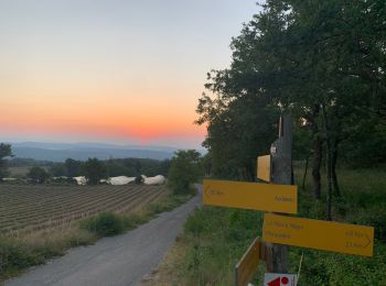
• Par Auribeau
Marche
• Ça dénivelle assez et dans ce sens la descente et relativement plus douce. De bonne heur en été, départ 6h30 plutôt b...
Marche
• Difficultés techniques. Rampes-Cailloux Venteux
Marche
Marche

Marche
• p1+t1 descente en ebouli
Marche
• Le Mourre Nègre, point culminant du Luberon, est accessible par de nombreux itinéraires, commençons par un circuit da...
Marche
Marche
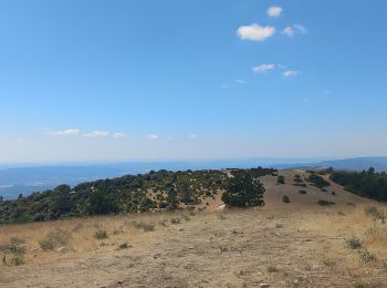
• Les crêtes du Grand Lubéron 1125m
Marche
• Prévoir une bonne 1/2 journée pour cette Rando. Le dénivelé est très progressif et donc de difficulté moindre. Penser...
Marche
• Rando sur le toit du Luberon. Du dénivelé au RdV mais avec des pentes progressives sans difficultés particulières et ...
Marche
• Monter très longue et raide. Retour plus facile mais peu de vues sauf au sommet
Marche
• le mourre negre par les crêtes
Marche
• moyen
Marche
• moyen
Marche
• Boucle en Luberon . sens horaire parking à l'entrée du village. Les crêtes , les bories.
Marche
•
Marche
• Pkg Auribeau, à l'extrémité Sud (alt. 600m), dans un virage, drerière un bosquet. Monter SE et traverser plusieurs va...
Marche
Marche
20 randonnées affichées sur 38
Application GPS de randonnée GRATUITE
 SityTrail
IGN / Instituts géographiques
SityTrail World
Le monde est à vous