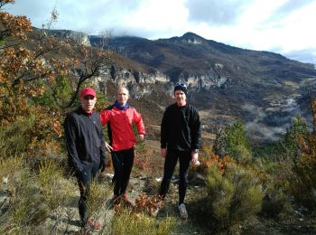
Saint-Vincent-sur-Jabron, Alpes-de-Haute-Provence : Les meilleures randonnées, itinéraires, parcours, balades et promenades

3 commentaires

Saint-Vincent-sur-Jabron : découvrez les meilleures randonnées : 17 pédestres. Tous ces circuits, parcours, itinéraires et activités en plein air sont disponibles dans nos applications SityTrail pour smartphones et tablettes.


Les meilleurs parcours (17)
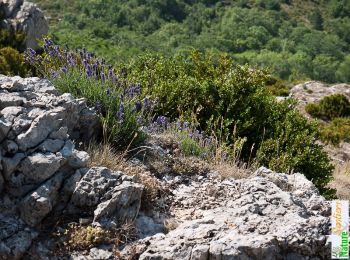
Randonnée Marche Saint-Vincent-sur-Jabron - Traversée de la Montagne de Mare depuis Aubard - Photo
Marche 13.255
Km

Marche

Facile
(1)
Saint-Vincent-sur-Jabron, Provence-Alpes-Côte d'Azur, Alpes-de-Haute-Provence, France
13,3 km | 23 km-effort
5h 45min
757 m
756 m
Oui
tracegps

• Baronnies - Montagne de Lure. Située à une quarantaine de kilomètres de Buis-les-Baronnies, la Montagne de Mare est r...
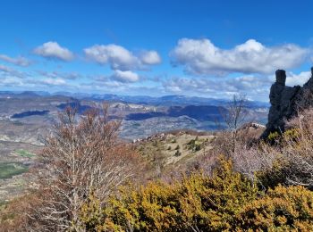
Randonnée Marche Saint-Vincent-sur-Jabron - Crête Montagne de Mare Via St Vincent sur Jabron - Photo
Marche 14.754
Km

Marche

Très difficile
Saint-Vincent-sur-Jabron, Provence-Alpes-Côte d'Azur, Alpes-de-Haute-Provence, France
14,8 km | 25 km-effort
5h 44min
789 m
787 m
Oui
PapouBertrand

• Impossible de se stationner à Aubard, vent très violent sur la longue crête.
Randonnée Marche Saint-Vincent-sur-Jabron - SAINT VINCENT DU JABRON.  Aubard,  col de Verdun , le pied du mulet o l m s  - Photo
Marche 13.255
Km

Marche

Moyen
Saint-Vincent-sur-Jabron, Provence-Alpes-Côte d'Azur, Alpes-de-Haute-Provence, France
13,3 km | 23 km-effort
3h 48min
707 m
705 m
Oui
RobinMicheline

• Bien indiquer , facile , sympa , belle vue

Randonnée Marche Saint-Vincent-sur-Jabron - SAINT VINCENT SUR JABRON. Pas de Parandier  ,montagne S Michel o n - Photo
Marche 14.4
Km

Marche

Moyen
Saint-Vincent-sur-Jabron, Provence-Alpes-Côte d'Azur, Alpes-de-Haute-Provence, France
14,4 km | 23 km-effort
4h 13min
608 m
608 m
Oui
RobinMicheline

• super balade

Randonnée Marche Saint-Vincent-sur-Jabron - SAINT VINCENT DU JABRON . Aubard ,  vieux Curel  , chateau des Graves o l s  - Photo
Marche 16.061
Km

Marche

Difficile
(1)
Saint-Vincent-sur-Jabron, Provence-Alpes-Côte d'Azur, Alpes-de-Haute-Provence, France
16,1 km | 24 km-effort
4h 53min
618 m
620 m
Oui
RobinMicheline

Randonnée Course à pied Saint-Vincent-sur-Jabron - Tour de la Combe et de Pralonguet - Photo
Course à pied 6.787
Km

Course à pied

Moyen
Saint-Vincent-sur-Jabron, Provence-Alpes-Côte d'Azur, Alpes-de-Haute-Provence, France
6,8 km | 11,7 km-effort
1h 23min
367 m
367 m
Oui
phd04

Randonnée Marche Saint-Vincent-sur-Jabron - 04 Mgne de Mare par Aubard (Jabron)  - Photo
Marche 15.411
Km

Marche

Moyen
Saint-Vincent-sur-Jabron, Provence-Alpes-Côte d'Azur, Alpes-de-Haute-Provence, France
15,4 km | 26 km-effort
5h 0min
799 m
798 m
Oui
Cosmos

• Sortie Gavots du 03/01/23 avec pierre BLANC

Randonnée Marche Saint-Vincent-sur-Jabron - st vincent sur jabron 2 - Photo
Marche 16.099
Km

Marche

Très difficile
(1)
Saint-Vincent-sur-Jabron, Provence-Alpes-Côte d'Azur, Alpes-de-Haute-Provence, France
16,1 km | 25 km-effort
5h 36min
645 m
645 m
Oui
jean pierre 04

• 16 km 645 m denivele

Randonnée Marche Saint-Vincent-sur-Jabron - St Vincent sur jabron  - Photo
Marche 16.655
Km

Marche

Très difficile
Saint-Vincent-sur-Jabron, Provence-Alpes-Côte d'Azur, Alpes-de-Haute-Provence, France
16,7 km | 25 km-effort
5h 4min
653 m
652 m
Oui
jean pierre 04

• randonnée 17 km 700m dénivelé

Randonnée Marche Saint-Vincent-sur-Jabron - St Vincent sur Jabron - Photo
Marche 8.819
Km

Marche

Facile
Saint-Vincent-sur-Jabron, Provence-Alpes-Côte d'Azur, Alpes-de-Haute-Provence, France
8,8 km | 13,3 km-effort
3h 11min
335 m
336 m
Oui
claude nier

• marche douce Andre

Randonnée Course à pied Saint-Vincent-sur-Jabron - Le Panouet - Photo
Course à pied 5.773
Km

Course à pied

Facile
Saint-Vincent-sur-Jabron, Provence-Alpes-Côte d'Azur, Alpes-de-Haute-Provence, France
5,8 km | 8,9 km-effort
45min
237 m
235 m
Oui
phd04

• Boucle au départ de St Vincent sur Jabron

Randonnée Course à pied Saint-Vincent-sur-Jabron - Montagne de Mare par Aubard - Photo
Course à pied 17.706
Km

Course à pied

Difficile
Saint-Vincent-sur-Jabron, Provence-Alpes-Côte d'Azur, Alpes-de-Haute-Provence, France
17,7 km | 32 km-effort
2h 0min
1059 m
1056 m
Oui
phd04

• par Aubar

Randonnée Marche Saint-Vincent-sur-Jabron - La Mare - Photo
Marche 13.255
Km

Marche

Moyen
Saint-Vincent-sur-Jabron, Provence-Alpes-Côte d'Azur, Alpes-de-Haute-Provence, France
13,3 km | 23 km-effort
5h 0min
757 m
756 m
Oui
nbietry

• Traversée de la Montagne de Mare depuis Aubard

Randonnée Marche Saint-Vincent-sur-Jabron - Un tour dans le Jabron - Photo
Marche 16.136
Km

Marche

Moyen
Saint-Vincent-sur-Jabron, Provence-Alpes-Côte d'Azur, Alpes-de-Haute-Provence, France
16,1 km | 24 km-effort
4h 35min
622 m
624 m
Oui
Clo0413

Randonnée Marche Saint-Vincent-sur-Jabron - St Vincent à Noyer sur Jabron - Photo
Marche 14.407
Km

Marche

Moyen
Saint-Vincent-sur-Jabron, Provence-Alpes-Côte d'Azur, Alpes-de-Haute-Provence, France
14,4 km | 23 km-effort
6h 42min
598 m
674 m
Non
PITOUSSAINT

Randonnée Marche Saint-Vincent-sur-Jabron - Aubard - Photo
Marche 14.491
Km

Marche

Moyen
Saint-Vincent-sur-Jabron, Provence-Alpes-Côte d'Azur, Alpes-de-Haute-Provence, France
14,5 km | 26 km-effort
5h 0min
886 m
770 m
Non
berhub

Randonnée Course à pied Saint-Vincent-sur-Jabron - Crête de Mare par le Col de Verdun - Photo
Course à pied 20.353
Km

Course à pied

Difficile
Saint-Vincent-sur-Jabron, Provence-Alpes-Côte d'Azur, Alpes-de-Haute-Provence, France
20 km | 35 km-effort
2h 0min
1087 m
1087 m
Oui
phd04

17 randonnées affichées sur 17

Application GPS de randonnée GRATUITE

Logo SityTrail SityTrail

IGN / Instituts géographiques

Télécharger SityTrail sur l'App Store Télécharger SityTrail sur Google Play

Logo SityTrail SityTrail World

Le monde est à vous

Télécharger SityTrail sur l'App Store Télécharger SityTrail sur Google Play Télécharger SityTrail sur Huawei AppGallery

Activités

Fermer
Mes abonnements