


27 km | 34 km-effort
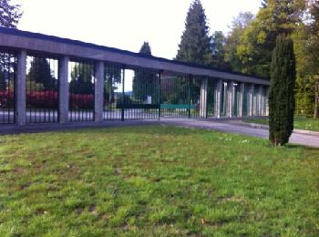
Égletons : découvrez les meilleures randonnées : 10 pédestres, 10 à vélo ou VTT et 2 parcours équestres. Tous ces circuits, parcours, itinéraires et activités en plein air sont disponibles dans nos applications SityTrail pour smartphones et tablettes.
V.T.T.


• Ce tour de la commune d'Egletons vous fera passer par des chemins faciles . Vous aurez l'occasion de passer à proximi...

Marche
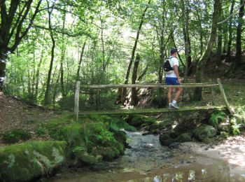
• Entre Vedrenne et la Brette - Égletons - Pays d'Égletons. L’histoire et le paysage se côtoient pour le plaisir du ran...

Cheval
• Entre Vedrenne et la Brette - Égletons - Pays d'Égletons. L’histoire et le paysage se côtoient pour le plaisir du ran...

V.T.T.
• Entre Vedrenne et la Brette - Égletons - Pays d'Égletons. L’histoire et le paysage se côtoient pour le plaisir du ran...
Marche
• Entre Vedrenne et la Brette - Égletons - Pays d'Égletons. L’histoire et le paysage se côtoient pour le plaisir du ran...
Cheval
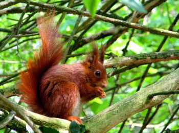
• Entre Vedrenne et la Brette - Pays de Ventadour. Parcourez les pays boisés caractéristiques de la région, découvrez l...

V.T.T.
• Entre Vedrenne et la Brette - Pays de Ventadour. Parcourez les pays boisés caractéristiques de la région, découvrez l...

Marche
• Entre Vedrenne et la Brette - Pays de Ventadour. Parcourez les pays boisés caractéristiques de la région, découvrez l...

Marche
• aerodrome vers ville. toute petite sans plus. lac très joli à faire

V.T.T.
• Départ du Village Vaccances, avec passage initiatique jusqu'à "Robert"(chemins, route, descente, et montée) Excursion...
V.T.T.
• Au départ du VV Le LAC,l'ascension du Puy de la TOURTE se fait en passant par les cascades du DEIRO. Quelques pousset...
V.T.T.
• Au départ du VV Le LAC,l'ascension du Puy de la TOURTE se fait en passant par les cascades du DEIRO. Quelques pousset...
V.T.T.
• Ce circuit d'un peu plus de 24kms peu se pratiquer en VTT ou à pied. Il se caractérise par de très beaux panoramas,un...
V.T.T.
• Un petit circuit à faire en famille,sans grande difficulté majeure si ce n'est vers la fin du parcours ou,arrivant au...
V.T.T.
• Entre l'ancienne piscine d'Egletons et des panoramas surplombant cette ville,cette itinéraire ,assez facile,vous perm...
Marche
Marche

Quad
Marche
Marche
20 randonnées affichées sur 26
Application GPS de randonnée GRATUITE
 SityTrail
IGN / Instituts géographiques
SityTrail World
Le monde est à vous