![](/images/other/stat-length.png)
![Randonnée Marche Gourbit - Etangs d'Artax - Photo](https://media.geolcdn.com/t/1900/400/ext.pjpeg?maxdim=2&url=https%3A%2F%2Fservices.sitytrail.com%2FGeolivesWS%2FDownloadMedia.ashx%3FTrailID%3D101253%26Media%3D743_1.jpg)
Etangs d'Artax
tracegps
Utilisateur
![Longueur](/images/other/stat-length.png)
Longueur
3,8 km
![Altitude max](https://static1.geolcdn.com/siteimages/upload/files/1508320355ic_sort_altitude_max_24dp.png)
Altitude max
1707 m
![Dénivelé positif](https://static1.geolcdn.com/siteimages/upload/files/1508320355ic_sort_den_pos_24dp.png)
Dénivelé positif
788 m
![Km-Effort](/images/other/stat-length.png)
Km-Effort
11,7 km
![Altitude min](https://static1.geolcdn.com/siteimages/upload/files/1508320355ic_sort_altitude_min_24dp.png)
Altitude min
913 m
![Dénivelé négatif](https://static1.geolcdn.com/siteimages/upload/files/1508320355ic_sort_den_neg_24dp.png)
Dénivelé négatif
6 m
![Boucle](https://static1.geolcdn.com/siteimages/upload/files/16400158638029165_repeat_loop_refresh_sync_direction_icon.png)
Boucle
Non
Date de création :
2014-12-10 00:00:00.0
Dernière modification :
2014-12-10 00:00:00.0
![Marche](https://static1.geolcdn.com/sitytour/trail-icons/101.png)
4h00
Difficulté : Difficile
![Scannez ce code QR pour ouvrir la randonnée dans l'application SityTrail](https://capi.geolives.com/qq0zvz2zws4bq2lad0pu/sitytour/trails/101253/qr.png?size=200)
Application GPS de randonnée GRATUITE
À propos
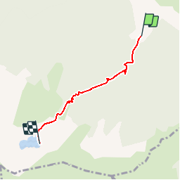
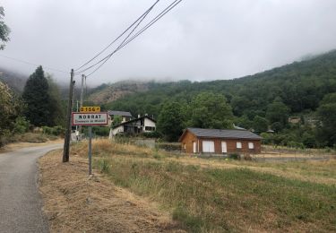
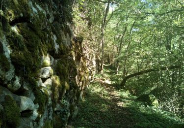
Randonnée Marche de 3,8 km à découvrir à Occitanie, Ariège, Gourbit. Cette randonnée est proposée par tracegps.
Description
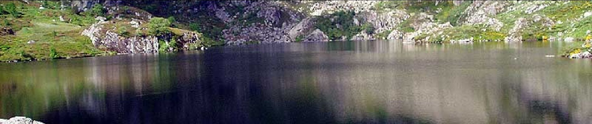
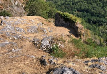
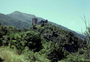
Belle randonnée, dans un cadre agréable et loin de la foule avec un lac sympa et accessible à la clef. En plus, on part d'un village merveilleux, Gourbit, le nombril de l'Ariège ! On trouve toutes les explications sur Montagne Cool
Localisation
Pays :
France
Région :
Occitanie
Département/Province :
Ariège
Commune :
Gourbit
Localité :
Unknown
Départ:(Dec)
Départ:(UTM)
380108 ; 4743489 (31T) N.
Commentaires
Randonnées à proximité
![Randonnée Marche Rabat-les-Trois-Seigneurs - Pyrénées-120910 - EtangBleu - Photo](https://media.geolcdn.com/t/375/260/ext.jpg?maxdim=2&url=https%3A%2F%2Fservices.sitytrail.com%2FGeolivesWS%2FDownloadMedia.ashx%3FTrailID%3D154212%26Media%3D20120910120731.jpeg)
![Marche Marche](https://static1.geolcdn.com/sitytour/trail-icons/101.png)
Pyrénées-120910 - EtangBleu
Marche
Moyen
(1)
Rabat-les-Trois-Seigneurs,
Occitanie,
Ariège,
France
![](/images/other/stat-length.png)
11,9 km | 23 km-effort
7h 45min
![](https://static1.geolcdn.com/siteimages/upload/files/16400158638029165_repeat_loop_refresh_sync_direction_icon.png)
Oui
![Randonnée Marche Gourbit - 04/06/2014 Rando Etang d'Artax - Photo](https://media.geolcdn.com/t/375/260/ext.jpg?maxdim=2&url=https%3A%2F%2Fservices.sitytrail.com%2FGeolivesWS%2FDownloadMedia.ashx%3FTrailID%3D308062%26Media%3D20140601132627.jpg)
![Marche Marche](https://static1.geolcdn.com/sitytour/trail-icons/101.png)
04/06/2014 Rando Etang d'Artax
Marche
Difficile
(1)
Gourbit,
Occitanie,
Ariège,
France
![](/images/other/stat-length.png)
10,8 km | 24 km-effort
2h 53min
![](https://static1.geolcdn.com/siteimages/upload/files/16400158638029165_repeat_loop_refresh_sync_direction_icon.png)
Oui
![Randonnée Marche Rabat-les-Trois-Seigneurs - Cirque D'Embans - Photo](https://media.geolcdn.com/t/375/260/ext.jpg?maxdim=2&url=https%3A%2F%2Fstatic1.geolcdn.com%2Fsiteimages%2Fupload%2Ffiles%2F1553511878bg_sport_marche.png)
![Marche Marche](https://static1.geolcdn.com/sitytour/trail-icons/101.png)
Cirque D'Embans
Marche
Moyen
(2)
Rabat-les-Trois-Seigneurs,
Occitanie,
Ariège,
France
![](/images/other/stat-length.png)
8,8 km | 18,4 km-effort
3h 52min
![](https://static1.geolcdn.com/siteimages/upload/files/16400158638029165_repeat_loop_refresh_sync_direction_icon.png)
Oui
![Randonnée Marche Surba - Tour du roc de Sédour - Photo](https://media.geolcdn.com/t/375/260/ext.jpg?maxdim=2&url=https%3A%2F%2Fmedia.geolcdn.com%2Ff%2F0a6f46ec-50b3-4cd7-935e-a334e1ae38c6.jpg)
![Marche Marche](https://static1.geolcdn.com/sitytour/trail-icons/101.png)
Tour du roc de Sédour
Marche
Facile
Surba,
Occitanie,
Ariège,
France
![](/images/other/stat-length.png)
13,1 km | 19,5 km-effort
4h 10min
![](https://static1.geolcdn.com/siteimages/upload/files/16400158638029165_repeat_loop_refresh_sync_direction_icon.png)
Oui
![Randonnée Vélo électrique Niaux - Niaux - Photo](https://media.geolcdn.com/t/375/260/ext.jpg?maxdim=2&url=https%3A%2F%2Fmedia.geolcdn.com%2Ff%2F2925b5db-f18d-4157-bbef-94a57335fc75.jpg)
![Vélo électrique Vélo électrique](https://static1.geolcdn.com/sitytour/trail-icons/205.png)
![Randonnée Vélo électrique Niaux - Château Miglos - Photo](https://media.geolcdn.com/t/375/260/ext.jpg?maxdim=2&url=https%3A%2F%2Fmedia.geolcdn.com%2Ff%2F8bba2701-86a9-409d-bc1b-998f1da97a1d.jpg)
![Vélo électrique Vélo électrique](https://static1.geolcdn.com/sitytour/trail-icons/205.png)
Château Miglos
Vélo électrique
Très facile
Niaux,
Occitanie,
Ariège,
France
![](/images/other/stat-length.png)
8,1 km | 11 km-effort
45min
![](https://static1.geolcdn.com/siteimages/upload/files/16400158638029165_repeat_loop_refresh_sync_direction_icon.png)
Non
![Randonnée A pied Lapège - Lapège et Pladetis - Photo](https://media.geolcdn.com/t/375/260/ext.jpg?maxdim=2&url=https%3A%2F%2Fmedia.geolcdn.com%2Ff%2Facf32a31-72a6-4e31-a909-32a8fa5a01b2.jpeg)
![A pied A pied](https://static1.geolcdn.com/sitytour/trail-icons/100.png)
Lapège et Pladetis
A pied
Facile
Lapège,
Occitanie,
Ariège,
France
![](/images/other/stat-length.png)
10,1 km | 18,8 km-effort
4h 16min
![](https://static1.geolcdn.com/siteimages/upload/files/16400158638029165_repeat_loop_refresh_sync_direction_icon.png)
Non
![Randonnée A pied Gourbit - Étang d'Artax - Photo](https://media.geolcdn.com/t/375/260/ext.jpg?maxdim=2&url=https%3A%2F%2Fmedia.geolcdn.com%2Ff%2Fb2f84de2-fa0a-4b97-b201-829b16672ace.jpeg)
![A pied A pied](https://static1.geolcdn.com/sitytour/trail-icons/100.png)
![Randonnée Marche Capoulet-et-Junac - Le Vicdessos par Illié - Photo](https://media.geolcdn.com/t/375/260/ext.jpg?maxdim=2&url=https%3A%2F%2Fmedia.geolcdn.com%2Ff%2Fca761c83-3387-4b8c-a324-b7eee82e1103.jpg)
![Marche Marche](https://static1.geolcdn.com/sitytour/trail-icons/101.png)
Le Vicdessos par Illié
Marche
Moyen
Capoulet-et-Junac,
Occitanie,
Ariège,
France
![](/images/other/stat-length.png)
14,3 km | 24 km-effort
5h 52min
![](https://static1.geolcdn.com/siteimages/upload/files/16400158638029165_repeat_loop_refresh_sync_direction_icon.png)
Oui