


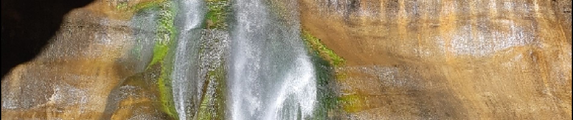
lower calf creek falls

phi14
Utilisateur
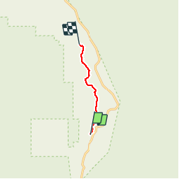

Longueur
5,3 km

Altitude max
1776 m

Dénivelé positif
253 m
Km-Effort
8,3 km

Altitude min
1631 m

Dénivelé négatif
153 m
Boucle
Non
Date de création :
2019-01-15 16:39:29.699
Dernière modification :
2019-01-15 16:39:29.699
1h47
Difficulté : Facile

Application GPS de randonnée GRATUITE
 SityTrail
IGN / Instituts géographiques
SityTrail Plus
Le monde est à vous
À propos
Randonnée Marche de 5,3 km à découvrir à Utah, Garfield County. Cette randonnée est proposée par phi14.
Description
Très belle balade avec à l'arrivée une superbe chute d'eau. 10.6 km AR
Photos


Localisation
Pays :
États-Unis
Région :
Utah
Département/Province :
Garfield County
Commune :
Calf Creek Recreation Area
Localité :
Unknown
Départ:(Dec)
Départ:(UTM)
463471 ; 4183027 (12S) N.
Commentaires