![](/images/other/stat-length.png)
![Randonnée Marche Cabrerolles - Le trou du Météore - Photo](https://media.geolcdn.com/t/1900/400/ext.pjpeg?maxdim=2&url=https%3A%2F%2Fstatic1.geolcdn.com%2Fsiteimages%2Fupload%2Ffiles%2F1553511878bg_sport_marche.png)
Le trou du Météore
jdelettrez
Utilisateur
![Longueur](/images/other/stat-length.png)
Longueur
14,2 km
![Altitude max](https://static1.geolcdn.com/siteimages/upload/files/1508320355ic_sort_altitude_max_24dp.png)
Altitude max
386 m
![Dénivelé positif](https://static1.geolcdn.com/siteimages/upload/files/1508320355ic_sort_den_pos_24dp.png)
Dénivelé positif
443 m
![Km-Effort](/images/other/stat-length.png)
Km-Effort
20 km
![Altitude min](https://static1.geolcdn.com/siteimages/upload/files/1508320355ic_sort_altitude_min_24dp.png)
Altitude min
166 m
![Dénivelé négatif](https://static1.geolcdn.com/siteimages/upload/files/1508320355ic_sort_den_neg_24dp.png)
Dénivelé négatif
450 m
![Boucle](https://static1.geolcdn.com/siteimages/upload/files/16400158638029165_repeat_loop_refresh_sync_direction_icon.png)
Boucle
Oui
Date de création :
2014-12-10 00:00:00.0
Dernière modification :
2014-12-10 00:00:00.0
![Marche](https://static1.geolcdn.com/sitytour/trail-icons/101.png)
4h21
Difficulté : Moyen
![Scannez ce code QR pour ouvrir la randonnée dans l'application SityTrail](https://capi.geolives.com/qq0zvz2zws4bq2lad0pu/sitytour/trails/170120/qr.png?size=200)
Application GPS de randonnée GRATUITE
À propos
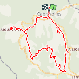
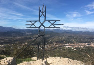
Randonnée Marche de 14,2 km à découvrir à Occitanie, Hérault, Cabrerolles. Cette randonnée est proposée par jdelettrez.
Description
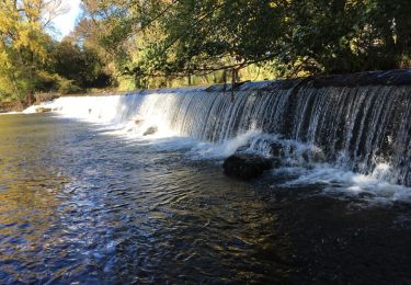
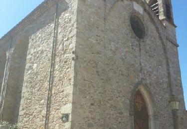
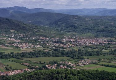
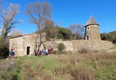
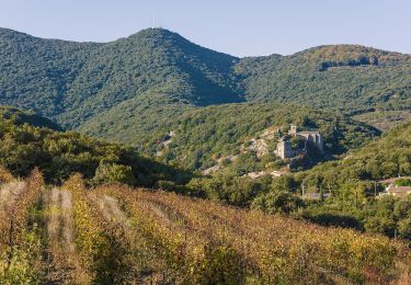
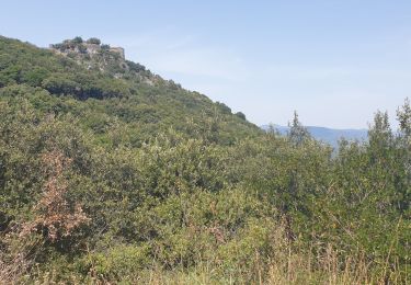
Une très belle rando partant de Cabrerolles sur des pistes très praticables et une étonnante structure géologique nommé le Trou du Météore. Parking devant l'église
Localisation
Pays :
France
Région :
Occitanie
Département/Province :
Hérault
Commune :
Cabrerolles
Localité :
Unknown
Départ:(Dec)
Départ:(UTM)
510093 ; 4821276 (31T) N.
Commentaires
Randonnées à proximité
![Randonnée Marche Hérépian - herepian pic de Tantajo - Photo](https://media.geolcdn.com/t/375/260/ext.jpg?maxdim=2&url=https%3A%2F%2Fservices.sitytrail.com%2FGeolivesWS%2FDownloadMedia.ashx%3FTrailID%3D656804%26Media%3D20161106140841.jpg)
![Marche Marche](https://static1.geolcdn.com/sitytour/trail-icons/101.png)
herepian pic de Tantajo
Marche
Facile
(1)
Hérépian,
Occitanie,
Hérault,
France
![](/images/other/stat-length.png)
13 km | 18,6 km-effort
4h 17min
![](https://static1.geolcdn.com/siteimages/upload/files/16400158638029165_repeat_loop_refresh_sync_direction_icon.png)
Oui
![Randonnée Marche Les Aires - Saint Michel la coquillade - Photo](https://media.geolcdn.com/t/375/260/ext.jpg?maxdim=2&url=https%3A%2F%2Fservices.sitytrail.com%2FGeolivesWS%2FDownloadMedia.ashx%3FTrailID%3D419022%26Media%3Dfix__20150406153326.jpg)
![Marche Marche](https://static1.geolcdn.com/sitytour/trail-icons/101.png)
Saint Michel la coquillade
Marche
Moyen
(1)
Les Aires,
Occitanie,
Hérault,
France
![](/images/other/stat-length.png)
13,2 km | 21 km-effort
4h 7min
![](https://static1.geolcdn.com/siteimages/upload/files/16400158638029165_repeat_loop_refresh_sync_direction_icon.png)
Oui
![Randonnée A pied Les Aires - Pic de la Coquillade - Photo](https://media.geolcdn.com/t/375/260/ext.jpg?maxdim=2&url=https%3A%2F%2Fmedia.geolcdn.com%2Ff%2Fa1b049b6-4309-4e8c-86c9-1d2c07783337.jpeg)
![A pied A pied](https://static1.geolcdn.com/sitytour/trail-icons/100.png)
Pic de la Coquillade
A pied
Facile
Les Aires,
Occitanie,
Hérault,
France
![](/images/other/stat-length.png)
11,3 km | 19 km-effort
4h 19min
![](https://static1.geolcdn.com/siteimages/upload/files/16400158638029165_repeat_loop_refresh_sync_direction_icon.png)
Oui
![Randonnée V.T.T. Cabrerolles - Cabrerolles-Roquebrun-Cabrerolles - Photo](https://media.geolcdn.com/t/375/260/ext.jpg?maxdim=2&url=https%3A%2F%2Fstatic1.geolcdn.com%2Fsiteimages%2Fupload%2Ffiles%2F1524743154velo.jpg)
![V.T.T. V.T.T.](https://static1.geolcdn.com/sitytour/trail-icons/202.png)
Cabrerolles-Roquebrun-Cabrerolles
V.T.T.
Difficile
(1)
Cabrerolles,
Occitanie,
Hérault,
France
![](/images/other/stat-length.png)
41 km | 62 km-effort
3h 0min
![](https://static1.geolcdn.com/siteimages/upload/files/16400158638029165_repeat_loop_refresh_sync_direction_icon.png)
Oui
![Randonnée Marche Cabrerolles - Cabrerolles - Photo](https://media.geolcdn.com/t/375/260/ext.jpg?maxdim=2&url=https%3A%2F%2Fmedia.geolcdn.com%2Ff%2Ff7148cd6-e1d8-4e1b-b32e-00e6281cecd4.jpg)
![Marche Marche](https://static1.geolcdn.com/sitytour/trail-icons/101.png)
Cabrerolles
Marche
Moyen
Cabrerolles,
Occitanie,
Hérault,
France
![](/images/other/stat-length.png)
14 km | 18,9 km-effort
4h 30min
![](https://static1.geolcdn.com/siteimages/upload/files/16400158638029165_repeat_loop_refresh_sync_direction_icon.png)
Oui
![Randonnée Marche Le Poujol-sur-Orb - Rando Seviracttt - Photo](https://media.geolcdn.com/t/375/260/ext.jpg?maxdim=2&url=https%3A%2F%2Fmedia.geolcdn.com%2Ff%2Fabbb6ad5-7718-434b-be19-2e67e5d9637f.jpg)
![Marche Marche](https://static1.geolcdn.com/sitytour/trail-icons/101.png)
Rando Seviracttt
Marche
Très difficile
Le Poujol-sur-Orb,
Occitanie,
Hérault,
France
![](/images/other/stat-length.png)
14,9 km | 21 km-effort
4h 40min
![](https://static1.geolcdn.com/siteimages/upload/files/16400158638029165_repeat_loop_refresh_sync_direction_icon.png)
Oui
![Randonnée A pied Cabrerolles - Le trou du météore à Cabrerolles - Photo](https://media.geolcdn.com/t/375/260/ext.jpg?maxdim=2&url=https%3A%2F%2Fmedia.geolcdn.com%2Ff%2Fbfc0afe0-7af6-4650-a40f-97c6d7a43ce8.jpeg)
![A pied A pied](https://static1.geolcdn.com/sitytour/trail-icons/100.png)
Le trou du météore à Cabrerolles
A pied
Facile
Cabrerolles,
Occitanie,
Hérault,
France
![](/images/other/stat-length.png)
12,2 km | 16,3 km-effort
3h 42min
![](https://static1.geolcdn.com/siteimages/upload/files/16400158638029165_repeat_loop_refresh_sync_direction_icon.png)
Oui
![Randonnée Marche Les Aires - les aires, chapelle Saint Michel - Photo](https://media.geolcdn.com/t/375/260/ext.jpg?maxdim=2&url=https%3A%2F%2Fmedia.geolcdn.com%2Ff%2F5794cff5-7317-4fba-a64f-d491ed24084c.jpg)
![Marche Marche](https://static1.geolcdn.com/sitytour/trail-icons/101.png)
les aires, chapelle Saint Michel
Marche
Moyen
Les Aires,
Occitanie,
Hérault,
France
![](/images/other/stat-length.png)
7,6 km | 11,4 km-effort
3h 25min
![](https://static1.geolcdn.com/siteimages/upload/files/16400158638029165_repeat_loop_refresh_sync_direction_icon.png)
Oui
![Randonnée Marche Faugères - La Caumette- Pic du Tantajo - Photo](https://media.geolcdn.com/t/375/260/ext.jpg?maxdim=2&url=https%3A%2F%2Fmedia.geolcdn.com%2Ff%2Fa3bc5e44-6b9f-4ff4-a63f-d3f7e92231db.jpg)
![Marche Marche](https://static1.geolcdn.com/sitytour/trail-icons/101.png)
La Caumette- Pic du Tantajo
Marche
Difficile
(1)
Faugères,
Occitanie,
Hérault,
France
![](/images/other/stat-length.png)
13 km | 18,7 km-effort
4h 59min
![](https://static1.geolcdn.com/siteimages/upload/files/16400158638029165_repeat_loop_refresh_sync_direction_icon.png)
Oui
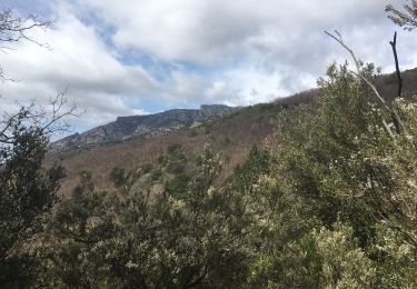
Rando suivie le 13/03/2015. Des taches de peinture rouge sur des cailloux aident à trouver la bonne direction.Rando en pleine nature et dans les vignes un peu montagnes russes.