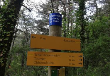
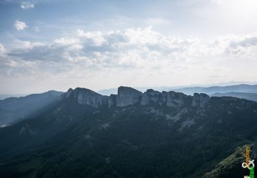
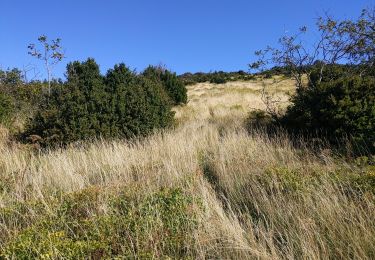
Randonnée Trail Peyrus - tourette Pierre chauve st Vincent  - Photo

tourette Pierre chauve st Vincent

 fabal
fabal

Utilisateur

© OpenStreetMap contributors
Longueur
Longueur
15 km
Boucle
Boucle
Oui
Date de création :
2019-05-15 07:48:22.424
Dernière modification :
2019-05-15 15:00:30.099

(0 Avis)

Trail
Trail
6h44
Difficulté : Moyen

Scannez ce code QR pour ouvrir la randonnée dans l'application SityTrail

Application GPS de randonnée GRATUITE

Logo SityTrail SityTrail

IGN / Instituts géographiques

Télécharger SityTrail sur l'App Store Télécharger SityTrail sur Google Play

Logo SityTrail SityTrail World

Le monde est à vous

Télécharger SityTrail sur l'App Store Télécharger SityTrail sur Google Play Télécharger SityTrail sur Huawei AppGallery

À propos

Randonnée Trail de 15 km à découvrir à Auvergne-Rhône-Alpes, Drôme, Peyrus. Cette randonnée est proposée par fabal.

Description

moyenne

Profil altimétrique

Localisation

Pays :
France
Région :
Auvergne-Rhône-Alpes
Département/Province :
Drôme
Commune :
Peyrus
Localité :
Unknown
Départ:(UTM)
667594 ; 4974759 (31T) N.

Randonnées à proximité

Randonnée Marche Châteaudouble - Le pont des sarazins par la fontaine des corbeaux - Photo
Marche
ikusen26@gmail.com

Marche

Moyen
(1)
Châteaudouble, Auvergne-Rhône-Alpes, Drôme, France
6,4 km | 11,2 km-effort
2h 57min
Non
Randonnée Marche Saint-Vincent-la-Commanderie - Pierre Chauve 1308m, les Roches de Treillaras, depuis les Condamines - Photo
Marche
tracegps

Marche

Moyen
(2)
Saint-Vincent-la-Commanderie, Auvergne-Rhône-Alpes, Drôme, France
12,7 km | 25 km-effort
6h 30min
Oui
Randonnée Marche Le Chaffal - 26 vacherie arches comberoufle - Photo
Marche
GUIDE
randodyssée

Marche

Facile
Le Chaffal, Auvergne-Rhône-Alpes, Drôme, France
7,3 km | 12,1 km-effort
3h 25min
Oui
Randonnée Marche Saint-Vincent-la-Commanderie - 26 st Vincent commanderie zel - Photo
Marche
GUIDE
randodyssée

Marche

Facile
Saint-Vincent-la-Commanderie, Auvergne-Rhône-Alpes, Drôme, France
14,2 km | 22 km-effort
6h 5min
Oui
Randonnée Marche Léoncel - les roches de treillaras - Photo
Marche
olivier26

Marche

Facile
(3)
Léoncel, Auvergne-Rhône-Alpes, Drôme, France
11 km | 16 km-effort
2h 14min
Non
Randonnée Marche Léoncel - Rando Pas du touet -rocher de la drayette - Photo
Marche
jeebeek

Marche

Facile
(3)
Léoncel, Auvergne-Rhône-Alpes, Drôme, France
6,3 km | 8,8 km-effort
2h 11min
Oui
Randonnée Marche Léoncel - Pierre Chauve depuis le Col de Tourniol - Photo
Marche
McTracy004

Marche

Facile
(3)
Léoncel, Auvergne-Rhône-Alpes, Drôme, France
7,9 km | 12,3 km-effort
2h 52min
Oui
Randonnée Marche Le Chaffal - Col de la Bataille, Omblèze - Photo
Marche
ajd26

Marche

Difficile
Le Chaffal, Auvergne-Rhône-Alpes, Drôme, France
17,6 km | 32 km-effort
5h 15min
Oui
Randonnée Marche Peyrus - pont des sarrasins, faucon, piaroux  - Photo
Marche
bymarc26

Marche

Très difficile
Peyrus, Auvergne-Rhône-Alpes, Drôme, France
8,3 km | 14,3 km-effort
3h 2min
Oui


Fermer
Mes abonnements