![](/images/other/stat-length.png)
![Randonnée Marche Maaseik - Rond Oudberg - Photo](https://media.geolcdn.com/t/1900/400/ext.pjpeg?maxdim=2&url=https%3A%2F%2Fmedia.geolcdn.com%2Ff%2Fa912a49f-530d-4a9a-845c-ab72c5f0575c.jpg)
Rond Oudberg
bometdehamer
Utilisateur
![Longueur](/images/other/stat-length.png)
Longueur
13,4 km
![Altitude max](https://static1.geolcdn.com/siteimages/upload/files/1508320355ic_sort_altitude_max_24dp.png)
Altitude max
89 m
![Dénivelé positif](https://static1.geolcdn.com/siteimages/upload/files/1508320355ic_sort_den_pos_24dp.png)
Dénivelé positif
133 m
![Km-Effort](/images/other/stat-length.png)
Km-Effort
15,2 km
![Altitude min](https://static1.geolcdn.com/siteimages/upload/files/1508320355ic_sort_altitude_min_24dp.png)
Altitude min
59 m
![Dénivelé négatif](https://static1.geolcdn.com/siteimages/upload/files/1508320355ic_sort_den_neg_24dp.png)
Dénivelé négatif
134 m
![Boucle](https://static1.geolcdn.com/siteimages/upload/files/16400158638029165_repeat_loop_refresh_sync_direction_icon.png)
Boucle
Oui
Date de création :
2020-01-30 09:44:32.0
Dernière modification :
2020-01-30 14:37:58.585
![Marche](https://static1.geolcdn.com/sitytour/trail-icons/101.png)
4h14
Difficulté : Facile
![Scannez ce code QR pour ouvrir la randonnée dans l'application SityTrail](https://capi.geolives.com/qq0zvz2zws4bq2lad0pu/sitytour/trails/2319543/qr.png?size=200)
Application GPS de randonnée GRATUITE
À propos
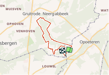
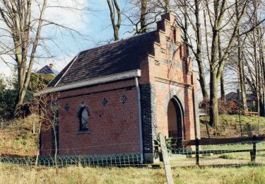
Randonnée Marche de 13,4 km à découvrir à Flandre, Limbourg, Maaseik. Cette randonnée est proposée par bometdehamer.
Description
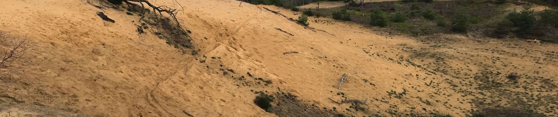
Vertrokken op camping Zavelbos, op en over de Oudsberg, tot in Gruitrode en terug. Traag gewandeld en genoten van kleine dingen, vooral veel zwammen op dood hout..
Localisation
Pays :
Belgique
Région :
Flandre
Département/Province :
Limbourg
Commune :
Maaseik
Localité :
Opoeteren
Départ:(Dec)
Départ:(UTM)
684086 ; 5659617 (31U) N.
Commentaires
Randonnées à proximité
![Randonnée Marche Maaseik - Opoeteren _930 - Photo](https://media.geolcdn.com/t/375/260/ext.jpg?maxdim=2&url=https%3A%2F%2Fmedia.geolcdn.com%2Ff%2F784b545d-0697-41ea-9878-b528d019e3de.jpg)
![Marche Marche](https://static1.geolcdn.com/sitytour/trail-icons/101.png)
Opoeteren _930
Marche
Facile
(1)
Maaseik,
Flandre,
Limbourg,
Belgique
![](/images/other/stat-length.png)
17,8 km | 20 km-effort
4h 38min
![](https://static1.geolcdn.com/siteimages/upload/files/16400158638029165_repeat_loop_refresh_sync_direction_icon.png)
Oui
![Randonnée A pied As - Heiderbos blauwe ruit - Photo](https://media.geolcdn.com/t/375/260/ext.jpg?maxdim=2&url=https%3A%2F%2Fmedia.geolcdn.com%2Ff%2Fe65c145e-dca4-4d58-ae17-fc8ca78c84c8.jpeg)
![A pied A pied](https://static1.geolcdn.com/sitytour/trail-icons/100.png)
Heiderbos blauwe ruit
A pied
Facile
As,
Flandre,
Limbourg,
Belgique
![](/images/other/stat-length.png)
7,7 km | 8,5 km-effort
1h 56min
![](https://static1.geolcdn.com/siteimages/upload/files/16400158638029165_repeat_loop_refresh_sync_direction_icon.png)
Oui
![Randonnée A pied Oudsbergen - Bosbeekvallei Rode vierkant - Photo](https://media.geolcdn.com/t/375/260/ext.jpg?maxdim=2&url=https%3A%2F%2Fmedia.geolcdn.com%2Ff%2F05b94e83-943e-4a8a-b6a2-23050984110f.jpeg)
![A pied A pied](https://static1.geolcdn.com/sitytour/trail-icons/100.png)
Bosbeekvallei Rode vierkant
A pied
Facile
Oudsbergen,
Flandre,
Limbourg,
Belgique
![](/images/other/stat-length.png)
6,3 km | 6,8 km-effort
1h 32min
![](https://static1.geolcdn.com/siteimages/upload/files/16400158638029165_repeat_loop_refresh_sync_direction_icon.png)
Oui
![Randonnée A pied Maaseik - Oudsberg Blauwe ruit - Photo](https://media.geolcdn.com/t/375/260/ext.jpg?maxdim=2&url=https%3A%2F%2Fmedia.geolcdn.com%2Ff%2Fbd436d3d-7786-4c28-877a-e4f4a8ff02e7.jpeg)
![A pied A pied](https://static1.geolcdn.com/sitytour/trail-icons/100.png)
Oudsberg Blauwe ruit
A pied
Facile
Maaseik,
Flandre,
Limbourg,
Belgique
![](/images/other/stat-length.png)
7 km | 8 km-effort
1h 48min
![](https://static1.geolcdn.com/siteimages/upload/files/16400158638029165_repeat_loop_refresh_sync_direction_icon.png)
Oui
![Randonnée A pied Oudsbergen - Oudsberg Blauwe ruit - Photo](https://media.geolcdn.com/t/375/260/ext.jpg?maxdim=2&url=https%3A%2F%2Fmedia.geolcdn.com%2Ff%2F587c0d46-8fc2-4453-a2ba-63c77f582c07.jpeg)
![A pied A pied](https://static1.geolcdn.com/sitytour/trail-icons/100.png)
Oudsberg Blauwe ruit
A pied
Facile
Oudsbergen,
Flandre,
Limbourg,
Belgique
![](/images/other/stat-length.png)
4 km | 4,5 km-effort
1h 0min
![](https://static1.geolcdn.com/siteimages/upload/files/16400158638029165_repeat_loop_refresh_sync_direction_icon.png)
Oui
![Randonnée A pied Maaseik - Oudsberg Groene rechthoek - Photo](https://media.geolcdn.com/t/375/260/ext.jpg?maxdim=2&url=https%3A%2F%2Fmedia.geolcdn.com%2Ff%2F87a0d596-d580-45a8-874d-5f76f3c7dee5.jpeg)
![A pied A pied](https://static1.geolcdn.com/sitytour/trail-icons/100.png)
Oudsberg Groene rechthoek
A pied
Facile
Maaseik,
Flandre,
Limbourg,
Belgique
![](/images/other/stat-length.png)
3,1 km | 3,4 km-effort
45min
![](https://static1.geolcdn.com/siteimages/upload/files/16400158638029165_repeat_loop_refresh_sync_direction_icon.png)
Oui
![Randonnée A pied Maaseik - Oudsberg Oranje bol - Photo](https://media.geolcdn.com/t/375/260/ext.jpg?maxdim=2&url=https%3A%2F%2Fmedia.geolcdn.com%2Ff%2Fbd436d3d-7786-4c28-877a-e4f4a8ff02e7.jpeg)
![A pied A pied](https://static1.geolcdn.com/sitytour/trail-icons/100.png)
Oudsberg Oranje bol
A pied
Facile
Maaseik,
Flandre,
Limbourg,
Belgique
![](/images/other/stat-length.png)
11,7 km | 13,4 km-effort
3h 2min
![](https://static1.geolcdn.com/siteimages/upload/files/16400158638029165_repeat_loop_refresh_sync_direction_icon.png)
Oui
![Randonnée A pied Dilsen-Stokkem - Bergerven Gele zeshoek - Photo](https://media.geolcdn.com/t/375/260/ext.jpg?maxdim=2&url=https%3A%2F%2Fmedia.geolcdn.com%2Ff%2F050a923b-2af9-40e2-aacc-99779fc4e3d7.jpeg)
![A pied A pied](https://static1.geolcdn.com/sitytour/trail-icons/100.png)
Bergerven Gele zeshoek
A pied
Facile
Dilsen-Stokkem,
Flandre,
Limbourg,
Belgique
![](/images/other/stat-length.png)
15,1 km | 17,5 km-effort
3h 58min
![](https://static1.geolcdn.com/siteimages/upload/files/16400158638029165_repeat_loop_refresh_sync_direction_icon.png)
Oui
![Randonnée A pied Maaseik - Bergerven Blauwe ruit - Photo](https://media.geolcdn.com/t/375/260/ext.jpg?maxdim=2&url=https%3A%2F%2Fmedia.geolcdn.com%2Ff%2F050a923b-2af9-40e2-aacc-99779fc4e3d7.jpeg)
![A pied A pied](https://static1.geolcdn.com/sitytour/trail-icons/100.png)
Bergerven Blauwe ruit
A pied
Facile
Maaseik,
Flandre,
Limbourg,
Belgique
![](/images/other/stat-length.png)
7,4 km | 8,3 km-effort
1h 53min
![](https://static1.geolcdn.com/siteimages/upload/files/16400158638029165_repeat_loop_refresh_sync_direction_icon.png)
Oui