![](/images/other/stat-length.png)
![Randonnée Randonnée équestre Adamswiller - Boucle Adamswiller Kirschberg - Photo](https://media.geolcdn.com/t/1900/400/ext.pjpeg?maxdim=2&url=https%3A%2F%2Fmedia.geolcdn.com%2Ff%2F2f0a407a-793d-4d42-a4b6-0a5db5e20562.jpg)
Boucle Adamswiller Kirschberg
Tourisme Equestre Alsace
Promouvoir le Tourisme Equestre en Alsace GUIDE+
![Longueur](/images/other/stat-length.png)
Longueur
24 km
![Altitude max](https://static1.geolcdn.com/siteimages/upload/files/1508320355ic_sort_altitude_max_24dp.png)
Altitude max
351 m
![Dénivelé positif](https://static1.geolcdn.com/siteimages/upload/files/1508320355ic_sort_den_pos_24dp.png)
Dénivelé positif
401 m
![Km-Effort](/images/other/stat-length.png)
Km-Effort
30 km
![Altitude min](https://static1.geolcdn.com/siteimages/upload/files/1508320355ic_sort_altitude_min_24dp.png)
Altitude min
229 m
![Dénivelé négatif](https://static1.geolcdn.com/siteimages/upload/files/1508320355ic_sort_den_neg_24dp.png)
Dénivelé négatif
401 m
![Boucle](https://static1.geolcdn.com/siteimages/upload/files/16400158638029165_repeat_loop_refresh_sync_direction_icon.png)
Boucle
Oui
Date de création :
2021-08-20 09:35:26.606
Dernière modification :
2021-08-20 09:39:33.747
![Randonnée équestre](https://static1.geolcdn.com/sitytour/trail-icons/301.png)
3h53
Difficulté : Moyen
![Scannez ce code QR pour ouvrir la randonnée dans l'application SityTrail](https://capi.geolives.com/qq0zvz2zws4bq2lad0pu/sitytour/trails/2905845/qr.png?size=200)
Application GPS de randonnée GRATUITE
À propos
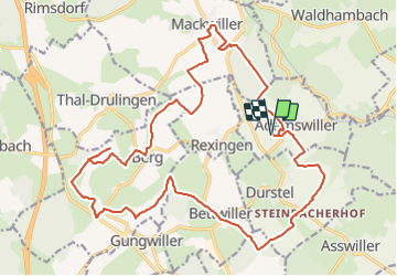
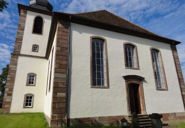
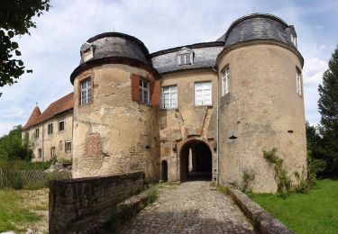
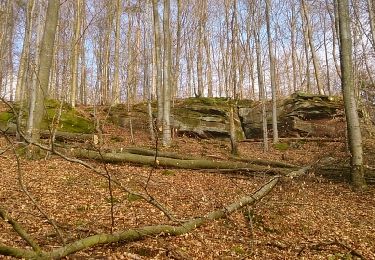
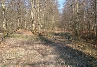
Randonnée Randonnée équestre de 24 km à découvrir à Grand Est, Bas-Rhin, Adamswiller. Cette randonnée est proposée par Tourisme Equestre Alsace.
Description
Boucle au départ et à l'arrivée d'Adamswiller avec pause pique-nique au milieu du parcours au Kirschberg avec sa barre d'attaches
Localisation
Pays :
France
Région :
Grand Est
Département/Province :
Bas-Rhin
Commune :
Adamswiller
Localité :
Unknown
Départ:(Dec)
Départ:(UTM)
367797 ; 5418269 (32U) N.
Commentaires
Randonnées à proximité
![Randonnée A pied Diemeringen - Mackwiller la romaine - Photo](https://media.geolcdn.com/t/375/260/ext.jpg?maxdim=2&url=https%3A%2F%2Fmedia.geolcdn.com%2Ff%2F6e42945c-7f24-4443-aff5-37264c5394f0.jpeg)
![A pied A pied](https://static1.geolcdn.com/sitytour/trail-icons/100.png)
Mackwiller la romaine
A pied
Facile
Diemeringen,
Grand Est,
Bas-Rhin,
France
![](/images/other/stat-length.png)
4,6 km | 5,4 km-effort
1h 14min
![](https://static1.geolcdn.com/siteimages/upload/files/16400158638029165_repeat_loop_refresh_sync_direction_icon.png)
Oui
![Randonnée A pied Diemeringen - Croix bleue - Photo](https://media.geolcdn.com/t/375/260/ext.jpg?maxdim=2&url=https%3A%2F%2Fmedia.geolcdn.com%2Ff%2F038b5fbd-ad7d-4d8f-a6b9-4f60e8eebeb8.jpeg)
![A pied A pied](https://static1.geolcdn.com/sitytour/trail-icons/100.png)
Croix bleue
A pied
Facile
Diemeringen,
Grand Est,
Bas-Rhin,
France
![](/images/other/stat-length.png)
12,3 km | 16,1 km-effort
3h 39min
![](https://static1.geolcdn.com/siteimages/upload/files/16400158638029165_repeat_loop_refresh_sync_direction_icon.png)
Non
![Randonnée A pied Berg - Mémoire de pierres et d'eau - Photo](https://media.geolcdn.com/t/375/260/ext.jpg?maxdim=2&url=https%3A%2F%2Fmedia.geolcdn.com%2Ff%2Fb6558429-a52c-44ad-aefb-7b2d392d13ef.jpeg)
![A pied A pied](https://static1.geolcdn.com/sitytour/trail-icons/100.png)
Mémoire de pierres et d'eau
A pied
Facile
Berg,
Grand Est,
Bas-Rhin,
France
![](/images/other/stat-length.png)
3,3 km | 3,8 km-effort
51min
![](https://static1.geolcdn.com/siteimages/upload/files/16400158638029165_repeat_loop_refresh_sync_direction_icon.png)
Non
![Randonnée A pied Diemeringen - Triangle bleu - Photo](https://media.geolcdn.com/t/375/260/ext.jpg?maxdim=2&url=https%3A%2F%2Fmedia.geolcdn.com%2Ff%2Fd4b9e7be-1430-47f3-af7c-96cdacf9298e.jpeg)
![A pied A pied](https://static1.geolcdn.com/sitytour/trail-icons/100.png)
Triangle bleu
A pied
Facile
Diemeringen,
Grand Est,
Bas-Rhin,
France
![](/images/other/stat-length.png)
7,6 km | 9,6 km-effort
2h 10min
![](https://static1.geolcdn.com/siteimages/upload/files/16400158638029165_repeat_loop_refresh_sync_direction_icon.png)
Non
![Randonnée A pied Diemeringen - Comtesse Sophie de Nassau - Photo](https://media.geolcdn.com/t/375/260/ext.jpg?maxdim=2&url=https%3A%2F%2Fmedia.geolcdn.com%2Ff%2F8c2b8556-e0a8-4065-811c-0a8a71e07fa2.jpeg)
![A pied A pied](https://static1.geolcdn.com/sitytour/trail-icons/100.png)
Comtesse Sophie de Nassau
A pied
Facile
Diemeringen,
Grand Est,
Bas-Rhin,
France
![](/images/other/stat-length.png)
6,9 km | 8,1 km-effort
1h 50min
![](https://static1.geolcdn.com/siteimages/upload/files/16400158638029165_repeat_loop_refresh_sync_direction_icon.png)
Oui
![Randonnée A pied Diemeringen - Triangle jaune - Photo](https://media.geolcdn.com/t/375/260/ext.jpg?maxdim=2&url=https%3A%2F%2Fmedia.geolcdn.com%2Ff%2Fd4b9e7be-1430-47f3-af7c-96cdacf9298e.jpeg)
![A pied A pied](https://static1.geolcdn.com/sitytour/trail-icons/100.png)
Triangle jaune
A pied
Moyen
Diemeringen,
Grand Est,
Bas-Rhin,
France
![](/images/other/stat-length.png)
21 km | 27 km-effort
6h 11min
![](https://static1.geolcdn.com/siteimages/upload/files/16400158638029165_repeat_loop_refresh_sync_direction_icon.png)
Non
![Randonnée Marche Mackwiller - mackwiller - Photo](https://media.geolcdn.com/t/375/260/ext.jpg?maxdim=2&url=https%3A%2F%2Fservices.sitytrail.com%2FGeolivesWS%2FDownloadMedia.ashx%3FTrailID%3D257697%26Media%3Dfix__20140316085449.jpg)
![Marche Marche](https://static1.geolcdn.com/sitytour/trail-icons/101.png)
![Randonnée Marche Mackwiller - mackwiller - Photo](https://media.geolcdn.com/t/375/260/ext.jpg?maxdim=2&url=https%3A%2F%2Fservices.sitytrail.com%2FGeolivesWS%2FDownloadMedia.ashx%3FTrailID%3D256525%26Media%3Dfix__20140312152446.jpg)
![Marche Marche](https://static1.geolcdn.com/sitytour/trail-icons/101.png)
mackwiller
Marche
Facile
(1)
Mackwiller,
Grand Est,
Bas-Rhin,
France
![](/images/other/stat-length.png)
10,4 km | 13,5 km-effort
1h 52min
![](https://static1.geolcdn.com/siteimages/upload/files/16400158638029165_repeat_loop_refresh_sync_direction_icon.png)
Oui
![Randonnée Vélo Berg - Villages welches (Tronçon Sud) - Wolsthof - Photo](https://media.geolcdn.com/t/375/260/ext.jpg?maxdim=2&url=https%3A%2F%2Fservices.sitytrail.com%2FGeolivesWS%2FDownloadMedia.ashx%3FTrailID%3D104325%26Media%3D7555_6.jpg)
![Vélo Vélo](https://static1.geolcdn.com/sitytour/trail-icons/200.png)
Villages welches (Tronçon Sud) - Wolsthof
Vélo
Difficile
Berg,
Grand Est,
Bas-Rhin,
France
![](/images/other/stat-length.png)
44 km | 54 km-effort
3h 30min
![](https://static1.geolcdn.com/siteimages/upload/files/16400158638029165_repeat_loop_refresh_sync_direction_icon.png)
Oui