![](/images/other/stat-length.png)
![Randonnée Marche Gavarnie-Gèdre - jc.pambrun@yahoo.fr - Photo](https://media.geolcdn.com/t/1900/400/ext.pjpeg?maxdim=2&url=https%3A%2F%2Fservices.sitytrail.com%2FGeolivesWS%2FDownloadMedia.ashx%3FTrailID%3D302453%26Media%3D20140517111349.jpg)
jc.pambrun@yahoo.fr
sebastienPBN
Utilisateur
![Longueur](/images/other/stat-length.png)
Longueur
28 km
![Altitude max](https://static1.geolcdn.com/siteimages/upload/files/1508320355ic_sort_altitude_max_24dp.png)
Altitude max
2186 m
![Dénivelé positif](https://static1.geolcdn.com/siteimages/upload/files/1508320355ic_sort_den_pos_24dp.png)
Dénivelé positif
1263 m
![Km-Effort](/images/other/stat-length.png)
Km-Effort
48 km
![Altitude min](https://static1.geolcdn.com/siteimages/upload/files/1508320355ic_sort_altitude_min_24dp.png)
Altitude min
689 m
![Dénivelé négatif](https://static1.geolcdn.com/siteimages/upload/files/1508320355ic_sort_den_neg_24dp.png)
Dénivelé négatif
2444 m
![Boucle](https://static1.geolcdn.com/siteimages/upload/files/16400158638029165_repeat_loop_refresh_sync_direction_icon.png)
Boucle
Non
Date de création :
2014-12-10 00:00:00.0
Dernière modification :
2014-12-10 00:00:00.0
![Marche](https://static1.geolcdn.com/sitytour/trail-icons/101.png)
6h19
Difficulté : Facile
![Scannez ce code QR pour ouvrir la randonnée dans l'application SityTrail](https://capi.geolives.com/qq0zvz2zws4bq2lad0pu/sitytour/trails/302453/qr.png?size=200)
Application GPS de randonnée GRATUITE
À propos
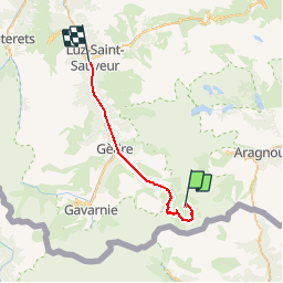
Randonnée Marche de 28 km à découvrir à Occitanie, Hautes-Pyrénées, Gavarnie-Gèdre. Cette randonnée est proposée par sebastienPBN.
Description
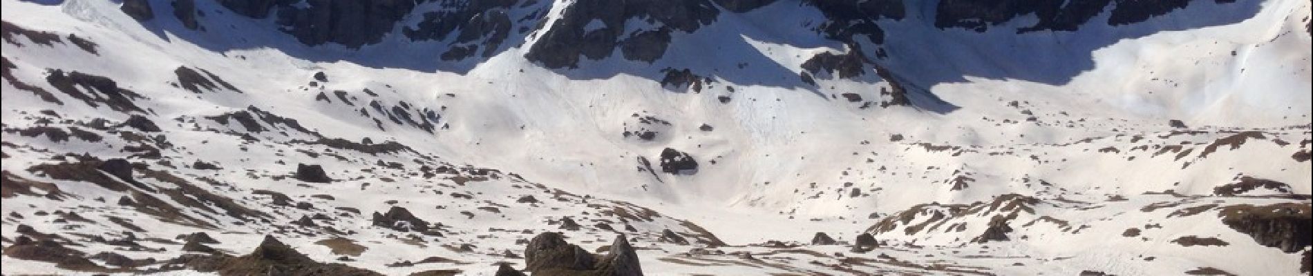
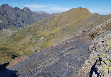
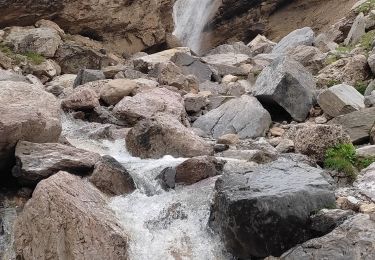
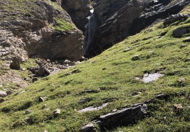
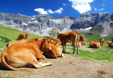
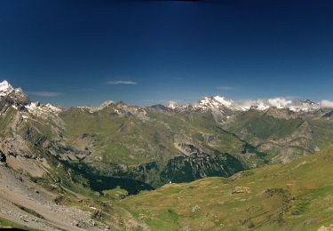
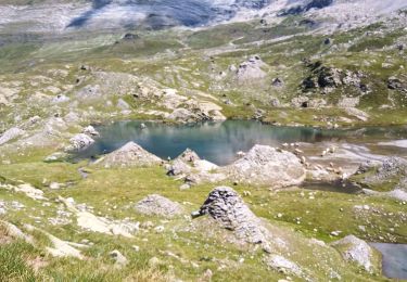
Cirque de troumouse 1er sorti avec maman et j-p 5h de marche. Mise en jambe pour le vignemale et la traversée des Pyrénées !! ??
Localisation
Pays :
France
Région :
Occitanie
Département/Province :
Hautes-Pyrénées
Commune :
Gavarnie-Gèdre
Localité :
Gèdre
Départ:(Dec)
Départ:(UTM)
263297 ; 4735507 (31T) N.
Commentaires
Randonnées à proximité
![Randonnée Marche Gavarnie-Gèdre - Le Pimené par la vallée d'Estaubé - Gèbre - Photo](https://media.geolcdn.com/t/375/260/ext.jpg?maxdim=2&url=https%3A%2F%2Fservices.sitytrail.com%2FGeolivesWS%2FDownloadMedia.ashx%3FTrailID%3D316841%26Media%3D15905_6.jpg)
![Marche Marche](https://static1.geolcdn.com/sitytour/trail-icons/101.png)
Le Pimené par la vallée d'Estaubé - Gèbre
Marche
Difficile
(1)
Gavarnie-Gèdre,
Occitanie,
Hautes-Pyrénées,
France
![](/images/other/stat-length.png)
19,8 km | 35 km-effort
9h 0min
![](https://static1.geolcdn.com/siteimages/upload/files/16400158638029165_repeat_loop_refresh_sync_direction_icon.png)
Oui
![Randonnée Marche Gavarnie-Gèdre - PYRENNES cirque d'Estaube - Photo](https://media.geolcdn.com/t/375/260/ext.jpg?maxdim=2&url=https%3A%2F%2Fstatic1.geolcdn.com%2Fsiteimages%2Fupload%2Ffiles%2F1553511878bg_sport_marche.png)
![Marche Marche](https://static1.geolcdn.com/sitytour/trail-icons/101.png)
PYRENNES cirque d'Estaube
Marche
Moyen
(1)
Gavarnie-Gèdre,
Occitanie,
Hautes-Pyrénées,
France
![](/images/other/stat-length.png)
6,1 km | 8,6 km-effort
1h 56min
![](https://static1.geolcdn.com/siteimages/upload/files/16400158638029165_repeat_loop_refresh_sync_direction_icon.png)
Non
![Randonnée Marche Gavarnie-Gèdre - Gèdre - barrage des gloriettes - Photo](https://media.geolcdn.com/t/375/260/ext.jpg?maxdim=2&url=https%3A%2F%2Fstatic1.geolcdn.com%2Fsiteimages%2Fupload%2Ffiles%2F1553511878bg_sport_marche.png)
![Marche Marche](https://static1.geolcdn.com/sitytour/trail-icons/101.png)
Gèdre - barrage des gloriettes
Marche
Facile
(1)
Gavarnie-Gèdre,
Occitanie,
Hautes-Pyrénées,
France
![](/images/other/stat-length.png)
6,2 km | 8,3 km-effort
1h 57min
![](https://static1.geolcdn.com/siteimages/upload/files/16400158638029165_repeat_loop_refresh_sync_direction_icon.png)
Oui
![Randonnée Marche Gavarnie-Gèdre - Héas- Hourquette d'Héas - Photo](https://media.geolcdn.com/t/375/260/ext.jpg?maxdim=2&url=https%3A%2F%2Fmedia.geolcdn.com%2Ff%2F618bc0c0-cedb-49ac-8534-ec0e663aaf8a.jpg)
![Marche Marche](https://static1.geolcdn.com/sitytour/trail-icons/101.png)
Héas- Hourquette d'Héas
Marche
Difficile
Gavarnie-Gèdre,
Occitanie,
Hautes-Pyrénées,
France
![](/images/other/stat-length.png)
15,8 km | 31 km-effort
7h 7min
![](https://static1.geolcdn.com/siteimages/upload/files/16400158638029165_repeat_loop_refresh_sync_direction_icon.png)
Oui
![Randonnée Marche Gavarnie-Gèdre - Les Gloriettes et Cascades . - Photo](https://media.geolcdn.com/t/375/260/ext.jpg?maxdim=2&url=https%3A%2F%2Fmedia.geolcdn.com%2Ff%2F4ea1e05c-fd2f-4013-b17a-3569ef0b1ae9.jpg)
![Marche Marche](https://static1.geolcdn.com/sitytour/trail-icons/101.png)
Les Gloriettes et Cascades .
Marche
Moyen
Gavarnie-Gèdre,
Occitanie,
Hautes-Pyrénées,
France
![](/images/other/stat-length.png)
12,3 km | 15,5 km-effort
3h 56min
![](https://static1.geolcdn.com/siteimages/upload/files/16400158638029165_repeat_loop_refresh_sync_direction_icon.png)
Oui
![Randonnée Marche Gavarnie-Gèdre - Cirque d’Estaubé - Photo](https://media.geolcdn.com/t/375/260/ext.jpg?maxdim=2&url=https%3A%2F%2Fmedia.geolcdn.com%2Ff%2F4c29a7c8-3656-4921-9709-0531d6156ab8.jpg)
![Marche Marche](https://static1.geolcdn.com/sitytour/trail-icons/101.png)
Cirque d’Estaubé
Marche
Facile
Gavarnie-Gèdre,
Occitanie,
Hautes-Pyrénées,
France
![](/images/other/stat-length.png)
13,5 km | 18,2 km-effort
6h 5min
![](https://static1.geolcdn.com/siteimages/upload/files/16400158638029165_repeat_loop_refresh_sync_direction_icon.png)
Oui
![Randonnée A pied Gavarnie-Gèdre - Cirque de Troumouse - Photo](https://media.geolcdn.com/t/375/260/ext.jpg?maxdim=2&url=https%3A%2F%2Fmedia.geolcdn.com%2Ff%2Fe95ba4dd-45b2-408c-b710-683bfb7ec245.jpeg)
![A pied A pied](https://static1.geolcdn.com/sitytour/trail-icons/100.png)
Cirque de Troumouse
A pied
Facile
Gavarnie-Gèdre,
Occitanie,
Hautes-Pyrénées,
France
![](/images/other/stat-length.png)
4,6 km | 10,5 km-effort
2h 23min
![](https://static1.geolcdn.com/siteimages/upload/files/16400158638029165_repeat_loop_refresh_sync_direction_icon.png)
Non
![Randonnée A pied Gavarnie-Gèdre - Vers la Hourquette d'Alans par le Cirque d'Estaubé - Photo](https://media.geolcdn.com/t/375/260/ext.jpg?maxdim=2&url=https%3A%2F%2Fmedia.geolcdn.com%2Ff%2F10da8125-40cd-4f51-abc5-7266a7f49c89.jpeg)
![A pied A pied](https://static1.geolcdn.com/sitytour/trail-icons/100.png)
Vers la Hourquette d'Alans par le Cirque d'Estaubé
A pied
Facile
Gavarnie-Gèdre,
Occitanie,
Hautes-Pyrénées,
France
![](/images/other/stat-length.png)
7,8 km | 15,8 km-effort
3h 35min
![](https://static1.geolcdn.com/siteimages/upload/files/16400158638029165_repeat_loop_refresh_sync_direction_icon.png)
Non
![Randonnée Marche Gavarnie-Gèdre - cirque de Tramouse - Photo](https://media.geolcdn.com/t/375/260/ext.jpg?maxdim=2&url=https%3A%2F%2Fmedia.geolcdn.com%2Ff%2F52fa33fc-0eec-4624-9e80-0a0b2ae7c99a.jpg)
![Marche Marche](https://static1.geolcdn.com/sitytour/trail-icons/101.png)
cirque de Tramouse
Marche
Facile
Gavarnie-Gèdre,
Occitanie,
Hautes-Pyrénées,
France
![](/images/other/stat-length.png)
7,7 km | 12,5 km-effort
2h 31min
![](https://static1.geolcdn.com/siteimages/upload/files/16400158638029165_repeat_loop_refresh_sync_direction_icon.png)
Oui