![](/images/other/stat-length.png)
![Randonnée Marche Flassans-sur-Issole - Château des PONTEVES-12-12-22 - Photo](https://media.geolcdn.com/t/1900/400/ext.pjpeg?maxdim=2&url=https%3A%2F%2Fmedia.geolcdn.com%2Ff%2F29de5f3f-3457-4257-8be5-b4f3b9815fc2.jpg)
Château des PONTEVES-12-12-22
Christiancordin
Utilisateur
![Longueur](/images/other/stat-length.png)
Longueur
16,8 km
![Altitude max](https://static1.geolcdn.com/siteimages/upload/files/1508320355ic_sort_altitude_max_24dp.png)
Altitude max
318 m
![Dénivelé positif](https://static1.geolcdn.com/siteimages/upload/files/1508320355ic_sort_den_pos_24dp.png)
Dénivelé positif
368 m
![Km-Effort](/images/other/stat-length.png)
Km-Effort
22 km
![Altitude min](https://static1.geolcdn.com/siteimages/upload/files/1508320355ic_sort_altitude_min_24dp.png)
Altitude min
217 m
![Dénivelé négatif](https://static1.geolcdn.com/siteimages/upload/files/1508320355ic_sort_den_neg_24dp.png)
Dénivelé négatif
367 m
![Boucle](https://static1.geolcdn.com/siteimages/upload/files/16400158638029165_repeat_loop_refresh_sync_direction_icon.png)
Boucle
Oui
Date de création :
2022-12-11 07:43:33.285
Dernière modification :
2022-12-12 16:54:29.533
![Marche](https://static1.geolcdn.com/sitytour/trail-icons/101.png)
4h27
Difficulté : Moyen
![Scannez ce code QR pour ouvrir la randonnée dans l'application SityTrail](https://capi.geolives.com/qq0zvz2zws4bq2lad0pu/sitytour/trails/3478972/qr.png?size=200)
Application GPS de randonnée GRATUITE
À propos
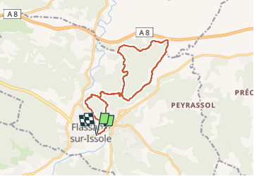
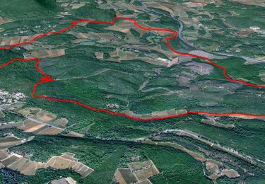
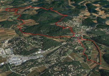
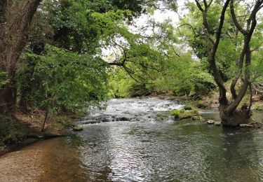
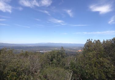
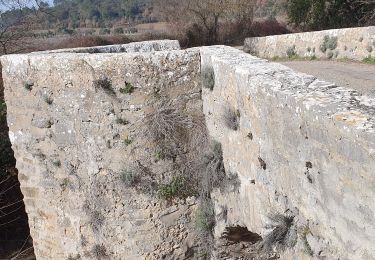
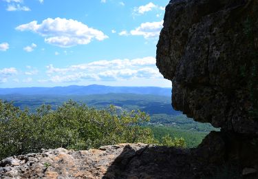
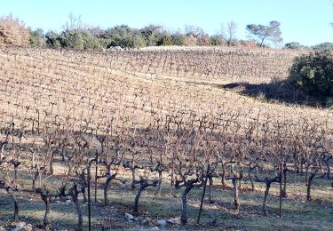
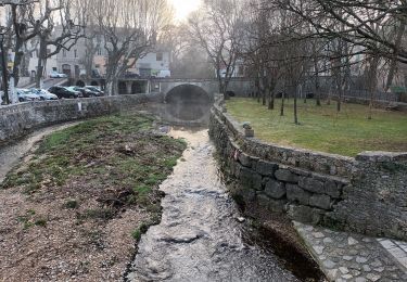
Randonnée Marche de 16,8 km à découvrir à Provence-Alpes-Côte d'Azur, Var, Flassans-sur-Issole. Cette randonnée est proposée par Christiancordin.
Description
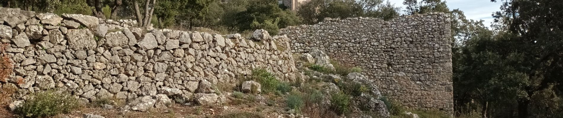
Flassans /Issole-la grande Bastide-Carteresse-château des Pontevès-Chapelle St Joseph- le vieux Flassans- Chapelle ND de la consolation-Chemin de croix caladé.
Localisation
Pays :
France
Région :
Provence-Alpes-Côte d'Azur
Département/Province :
Var
Commune :
Flassans-sur-Issole
Localité :
Unknown
Départ:(Dec)
Départ:(UTM)
274495 ; 4805326 (32T) N.
Commentaires
Randonnées à proximité
![Randonnée Marche Flassans-sur-Issole - La Campagne au Nord de Flassans / Issole - Photo](https://media.geolcdn.com/t/375/260/ext.jpg?maxdim=2&url=https%3A%2F%2Fmedia.geolcdn.com%2Ff%2Ff6b89427-8dbe-40a1-8c27-01bf04e99ddc.jpg)
![Marche Marche](https://static1.geolcdn.com/sitytour/trail-icons/101.png)
La Campagne au Nord de Flassans / Issole
Marche
Très difficile
(1)
Flassans-sur-Issole,
Provence-Alpes-Côte d'Azur,
Var,
France
![](/images/other/stat-length.png)
15,3 km | 19,9 km-effort
4h 31min
![](https://static1.geolcdn.com/siteimages/upload/files/16400158638029165_repeat_loop_refresh_sync_direction_icon.png)
Oui
![Randonnée Marche Flassans-sur-Issole - Boucle autour de Flassans-sur-Issole - Photo](https://media.geolcdn.com/t/375/260/ext.jpg?maxdim=2&url=https%3A%2F%2Fmedia.geolcdn.com%2Ff%2F272127f8-651e-43b0-864e-2373ba32a41c.jpg)
![Marche Marche](https://static1.geolcdn.com/sitytour/trail-icons/101.png)
Boucle autour de Flassans-sur-Issole
Marche
Facile
(1)
Flassans-sur-Issole,
Provence-Alpes-Côte d'Azur,
Var,
France
![](/images/other/stat-length.png)
13,5 km | 16,4 km-effort
5h 30min
![](https://static1.geolcdn.com/siteimages/upload/files/16400158638029165_repeat_loop_refresh_sync_direction_icon.png)
Oui
![Randonnée Marche Besse-sur-Issole - Boucle entre Besse et Ste Anastasie sur Issole - Photo](https://media.geolcdn.com/t/375/260/ext.jpg?maxdim=2&url=https%3A%2F%2Fmedia.geolcdn.com%2Ff%2F06e3e46b-800e-4c1c-9551-df99b428495c.jpg)
![Marche Marche](https://static1.geolcdn.com/sitytour/trail-icons/101.png)
Boucle entre Besse et Ste Anastasie sur Issole
Marche
Moyen
Besse-sur-Issole,
Provence-Alpes-Côte d'Azur,
Var,
France
![](/images/other/stat-length.png)
14,8 km | 18,9 km-effort
4h 17min
![](https://static1.geolcdn.com/siteimages/upload/files/16400158638029165_repeat_loop_refresh_sync_direction_icon.png)
Oui
![Randonnée Marche Besse-sur-Issole - Ermitage de Saint Quinis 16.3.24 - Photo](https://media.geolcdn.com/t/375/260/ext.jpg?maxdim=2&url=https%3A%2F%2Fmedia.geolcdn.com%2Ff%2Fdc71aa2c-2a52-4e81-901f-c8126950b626.jpg)
![Marche Marche](https://static1.geolcdn.com/sitytour/trail-icons/101.png)
Ermitage de Saint Quinis 16.3.24
Marche
Facile
Besse-sur-Issole,
Provence-Alpes-Côte d'Azur,
Var,
France
![](/images/other/stat-length.png)
10 km | 15,2 km-effort
3h 0min
![](https://static1.geolcdn.com/siteimages/upload/files/16400158638029165_repeat_loop_refresh_sync_direction_icon.png)
Oui
![Randonnée Marche Flassans-sur-Issole - Chateau de Ponteves - Flassans - Photo](https://media.geolcdn.com/t/375/260/ext.jpg?maxdim=2&url=https%3A%2F%2Fstatic1.geolcdn.com%2Fsiteimages%2Fupload%2Ffiles%2F1553511878bg_sport_marche.png)
![Marche Marche](https://static1.geolcdn.com/sitytour/trail-icons/101.png)
Chateau de Ponteves - Flassans
Marche
Facile
(2)
Flassans-sur-Issole,
Provence-Alpes-Côte d'Azur,
Var,
France
![](/images/other/stat-length.png)
11,3 km | 13,9 km-effort
3h 37min
![](https://static1.geolcdn.com/siteimages/upload/files/16400158638029165_repeat_loop_refresh_sync_direction_icon.png)
Oui
![Randonnée Marche Flassans-sur-Issole - flassans sur Issole - Photo](https://media.geolcdn.com/t/375/260/ext.jpg?maxdim=2&url=https%3A%2F%2Fmedia.geolcdn.com%2Ff%2F3227ace2-07fe-4c77-83e9-c6eb636bf68c.jpg)
![Marche Marche](https://static1.geolcdn.com/sitytour/trail-icons/101.png)
flassans sur Issole
Marche
Moyen
Flassans-sur-Issole,
Provence-Alpes-Côte d'Azur,
Var,
France
![](/images/other/stat-length.png)
11,4 km | 13,9 km-effort
2h 53min
![](https://static1.geolcdn.com/siteimages/upload/files/16400158638029165_repeat_loop_refresh_sync_direction_icon.png)
Oui
![Randonnée Marche Besse-sur-Issole - Besse sur Issole - Lac - Barre et Chapelle de St Quinis - Photo](https://media.geolcdn.com/t/375/260/ext.jpg?maxdim=2&url=https%3A%2F%2Fmedia.geolcdn.com%2Ff%2Fb739d371-fb64-4815-9a37-b4adf7e7c3a0.JPG)
![Marche Marche](https://static1.geolcdn.com/sitytour/trail-icons/101.png)
Besse sur Issole - Lac - Barre et Chapelle de St Quinis
Marche
Facile
Besse-sur-Issole,
Provence-Alpes-Côte d'Azur,
Var,
France
![](/images/other/stat-length.png)
16,7 km | 24 km-effort
4h 35min
![](https://static1.geolcdn.com/siteimages/upload/files/16400158638029165_repeat_loop_refresh_sync_direction_icon.png)
Oui
![Randonnée Marche Flassans-sur-Issole - Flassans - Photo](https://media.geolcdn.com/t/375/260/ext.jpg?maxdim=2&url=https%3A%2F%2Fmedia.geolcdn.com%2Ff%2F00c25a40-8d62-4837-a8af-47e610d2320c.jpg)
![Marche Marche](https://static1.geolcdn.com/sitytour/trail-icons/101.png)
Flassans
Marche
Très difficile
Flassans-sur-Issole,
Provence-Alpes-Côte d'Azur,
Var,
France
![](/images/other/stat-length.png)
16,4 km | 19,7 km-effort
4h 48min
![](https://static1.geolcdn.com/siteimages/upload/files/16400158638029165_repeat_loop_refresh_sync_direction_icon.png)
Oui
![Randonnée Marche Flassans-sur-Issole - Flassans sur Issole-19-01-22 - Photo](https://media.geolcdn.com/t/375/260/ext.jpg?maxdim=2&url=https%3A%2F%2Fmedia.geolcdn.com%2Ff%2F60080561-42ce-442b-8ec9-85b2deb792b3.jpg)
![Marche Marche](https://static1.geolcdn.com/sitytour/trail-icons/101.png)
Flassans sur Issole-19-01-22
Marche
Moyen
Flassans-sur-Issole,
Provence-Alpes-Côte d'Azur,
Var,
France
![](/images/other/stat-length.png)
20 km | 25 km-effort
5h 25min
![](https://static1.geolcdn.com/siteimages/upload/files/16400158638029165_repeat_loop_refresh_sync_direction_icon.png)
Oui