![](/images/other/stat-length.png)
![Randonnée Marche Dalhem - 20230322 - Dalhem 6.9 Km - Photo](https://media.geolcdn.com/t/1900/400/ext.pjpeg?maxdim=2&url=https%3A%2F%2Fmedia.geolcdn.com%2Ff%2Faf13fb9b-cafb-4c20-a110-54ca968f4fde.jpg)
20230322 - Dalhem 6.9 Km
pierreh01
Utilisateur GUIDE
![Longueur](/images/other/stat-length.png)
![Altitude max](https://static1.geolcdn.com/siteimages/upload/files/1508320355ic_sort_altitude_max_24dp.png)
![Dénivelé positif](https://static1.geolcdn.com/siteimages/upload/files/1508320355ic_sort_den_pos_24dp.png)
![Km-Effort](/images/other/stat-length.png)
![Altitude min](https://static1.geolcdn.com/siteimages/upload/files/1508320355ic_sort_altitude_min_24dp.png)
![Dénivelé négatif](https://static1.geolcdn.com/siteimages/upload/files/1508320355ic_sort_den_neg_24dp.png)
![Boucle](https://static1.geolcdn.com/siteimages/upload/files/16400158638029165_repeat_loop_refresh_sync_direction_icon.png)
![Marche](https://static1.geolcdn.com/sitytour/trail-icons/101.png)
1h44
Difficulté : Moyen
![Scannez ce code QR pour ouvrir la randonnée dans l'application SityTrail](https://capi.geolives.com/qq0zvz2zws4bq2lad0pu/sitytour/trails/3593566/qr.png?size=200)
Application GPS de randonnée GRATUITE
À propos
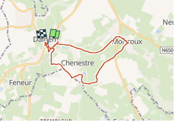
Randonnée Marche de 6,9 km à découvrir à Wallonie, Liège, Dalhem. Cette randonnée est proposée par pierreh01.
Description
Mercredi 22 mars 2023 : Balade en couple.
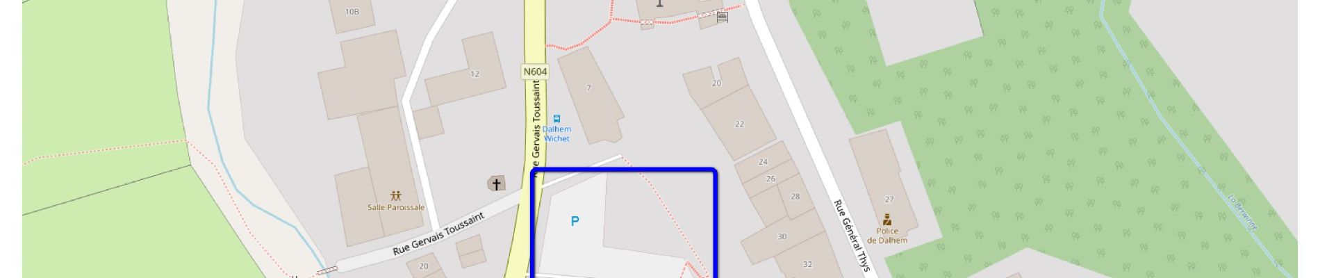
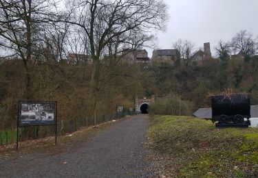
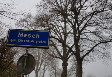
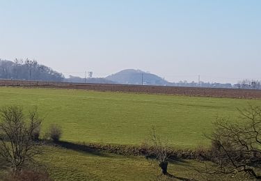
Au départ de Dalhem, sous un timide soleil et du vent par moment, découverte des alentours en passant par le tunnel, Chenestre, Mortroux avant de rejoindre Dalhem.
Distance mesurée avec Sity Trail, semblant plus proche de la réalité.
Tracé GPS un peu chaotique pour cause de perte de signal dans le tunnel.
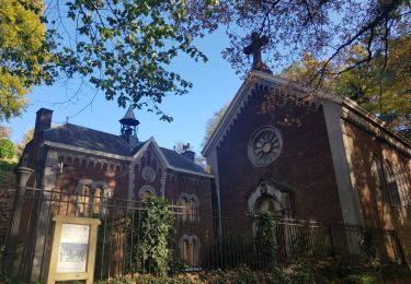
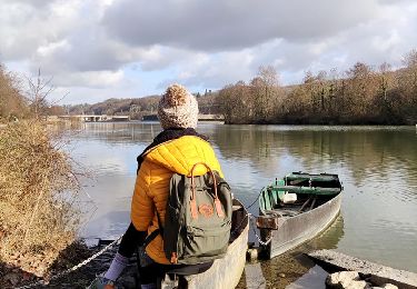
Localisation
Commentaires
Randonnées à proximité
![Randonnée Marche Dalhem - dalhem Bombaye aubin mortroux dalhem - Photo](https://media.geolcdn.com/t/375/260/ext.jpg?maxdim=2&url=https%3A%2F%2Fmedia.geolcdn.com%2Ff%2F16a64587-f39e-4282-a4fc-c52e1169e4ec.jpg)
![Marche Marche](https://static1.geolcdn.com/sitytour/trail-icons/101.png)
Marche
![](/images/other/stat-length.png)
![](https://static1.geolcdn.com/siteimages/upload/files/16400158638029165_repeat_loop_refresh_sync_direction_icon.png)
![Randonnée Marche Herve - Entre bois et GR (8km) - Photo](https://media.geolcdn.com/t/375/260/ext.jpg?maxdim=2&url=https%3A%2F%2Fstatic1.geolcdn.com%2Fsiteimages%2Fupload%2Ffiles%2F1553511878bg_sport_marche.png)
![Marche Marche](https://static1.geolcdn.com/sitytour/trail-icons/101.png)
Marche
![](/images/other/stat-length.png)
![](https://static1.geolcdn.com/siteimages/upload/files/16400158638029165_repeat_loop_refresh_sync_direction_icon.png)
![Randonnée Marche Blegny - Barchon _1702 - Photo](https://media.geolcdn.com/t/375/260/ext.jpg?maxdim=2&url=https%3A%2F%2Fmedia.geolcdn.com%2Ff%2F08e717c2-a47c-47f0-9a4e-fb7b564b3f18.jpg)
![Marche Marche](https://static1.geolcdn.com/sitytour/trail-icons/101.png)
Marche
![](/images/other/stat-length.png)
![](https://static1.geolcdn.com/siteimages/upload/files/16400158638029165_repeat_loop_refresh_sync_direction_icon.png)
![Randonnée Marche Blegny - 20230703 - Blegny-Mine 6.8 Km - Photo](https://media.geolcdn.com/t/375/260/ext.jpg?maxdim=2&url=https%3A%2F%2Fmedia.geolcdn.com%2Ff%2F840a4c96-62cb-4388-9c6c-d720f9bd1cc9.jpeg)
![Marche Marche](https://static1.geolcdn.com/sitytour/trail-icons/101.png)
Marche
![](/images/other/stat-length.png)
![](https://static1.geolcdn.com/siteimages/upload/files/16400158638029165_repeat_loop_refresh_sync_direction_icon.png)
![Randonnée Marche Visé - Domaine de la Julienne - Photo](https://media.geolcdn.com/t/375/260/ext.jpg?maxdim=2&url=https%3A%2F%2Fmedia.geolcdn.com%2Ff%2F5e4777ba-1a15-488d-98c7-dac2d98d32bb.jpg)
![Marche Marche](https://static1.geolcdn.com/sitytour/trail-icons/101.png)
Marche
![](/images/other/stat-length.png)
![](https://static1.geolcdn.com/siteimages/upload/files/16400158638029165_repeat_loop_refresh_sync_direction_icon.png)
![Randonnée Marche Oupeye - Promenade](https://media.geolcdn.com/t/375/260/ext.jpg?maxdim=2&url=https%3A%2F%2Fmedia.geolcdn.com%2Ff%2F4c0dc939-dd1a-4913-b8bc-ece5c8f95bc2.jpg)
![Marche Marche](https://static1.geolcdn.com/sitytour/trail-icons/101.png)
Marche
![](/images/other/stat-length.png)
![](https://static1.geolcdn.com/siteimages/upload/files/16400158638029165_repeat_loop_refresh_sync_direction_icon.png)
![Randonnée Marche Dalhem - Mortroux_1397 - Photo](https://media.geolcdn.com/t/375/260/ext.jpg?maxdim=2&url=https%3A%2F%2Fmedia.geolcdn.com%2Ff%2F9e5bb66b-83f0-45b1-bd6f-be4253f11322.jpg)
![Marche Marche](https://static1.geolcdn.com/sitytour/trail-icons/101.png)
Marche
![](/images/other/stat-length.png)
![](https://static1.geolcdn.com/siteimages/upload/files/16400158638029165_repeat_loop_refresh_sync_direction_icon.png)
![Randonnée Marche Fourons - Fouron-le-Comte - Photo](https://media.geolcdn.com/t/375/260/ext.jpg?maxdim=2&url=https%3A%2F%2Fmedia.geolcdn.com%2Ff%2Fe05bdacf-e910-4818-b0aa-de5529cdf1e8.jpg)
![Marche Marche](https://static1.geolcdn.com/sitytour/trail-icons/101.png)
Marche
![](/images/other/stat-length.png)
![](https://static1.geolcdn.com/siteimages/upload/files/16400158638029165_repeat_loop_refresh_sync_direction_icon.png)
![Randonnée Marche Herve - Julémont - Photo](https://media.geolcdn.com/t/375/260/ext.jpg?maxdim=2&url=https%3A%2F%2Fmedia.geolcdn.com%2Ff%2F397fd954-e4c5-479f-b08e-d81a79215105.jpg)
![Marche Marche](https://static1.geolcdn.com/sitytour/trail-icons/101.png)
Marche
![](/images/other/stat-length.png)
![](https://static1.geolcdn.com/siteimages/upload/files/16400158638029165_repeat_loop_refresh_sync_direction_icon.png)