![](/images/other/stat-length.png)
![Randonnée Marche La Ferté-Alais - La Ferté Alais - Photo](https://media.geolcdn.com/t/1900/400/ext.pjpeg?maxdim=2&url=https%3A%2F%2Fmedia.geolcdn.com%2Ff%2Fa9313d64-7ae1-42a9-a1c1-a58b290bb3c9.jpg)
La Ferté Alais
guydu41
Utilisateur
![Longueur](/images/other/stat-length.png)
Longueur
7,7 km
![Altitude max](https://static1.geolcdn.com/siteimages/upload/files/1508320355ic_sort_altitude_max_24dp.png)
Altitude max
147 m
![Dénivelé positif](https://static1.geolcdn.com/siteimages/upload/files/1508320355ic_sort_den_pos_24dp.png)
Dénivelé positif
95 m
![Km-Effort](/images/other/stat-length.png)
Km-Effort
9 km
![Altitude min](https://static1.geolcdn.com/siteimages/upload/files/1508320355ic_sort_altitude_min_24dp.png)
Altitude min
78 m
![Dénivelé négatif](https://static1.geolcdn.com/siteimages/upload/files/1508320355ic_sort_den_neg_24dp.png)
Dénivelé négatif
91 m
![Boucle](https://static1.geolcdn.com/siteimages/upload/files/16400158638029165_repeat_loop_refresh_sync_direction_icon.png)
Boucle
Oui
Date de création :
2023-05-22 07:18:26.27
Dernière modification :
2023-05-24 16:54:44.978
![Marche](https://static1.geolcdn.com/sitytour/trail-icons/101.png)
2h02
Difficulté : Moyen
![Scannez ce code QR pour ouvrir la randonnée dans l'application SityTrail](https://capi.geolives.com/qq0zvz2zws4bq2lad0pu/sitytour/trails/3669095/qr.png?size=200)
Application GPS de randonnée GRATUITE
À propos
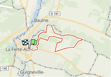
Randonnée Marche de 7,7 km à découvrir à Île-de-France, Essonne, La Ferté-Alais. Cette randonnée est proposée par guydu41.
Description
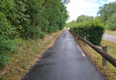
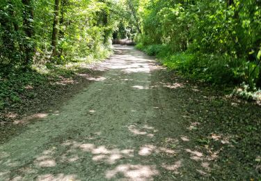
Petite randonnée au Nord-Est de la Ferté Alais.
Circuit empruntant de très beaux sentiers tortueux sur des coteaux boisés.
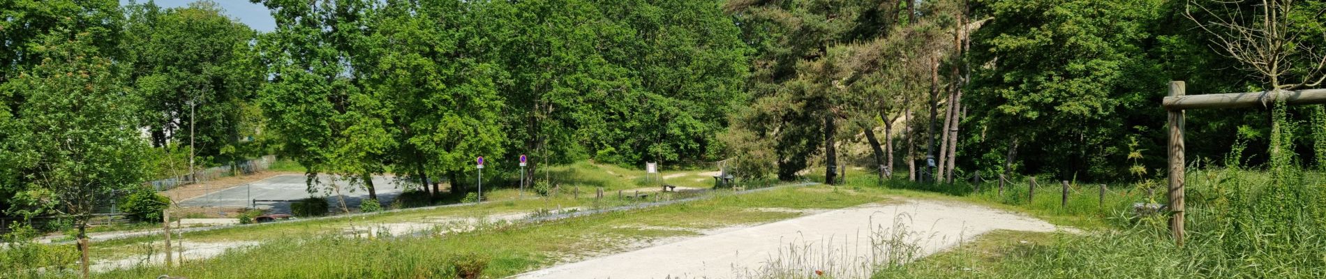
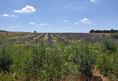
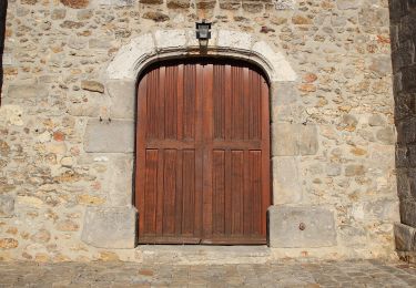
Localisation
Pays :
France
Région :
Île-de-France
Département/Province :
Essonne
Commune :
La Ferté-Alais
Localité :
Unknown
Départ:(Dec)
Départ:(UTM)
452218 ; 5370139 (31U) N.
Commentaires
Randonnées à proximité
![Randonnée Marche Itteville - Les vieilles ailes - Photo](https://media.geolcdn.com/t/375/260/ext.jpg?maxdim=2&url=https%3A%2F%2Fmedia.geolcdn.com%2Ff%2F401f9abb-572c-45de-a602-03e6caf0f1c1.jpg)
![Marche Marche](https://static1.geolcdn.com/sitytour/trail-icons/101.png)
Les vieilles ailes
Marche
Facile
(1)
Itteville,
Île-de-France,
Essonne,
France
![](/images/other/stat-length.png)
16,8 km | 19,2 km-effort
3h 37min
![](https://static1.geolcdn.com/siteimages/upload/files/16400158638029165_repeat_loop_refresh_sync_direction_icon.png)
Oui
![Randonnée V.T.T. Lardy - Autour de Lardy en VTT - Photo](https://media.geolcdn.com/t/375/260/ext.jpg?maxdim=2&url=https%3A%2F%2Fservices.sitytrail.com%2FGeolivesWS%2FDownloadMedia.ashx%3FTrailID%3D104079%26Media%3D7075_1.jpg)
![V.T.T. V.T.T.](https://static1.geolcdn.com/sitytour/trail-icons/202.png)
Autour de Lardy en VTT
V.T.T.
Moyen
(1)
Lardy,
Île-de-France,
Essonne,
France
![](/images/other/stat-length.png)
31 km | 38 km-effort
2h 4min
![](https://static1.geolcdn.com/siteimages/upload/files/16400158638029165_repeat_loop_refresh_sync_direction_icon.png)
Oui
![Randonnée A pied Itteville - Chemin des Marais - Photo](https://media.geolcdn.com/t/375/260/ext.jpg?maxdim=2&url=https%3A%2F%2Fmedia.geolcdn.com%2Ff%2F6ec12119-ce61-4685-a08a-304ea362f94a.jpeg)
![A pied A pied](https://static1.geolcdn.com/sitytour/trail-icons/100.png)
Chemin des Marais
A pied
Facile
Itteville,
Île-de-France,
Essonne,
France
![](/images/other/stat-length.png)
14,3 km | 16 km-effort
3h 38min
![](https://static1.geolcdn.com/siteimages/upload/files/16400158638029165_repeat_loop_refresh_sync_direction_icon.png)
Non
![Randonnée V.T.T. Baulne - Les Marais de l'Essonne 29,5 km - Photo](https://media.geolcdn.com/t/375/260/ext.jpg?maxdim=2&url=https%3A%2F%2Fstatic1.geolcdn.com%2Fsiteimages%2Fupload%2Ffiles%2F1524743154velo.jpg)
![V.T.T. V.T.T.](https://static1.geolcdn.com/sitytour/trail-icons/202.png)
Les Marais de l'Essonne 29,5 km
V.T.T.
Facile
(1)
Baulne,
Île-de-France,
Essonne,
France
![](/images/other/stat-length.png)
30 km | 33 km-effort
2h 12min
![](https://static1.geolcdn.com/siteimages/upload/files/16400158638029165_repeat_loop_refresh_sync_direction_icon.png)
Oui
![Randonnée Marche La Ferté-Alais - la ferté alais la sablière - Photo](https://media.geolcdn.com/t/375/260/ext.jpg?maxdim=2&url=https%3A%2F%2Fstatic1.geolcdn.com%2Fsiteimages%2Fupload%2Ffiles%2F1553511878bg_sport_marche.png)
![Marche Marche](https://static1.geolcdn.com/sitytour/trail-icons/101.png)
la ferté alais la sablière
Marche
Moyen
(2)
La Ferté-Alais,
Île-de-France,
Essonne,
France
![](/images/other/stat-length.png)
12,5 km | 14,8 km-effort
3h 15min
![](https://static1.geolcdn.com/siteimages/upload/files/16400158638029165_repeat_loop_refresh_sync_direction_icon.png)
Oui
![Randonnée Marche Mondeville - Boucle mondeville par videlles - Photo](https://media.geolcdn.com/t/375/260/ext.jpg?maxdim=2&url=https%3A%2F%2Fstatic1.geolcdn.com%2Fsiteimages%2Fupload%2Ffiles%2F1553511878bg_sport_marche.png)
![Marche Marche](https://static1.geolcdn.com/sitytour/trail-icons/101.png)
Boucle mondeville par videlles
Marche
Très facile
(1)
Mondeville,
Île-de-France,
Essonne,
France
![](/images/other/stat-length.png)
16,1 km | 18,6 km-effort
4h 2min
![](https://static1.geolcdn.com/siteimages/upload/files/16400158638029165_repeat_loop_refresh_sync_direction_icon.png)
Oui
![Randonnée Marche Ballancourt-sur-Essonne - Les roches du pere la musique Ballancourt-sur-essonne - Photo](https://media.geolcdn.com/t/375/260/ext.jpg?maxdim=2&url=https%3A%2F%2Fstatic1.geolcdn.com%2Fsiteimages%2Fupload%2Ffiles%2F1553511878bg_sport_marche.png)
![Marche Marche](https://static1.geolcdn.com/sitytour/trail-icons/101.png)
Les roches du pere la musique Ballancourt-sur-essonne
Marche
Moyen
(1)
Ballancourt-sur-Essonne,
Île-de-France,
Essonne,
France
![](/images/other/stat-length.png)
6,1 km | 7,9 km-effort
1h 47min
![](https://static1.geolcdn.com/siteimages/upload/files/16400158638029165_repeat_loop_refresh_sync_direction_icon.png)
Oui
![Randonnée Marche Bouville - Bouville - Photo](https://media.geolcdn.com/t/375/260/ext.jpg?maxdim=2&url=https%3A%2F%2Fmedia.geolcdn.com%2Ff%2F974d7298-2352-4001-9898-d49dbdbe3ea3.jpg)
![Marche Marche](https://static1.geolcdn.com/sitytour/trail-icons/101.png)
![Randonnée Marche Boutigny-sur-Essonne - Boutigny-sur-Essonne - Photo](https://media.geolcdn.com/t/375/260/ext.jpg?maxdim=2&url=https%3A%2F%2Fmedia.geolcdn.com%2Ff%2F35e7e1a4-0e81-4101-ba61-582eb9cd50f0.jpg)
![Marche Marche](https://static1.geolcdn.com/sitytour/trail-icons/101.png)
Boutigny-sur-Essonne
Marche
Moyen
Boutigny-sur-Essonne,
Île-de-France,
Essonne,
France
![](/images/other/stat-length.png)
6,4 km | 8,5 km-effort
1h 56min
![](https://static1.geolcdn.com/siteimages/upload/files/16400158638029165_repeat_loop_refresh_sync_direction_icon.png)
Oui