![](/images/other/stat-length.png)
![Randonnée Randonnée équestre Belmont - ALSACE - Photo](https://media.geolcdn.com/t/1900/400/ext.pjpeg?maxdim=2&url=https%3A%2F%2Fstatic1.geolcdn.com%2Fsiteimages%2Fupload%2Ffiles%2F1524743154cheval.jpg)
ALSACE
Sefi78
Utilisateur
![Longueur](/images/other/stat-length.png)
Longueur
157 km
![Altitude max](https://static1.geolcdn.com/siteimages/upload/files/1508320355ic_sort_altitude_max_24dp.png)
Altitude max
1098 m
![Dénivelé positif](https://static1.geolcdn.com/siteimages/upload/files/1508320355ic_sort_den_pos_24dp.png)
Dénivelé positif
4560 m
![Km-Effort](/images/other/stat-length.png)
Km-Effort
218 km
![Altitude min](https://static1.geolcdn.com/siteimages/upload/files/1508320355ic_sort_altitude_min_24dp.png)
Altitude min
177 m
![Dénivelé négatif](https://static1.geolcdn.com/siteimages/upload/files/1508320355ic_sort_den_neg_24dp.png)
Dénivelé négatif
4559 m
![Boucle](https://static1.geolcdn.com/siteimages/upload/files/16400158638029165_repeat_loop_refresh_sync_direction_icon.png)
Boucle
Oui
Date de création :
2023-07-19 17:47:18.698
Dernière modification :
2023-07-19 20:12:07.058
![Randonnée équestre](https://static1.geolcdn.com/sitytour/trail-icons/301.png)
28h40
Difficulté : Facile
![Scannez ce code QR pour ouvrir la randonnée dans l'application SityTrail](https://capi.geolives.com/qq0zvz2zws4bq2lad0pu/sitytour/trails/3740219/qr.png?size=200)
Application GPS de randonnée GRATUITE
À propos
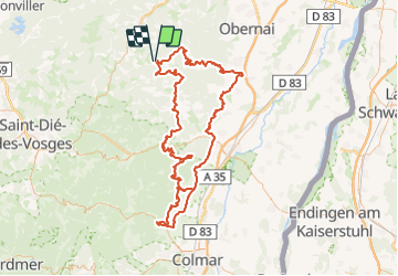
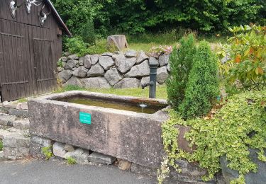
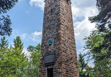
Randonnée Randonnée équestre de 157 km à découvrir à Grand Est, Bas-Rhin, Belmont. Cette randonnée est proposée par Sefi78.
Description
4 étapes :
Belmont / Saint-Pierre (32km)
Saint-Pierre / Bergheim (34km)
Bergheim / Bergheim (30km)
Bergheim / Lièpvre (30km)
Lièpvre / Belmont (non effectuée)
Localisation
Pays :
France
Région :
Grand Est
Département/Province :
Bas-Rhin
Commune :
Belmont
Localité :
Unknown
Départ:(Dec)
Départ:(UTM)
370827 ; 5363092 (32U) N.
Commentaires
Randonnées à proximité
![Randonnée Marche Le Hohwald - 2024-04-27 Marche Cascade du Hohwald Champ du Feu - Photo](https://media.geolcdn.com/t/375/260/ext.jpg?maxdim=2&url=https%3A%2F%2Fmedia.geolcdn.com%2Ff%2Fd8b206f8-0969-498e-bcc6-fd799e0e40cd.jpg)
![Marche Marche](https://static1.geolcdn.com/sitytour/trail-icons/101.png)
2024-04-27 Marche Cascade du Hohwald Champ du Feu
Marche
Moyen
Le Hohwald,
Grand Est,
Bas-Rhin,
France
![](/images/other/stat-length.png)
20 km | 31 km-effort
6h 58min
![](https://static1.geolcdn.com/siteimages/upload/files/16400158638029165_repeat_loop_refresh_sync_direction_icon.png)
Oui
![Randonnée Marche Solbach - Rando Solbach - Photo](https://media.geolcdn.com/t/375/260/ext.jpg?maxdim=2&url=https%3A%2F%2Fstatic1.geolcdn.com%2Fsiteimages%2Fupload%2Ffiles%2F1553511878bg_sport_marche.png)
![Marche Marche](https://static1.geolcdn.com/sitytour/trail-icons/101.png)
Rando Solbach
Marche
Moyen
(1)
Solbach,
Grand Est,
Bas-Rhin,
France
![](/images/other/stat-length.png)
4,6 km | 6,6 km-effort
1h 29min
![](https://static1.geolcdn.com/siteimages/upload/files/16400158638029165_repeat_loop_refresh_sync_direction_icon.png)
Oui
![Randonnée Marche Ranrupt - 2018-12-30 Marche Climont Voyemont - Photo](https://media.geolcdn.com/t/375/260/ext.jpg?maxdim=2&url=https%3A%2F%2Fmedia.geolcdn.com%2Ff%2F55e3f2c1-2c0e-4070-b418-3c553de20538.jpg)
![Marche Marche](https://static1.geolcdn.com/sitytour/trail-icons/101.png)
2018-12-30 Marche Climont Voyemont
Marche
Très facile
Ranrupt,
Grand Est,
Bas-Rhin,
France
![](/images/other/stat-length.png)
22 km | 33 km-effort
7h 21min
![](https://static1.geolcdn.com/siteimages/upload/files/16400158638029165_repeat_loop_refresh_sync_direction_icon.png)
Oui
![Randonnée Marche Le Hohwald - Tour du Hohwald - Photo](https://media.geolcdn.com/t/375/260/ext.jpg?maxdim=2&url=https%3A%2F%2Fstatic1.geolcdn.com%2Fsiteimages%2Fupload%2Ffiles%2F1553511878bg_sport_marche.png)
![Marche Marche](https://static1.geolcdn.com/sitytour/trail-icons/101.png)
Tour du Hohwald
Marche
Moyen
(1)
Le Hohwald,
Grand Est,
Bas-Rhin,
France
![](/images/other/stat-length.png)
8 km | 11,3 km-effort
2h 26min
![](https://static1.geolcdn.com/siteimages/upload/files/16400158638029165_repeat_loop_refresh_sync_direction_icon.png)
Oui
![Randonnée Randonnée équestre Belmont - Circuit VC Belmont - Le Climont - Photo](https://media.geolcdn.com/t/375/260/ext.jpg?maxdim=2&url=https%3A%2F%2Fmedia.geolcdn.com%2Ff%2Fa1198139-b874-4847-adb3-efd42fb36195.jpg)
![Randonnée équestre Randonnée équestre](https://static1.geolcdn.com/sitytour/trail-icons/301.png)
Circuit VC Belmont - Le Climont
Randonnée équestre
Moyen
Belmont,
Grand Est,
Bas-Rhin,
France
![](/images/other/stat-length.png)
23 km | 33 km-effort
4h 20min
![](https://static1.geolcdn.com/siteimages/upload/files/16400158638029165_repeat_loop_refresh_sync_direction_icon.png)
Non
![Randonnée Randonnée équestre Belmont - Circuit VC Serva - Belmont - Photo](https://media.geolcdn.com/t/375/260/ext.jpg?maxdim=2&url=https%3A%2F%2Fmedia.geolcdn.com%2Ff%2F1588be67-92f1-44c9-a365-dcd95e3feb13.jpg)
![Randonnée équestre Randonnée équestre](https://static1.geolcdn.com/sitytour/trail-icons/301.png)
Circuit VC Serva - Belmont
Randonnée équestre
Moyen
Belmont,
Grand Est,
Bas-Rhin,
France
![](/images/other/stat-length.png)
16,2 km | 22 km-effort
2h 50min
![](https://static1.geolcdn.com/siteimages/upload/files/16400158638029165_repeat_loop_refresh_sync_direction_icon.png)
Non
![Randonnée Marche Natzwiller - visite - Photo](https://media.geolcdn.com/t/375/260/ext.jpg?maxdim=2&url=https%3A%2F%2Fmedia.geolcdn.com%2Ff%2Ff3a361b7-b4c4-4d26-b468-ad6fc767e983.jpg)
![Marche Marche](https://static1.geolcdn.com/sitytour/trail-icons/101.png)
![Randonnée Marche Bellefosse - Col de la Charbonnière - château de la Roche - Bellefosse - Belmont - Photo](https://media.geolcdn.com/t/375/260/ext.jpg?maxdim=2&url=https%3A%2F%2Fmedia.geolcdn.com%2Ff%2F24310c6f-c7f0-4534-8ba0-5207981b0c8c.jpg)
![Marche Marche](https://static1.geolcdn.com/sitytour/trail-icons/101.png)
Col de la Charbonnière - château de la Roche - Bellefosse - Belmont
Marche
Très difficile
Bellefosse,
Grand Est,
Bas-Rhin,
France
![](/images/other/stat-length.png)
15,7 km | 24 km-effort
5h 27min
![](https://static1.geolcdn.com/siteimages/upload/files/16400158638029165_repeat_loop_refresh_sync_direction_icon.png)
Oui
![Randonnée Marche Ranrupt - 2023-06-04 Marche Col de Steige Tour du Climont - Photo](https://media.geolcdn.com/t/375/260/ext.jpg?maxdim=2&url=https%3A%2F%2Fmedia.geolcdn.com%2Ff%2F935b7e44-7265-42c7-b6c2-a8897e52a122.jpg)
![Marche Marche](https://static1.geolcdn.com/sitytour/trail-icons/101.png)
2023-06-04 Marche Col de Steige Tour du Climont
Marche
Facile
Ranrupt,
Grand Est,
Bas-Rhin,
France
![](/images/other/stat-length.png)
14,5 km | 24 km-effort
5h 28min
![](https://static1.geolcdn.com/siteimages/upload/files/16400158638029165_repeat_loop_refresh_sync_direction_icon.png)
Oui