Randonnée Marche Saint-Michel-de-Chabrillanoux - 07 st Michel de chabrillanoux 19.05.24 - Photo
 himba26100
himba26100

Utilisateur

© OpenStreetMap contributors
Longueur
Longueur
23 km
Altitude max
Altitude max
614 m
Dénivelé positif
Dénivelé positif
927 m
Km-Effort
Km-Effort  
35 km
Altitude min
Altitude min
213 m
Dénivelé négatif
Dénivelé négatif
921 m
Boucle
Boucle
Oui
Date de création :
2024-05-19 07:18:36.623
Dernière modification :
2024-05-19 14:05:23.699

(0 Avis)

Marche
Marche
6h45
Difficulté : Moyen

Scannez ce code QR pour ouvrir la randonnée dans l'application SityTrail

Application GPS de randonnée GRATUITE

Logo SityTrail SityTrail

IGN / Instituts géographiques

Télécharger SityTrail sur l'App Store Télécharger SityTrail sur Google Play

Logo SityTrail SityTrail World

Le monde est à vous

Télécharger SityTrail sur l'App Store Télécharger SityTrail sur Google Play Télécharger SityTrail sur Huawei AppGallery

À propos

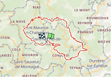
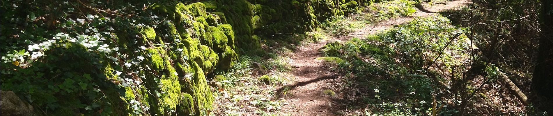
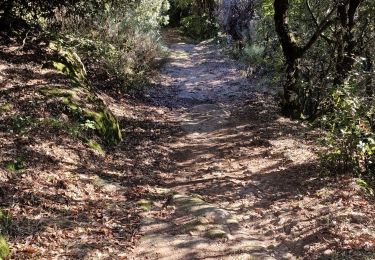
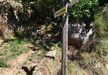
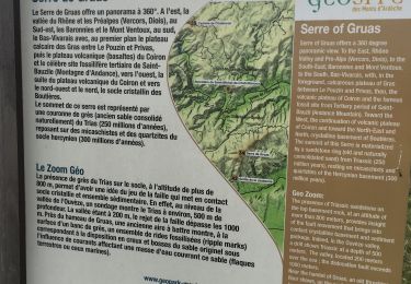
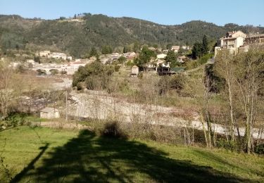
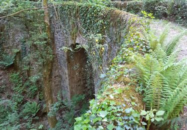
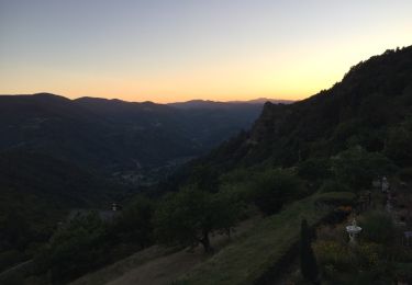
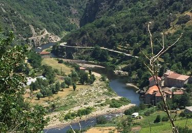
Randonnée Marche de 23 km à découvrir à Auvergne-Rhône-Alpes, Ardèche, Saint-Michel-de-Chabrillanoux. Cette randonnée est proposée par himba26100.

Description

rando orga
gene

Profil altimétrique

Photos

Localisation

Pays :
France
Région :
Auvergne-Rhône-Alpes
Département/Province :
Ardèche
Commune :
Saint-Michel-de-Chabrillanoux
Localité :
Unknown
Départ:(UTM)
626641 ; 4966245 (31T) N.

Randonnées à proximité

Randonnée Marche Saint-Sauveur-de-Montagut - photos de Saint-Sauveur Montagut - Photo
Marche
midu59

Marche

Difficile
Saint-Sauveur-de-Montagut, Auvergne-Rhône-Alpes, Ardèche, France
9 km | 15,6 km-effort
3h 54min
Oui
Randonnée Marche Saint-Maurice-en-Chalencon - 07 gliuras n2 suite - Photo
Marche
himba26100

Marche

Moyen
Saint-Maurice-en-Chalencon, Auvergne-Rhône-Alpes, Ardèche, France
21 km | 34 km-effort
8h 28min
Oui
Randonnée Marche Saint-Maurice-en-Chalencon - 07 gliuras n1 - Photo
Marche
himba26100

Marche

Moyen
Saint-Maurice-en-Chalencon, Auvergne-Rhône-Alpes, Ardèche, France
12,3 km | 21 km-effort
4h 55min
Non
Randonnée Marche Les Ollières-sur-Eyrieux - Serré de Gruas  - Photo
Marche
ajd26

Marche

Facile
Les Ollières-sur-Eyrieux, Auvergne-Rhône-Alpes, Ardèche, France
16,8 km | 27 km-effort
4h 51min
Oui
Randonnée Marche Les Ollières-sur-Eyrieux - la croix du banc - Photo
Marche
AIGUIER

Marche

Moyen
Les Ollières-sur-Eyrieux, Auvergne-Rhône-Alpes, Ardèche, France
13,6 km | 20 km-effort
4h 27min
Oui
Randonnée Marche Les Ollières-sur-Eyrieux - 07 ollieres sur eyrieux Gruas - Photo
Marche
himba26100

Marche

Moyen
Les Ollières-sur-Eyrieux, Auvergne-Rhône-Alpes, Ardèche, France
16,5 km | 27 km-effort
7h 0min
Oui
Randonnée Marche Chalencon - Circuit 2 Chalencon  - Photo
Marche
choubaka77

Marche

Moyen
Chalencon, Auvergne-Rhône-Alpes, Ardèche, France
15,6 km | 24 km-effort
4h 28min
Oui
Randonnée Marche Chalencon - Chalencon Circuit 2 - Photo
Marche
choubaka77

Marche

Moyen
Chalencon, Auvergne-Rhône-Alpes, Ardèche, France
15,6 km | 24 km-effort
4h 28min
Oui
Randonnée Marche Chalencon - Chalencon circuit 1 - Photo
Marche
choubaka77

Marche

Moyen
Chalencon, Auvergne-Rhône-Alpes, Ardèche, France
10,9 km | 17,2 km-effort
3h 0min
Oui


Fermer
Mes abonnements