![](/images/other/stat-length.png)
![Randonnée Vélo Merchtem - De Merchtem à l'Escaut - Photo](https://media.geolcdn.com/t/1900/400/ext.pjpeg?maxdim=2&url=https%3A%2F%2Fstatic1.geolcdn.com%2Fsiteimages%2Fupload%2Ffiles%2F1524743154velo.jpg)
De Merchtem à l'Escaut
AlainPoels
Utilisateur
![Longueur](/images/other/stat-length.png)
Longueur
26 km
![Altitude max](https://static1.geolcdn.com/siteimages/upload/files/1508320355ic_sort_altitude_max_24dp.png)
Altitude max
28 m
![Dénivelé positif](https://static1.geolcdn.com/siteimages/upload/files/1508320355ic_sort_den_pos_24dp.png)
Dénivelé positif
120 m
![Km-Effort](/images/other/stat-length.png)
Km-Effort
28 km
![Altitude min](https://static1.geolcdn.com/siteimages/upload/files/1508320355ic_sort_altitude_min_24dp.png)
Altitude min
-4 m
![Dénivelé négatif](https://static1.geolcdn.com/siteimages/upload/files/1508320355ic_sort_den_neg_24dp.png)
Dénivelé négatif
118 m
![Boucle](https://static1.geolcdn.com/siteimages/upload/files/16400158638029165_repeat_loop_refresh_sync_direction_icon.png)
Boucle
Oui
Date de création :
2018-04-16 23:25:07.784
Dernière modification :
2018-04-16 23:25:07.784
![Vélo](https://static1.geolcdn.com/sitytour/trail-icons/200.png)
1h38
Difficulté : Facile
![Scannez ce code QR pour ouvrir la randonnée dans l'application SityTrail](https://capi.geolives.com/qq0zvz2zws4bq2lad0pu/sitytour/trails/834479/qr.png?size=200)
Application GPS de randonnée GRATUITE
À propos
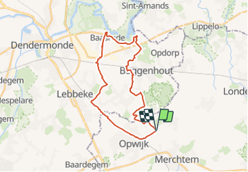
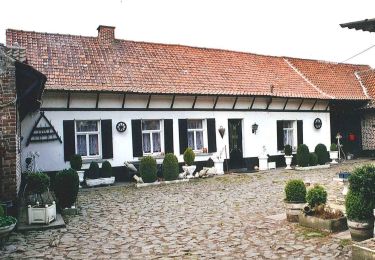
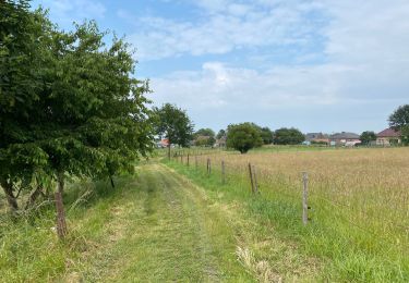
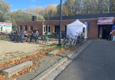
Randonnée Vélo de 26 km à découvrir à Flandre, Brabant flamand, Merchtem. Cette randonnée est proposée par AlainPoels.
Description
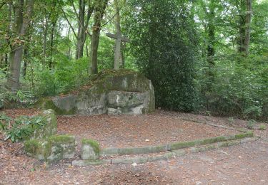
De Merchtem à l'Escaut. La partie du guide qui longe l'Escaut est désagréable car industrielle et sans vus sur l'Escaut.
Points d'intérêt
Localisation
Pays :
Belgique
Région :
Flandre
Département/Province :
Brabant flamand
Commune :
Merchtem
Localité :
Merchtem
Départ:(Dec)
Départ:(UTM)
585147 ; 5647957 (31U) N.
Commentaires
Randonnées à proximité
![Randonnée Randonnée équestre Opwijk - Mazenzele- Meldert vanuit De Kleine Deugd - Photo](https://media.geolcdn.com/t/375/260/ext.jpg?maxdim=2&url=https%3A%2F%2Fstatic1.geolcdn.com%2Fsiteimages%2Fupload%2Ffiles%2F1524743154cheval.jpg)
![Randonnée équestre Randonnée équestre](https://static1.geolcdn.com/sitytour/trail-icons/301.png)
Mazenzele- Meldert vanuit De Kleine Deugd
Randonnée équestre
Facile
(1)
Opwijk,
Flandre,
Brabant flamand,
Belgique
![](/images/other/stat-length.png)
12,3 km | 14 km-effort
1h 57min
![](https://static1.geolcdn.com/siteimages/upload/files/16400158638029165_repeat_loop_refresh_sync_direction_icon.png)
Oui
![Randonnée A pied Alost - Kersenwandeling - Photo](https://media.geolcdn.com/t/375/260/ext.jpg?maxdim=2&url=https%3A%2F%2Fmedia.geolcdn.com%2Ff%2Fea2bda03-7aab-439e-ac2f-d6e170d9c15f.jpeg)
![A pied A pied](https://static1.geolcdn.com/sitytour/trail-icons/100.png)
Kersenwandeling
A pied
Facile
Alost,
Flandre,
Flandre orientale,
Belgique
![](/images/other/stat-length.png)
5,1 km | 5,8 km-effort
1h 18min
![](https://static1.geolcdn.com/siteimages/upload/files/16400158638029165_repeat_loop_refresh_sync_direction_icon.png)
Oui
![Randonnée A pied Buggenhout - Wandeling Konijnenberg en Arboretum - Photo](https://media.geolcdn.com/t/375/260/ext.jpg?maxdim=2&url=https%3A%2F%2Fmedia.geolcdn.com%2Ff%2F3f10f8e8-9a4d-413d-9c1f-4e306b040279.jpeg)
![A pied A pied](https://static1.geolcdn.com/sitytour/trail-icons/100.png)
Wandeling Konijnenberg en Arboretum
A pied
Facile
Buggenhout,
Flandre,
Flandre orientale,
Belgique
![](/images/other/stat-length.png)
3,6 km | 4,2 km-effort
57min
![](https://static1.geolcdn.com/siteimages/upload/files/16400158638029165_repeat_loop_refresh_sync_direction_icon.png)
Oui
![Randonnée A pied Buggenhout - Wandeling Eendeput en Konijnenberg - Photo](https://media.geolcdn.com/t/375/260/ext.jpg?maxdim=2&url=https%3A%2F%2Fmedia.geolcdn.com%2Ff%2F3f10f8e8-9a4d-413d-9c1f-4e306b040279.jpeg)
![A pied A pied](https://static1.geolcdn.com/sitytour/trail-icons/100.png)
Wandeling Eendeput en Konijnenberg
A pied
Facile
Buggenhout,
Flandre,
Flandre orientale,
Belgique
![](/images/other/stat-length.png)
4,2 km | 4,8 km-effort
1h 5min
![](https://static1.geolcdn.com/siteimages/upload/files/16400158638029165_repeat_loop_refresh_sync_direction_icon.png)
Non
![Randonnée A pied Buggenhout - Wandelen en Fietsen in en rond Buggenhoutbos - Photo](https://media.geolcdn.com/t/375/260/ext.jpg?maxdim=2&url=https%3A%2F%2Fmedia.geolcdn.com%2Ff%2F858c12e0-d9ef-424f-a073-0c8e89a1def8.jpeg)
![A pied A pied](https://static1.geolcdn.com/sitytour/trail-icons/100.png)
Wandelen en Fietsen in en rond Buggenhoutbos
A pied
Facile
Buggenhout,
Flandre,
Flandre orientale,
Belgique
![](/images/other/stat-length.png)
9,3 km | 10,4 km-effort
2h 22min
![](https://static1.geolcdn.com/siteimages/upload/files/16400158638029165_repeat_loop_refresh_sync_direction_icon.png)
Non
![Randonnée A pied Buggenhout - Boskapel en omgeving - Photo](https://media.geolcdn.com/t/375/260/ext.jpg?maxdim=2&url=https%3A%2F%2Fmedia.geolcdn.com%2Ff%2F7c946627-d6d0-4e28-8052-859b17aaf1e7.jpeg)
![A pied A pied](https://static1.geolcdn.com/sitytour/trail-icons/100.png)
Boskapel en omgeving
A pied
Facile
Buggenhout,
Flandre,
Flandre orientale,
Belgique
![](/images/other/stat-length.png)
3 km | 3,4 km-effort
47min
![](https://static1.geolcdn.com/siteimages/upload/files/16400158638029165_repeat_loop_refresh_sync_direction_icon.png)
Oui
![Randonnée A pied Lebbeke - Mennenpad - Photo](https://media.geolcdn.com/t/375/260/ext.jpg?maxdim=2&url=https%3A%2F%2Fmedia.geolcdn.com%2Ff%2F9ca09073-979e-439c-9e92-d1334cfb6bb5.jpeg)
![A pied A pied](https://static1.geolcdn.com/sitytour/trail-icons/100.png)
Mennenpad
A pied
Facile
Lebbeke,
Flandre,
Flandre orientale,
Belgique
![](/images/other/stat-length.png)
5 km | 5,3 km-effort
1h 11min
![](https://static1.geolcdn.com/siteimages/upload/files/16400158638029165_repeat_loop_refresh_sync_direction_icon.png)
Non
![Randonnée Marche Merchtem - Brussegem nord 7,3 km - Photo](https://media.geolcdn.com/t/375/260/ext.jpg?maxdim=2&url=https%3A%2F%2Fmedia.geolcdn.com%2Ff%2Fc2a2b302-b3fd-44e8-9488-687c48558849.jpg)
![Marche Marche](https://static1.geolcdn.com/sitytour/trail-icons/101.png)
Brussegem nord 7,3 km
Marche
Facile
Merchtem,
Flandre,
Brabant flamand,
Belgique
![](/images/other/stat-length.png)
7,5 km | 8,3 km-effort
1h 40min
![](https://static1.geolcdn.com/siteimages/upload/files/16400158638029165_repeat_loop_refresh_sync_direction_icon.png)
Oui
![Randonnée Marche Lebbeke - 20221022 WSV Denderklokjes - Photo](https://media.geolcdn.com/t/375/260/ext.jpg?maxdim=2&url=https%3A%2F%2Fmedia.geolcdn.com%2Ff%2F9acb97e2-2a79-491f-b51d-0e724e154a34.jpg)
![Marche Marche](https://static1.geolcdn.com/sitytour/trail-icons/101.png)
20221022 WSV Denderklokjes
Marche
Difficile
Lebbeke,
Flandre,
Flandre orientale,
Belgique
![](/images/other/stat-length.png)
11,9 km | 12,7 km-effort
11h 27min
![](https://static1.geolcdn.com/siteimages/upload/files/16400158638029165_repeat_loop_refresh_sync_direction_icon.png)
Non