![](/images/other/stat-length.png)
- Tochten
- Outdoor
- France
- Auvergne-Rhône-Alpes
- Ardèche
- Saint-Apollinaire-de-Rias
Saint-Apollinaire-de-Rias, Ardèche: Top van de beste wandelroutes, trajecten, tochten en wandelingen
Saint-Apollinaire-de-Rias: Ontdek de beste tochten: 2 te voet en 1 te paard. Al deze tochten, trajecten, routes en outdoor activiteiten zijn beschikbaar in onze SityTrail-apps voor smartphones en tablets.
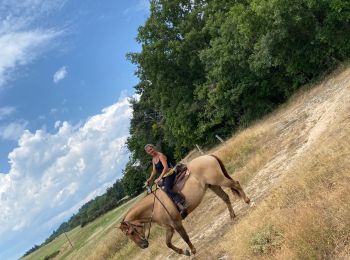
De beste trajecten (3)
![Tocht Paardrijden Saint-Apollinaire-de-Rias - St Appollinaire de Rias au top 👍 - Photo](https://media.geolcdn.com/t/350/260/ext.jpg?maxdim=2&url=https%3A%2F%2Fmedia.geolcdn.com%2Ff%2F1c007958-71f4-4e95-8cb1-eb6550d659d1.jpg)
![Paardrijden Paardrijden](https://static1.geolcdn.com/sitytour/trail-icons/301.png)
Km
#1 - St Appollinaire de Rias au top 👍
Paardrijden
Saint-Apollinaire-de-Rias,
Auvergne-Rhône-Alpes,
Ardèche,
France
![](/images/other/stat-length.png)
28 km | 38 km-effort
7h 6min
![](https://static1.geolcdn.com/siteimages/upload/files/1508320355ic_sort_den_pos_24dp.png)
764 m
![](https://static1.geolcdn.com/siteimages/upload/files/1508320355ic_sort_den_neg_24dp.png)
765 m
![](https://static1.geolcdn.com/siteimages/upload/files/16400158638029165_repeat_loop_refresh_sync_direction_icon.png)
Ja
Patrice Maia Fonseca
![Tocht Stappen Saint-Apollinaire-de-Rias - 3 janv 2019 source de la Duniere - Photo](https://media.geolcdn.com/t/350/260/ext.jpg?maxdim=2&url=https%3A%2F%2Fservices.sitytrail.com%2FGeolivesWS%2FDownloadMedia.ashx%3FTrailID%3D1096614%26Media%3D20190103142549.jpg)
![Stappen Stappen](https://static1.geolcdn.com/sitytour/trail-icons/101.png)
Km
#2 - 3 janv 2019 source de la Duniere
Stappen
Gemakkelijk
Saint-Apollinaire-de-Rias,
Auvergne-Rhône-Alpes,
Ardèche,
France
![](/images/other/stat-length.png)
17,4 km | 25 km-effort
4h 9min
![](https://static1.geolcdn.com/siteimages/upload/files/1508320355ic_sort_den_pos_24dp.png)
559 m
![](https://static1.geolcdn.com/siteimages/upload/files/1508320355ic_sort_den_neg_24dp.png)
567 m
![](https://static1.geolcdn.com/siteimages/upload/files/16400158638029165_repeat_loop_refresh_sync_direction_icon.png)
Ja
ajd26
• À 500m du départ, il faut eviter la maison en passant sur la gauche à essayer
![Tocht Stappen Saint-Apollinaire-de-Rias - Les sources de la Dunière - Photo](https://media.geolcdn.com/t/350/260/ext.jpg?maxdim=2&url=https%3A%2F%2Fstatic1.geolcdn.com%2Fsiteimages%2Fupload%2Ffiles%2F1553511878bg_sport_marche.png)
![Stappen Stappen](https://static1.geolcdn.com/sitytour/trail-icons/101.png)
Km
#3 - Les sources de la Dunière
Stappen
Gemakkelijk
Saint-Apollinaire-de-Rias,
Auvergne-Rhône-Alpes,
Ardèche,
France
![](/images/other/stat-length.png)
15,7 km | 22 km-effort
4h 46min
![](https://static1.geolcdn.com/siteimages/upload/files/1508320355ic_sort_den_pos_24dp.png)
482 m
![](https://static1.geolcdn.com/siteimages/upload/files/1508320355ic_sort_den_neg_24dp.png)
485 m
![](https://static1.geolcdn.com/siteimages/upload/files/16400158638029165_repeat_loop_refresh_sync_direction_icon.png)
Ja
frizou83
3 tochten weergegeven op 3
Gratisgps-wandelapplicatie