Tocht Mountainbike Bruz - Les Fours à Chaux à Bruz - Photo

Les Fours à Chaux à Bruz

 tracegps
tracegps

Gebruiker

© OpenStreetMap contributors
Lengte
Lengte
16,6 km
Max. hoogte
Max. hoogte
46 m
Positief hoogteverschil
124 m
Km-Effort
Km-Effort  
18,3 km
Min. hoogte
Min. hoogte
15 m
Negatief hoogteverschil
125 m
Boucle
Boucle
Ja
Datum van aanmaak :
2014-12-10 00:00:00.0
Laatste wijziging :
2014-12-10 00:00:00.0

(0 Bericht)

Mountainbike
Mountainbike
1h30
Moeilijkheid : Gemakkelijk

Scan deze QR-code om de tocht te openen in de SityTrail-applicatie

Gratisgps-wandelapplicatie

Logo SityTrail SityTrail

IGN / Geografische instituten

SityTrail uit de App Store downloaden SityTrail uit Google Play downloaden

Logo SityTrail SityTrail World

De wereld gaat voor u open

SityTrail uit de App Store downloaden SityTrail uit Google Play downloaden SityTrail op Huawei AppGallery downloaden

Over ons

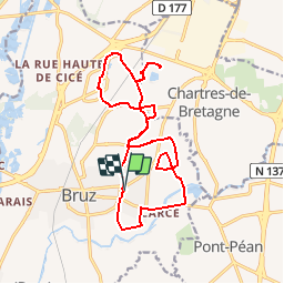
Tocht Mountainbike van 16,6 km beschikbaar op Bretagne, Ille-et-Vilaine, Bruz. Deze tocht wordt voorgesteld door tracegps.

Beschrijving

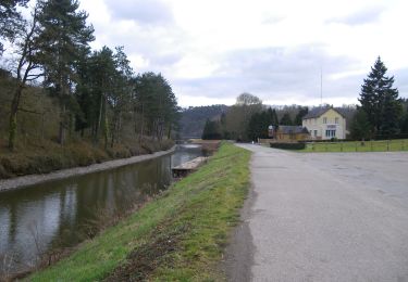
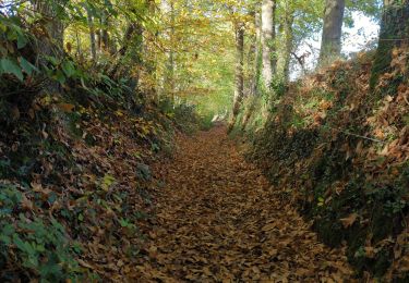
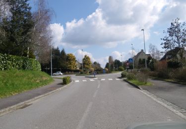
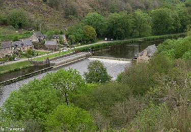
Balade par les petites routes de Bruz. Départ par le Sud puis remontée par le Nord. Les travaux de la RD44 obligent à passer par la zone industrielle avant d'atteindre les petits lacs de Lomandières suivi du site des fours à chaux. D'anciens rails au sol. Passage par Ker Lann et ses petits lacs et retour vers Bruz. Travaux autour du Callouêt peuvent obliger à passer difficilement par certains endroits. Itinéraire très agréable à faire avec enfants, carrioles ou bien vélo couché. Aucune difficulté.

Hoogteprofiel

Plaatsbepaling

Land:
France
Regio :
Bretagne
Departement/Provincie :
Ille-et-Vilaine
Gemeente :
Bruz
Locatie:
Unknown
Vertrek:(Dec)
Vertrek:(UTM)
594380 ; 5319849 (30U) N.

Wandeltochten in de omgeving

Tocht Mountainbike Pont-Péan - Le long de la Vilaine - Pont Péan - Photo
Mountainbike
tracegps

Mountainbike

Moeilijk
(1)
Pont-Péan, Bretagne, Ille-et-Vilaine, France
35 km | 41 km-effort
2h 15min
Ja
Tocht Stappen Pont-Péan - Randonnée autour de Pont-Péan - Photo
Stappen
tracegps

Stappen

Medium
(1)
Pont-Péan, Bretagne, Ille-et-Vilaine, France
7,9 km | 8,5 km-effort
2h 0min
Ja
Tocht Te voet Laillé - Laillé la Chapelle - Photo
Te voet
PRO

Te voet

Gemakkelijk
Laillé, Bretagne, Ille-et-Vilaine, France
13,2 km | 15,6 km-effort
3h 33min
Ja
Tocht Te voet Guichen - Les landes du Boël - Photo
Te voet
PRO

Te voet

Gemakkelijk
Guichen, Bretagne, Ille-et-Vilaine, France
5,2 km | 6,1 km-effort
1h 23min
Ja
Tocht Te voet Guichen - Les bords de Vilaine - Photo
Te voet
PRO

Te voet

Gemakkelijk
Guichen, Bretagne, Ille-et-Vilaine, France
6,9 km | 8,4 km-effort
1h 54min
Ja
Tocht Te voet Guichen - Pont-Réan Le Boël - Photo
Te voet
PRO

Te voet

Gemakkelijk
Guichen, Bretagne, Ille-et-Vilaine, France
9,3 km | 11,5 km-effort
2h 37min
Ja
Tocht Stappen Laillé - Laillé, Roche qui chome - Photo
Stappen
nolsim

Stappen

Heel gemakkelijk
Laillé, Bretagne, Ille-et-Vilaine, France
11,4 km | 13,1 km-effort
2h 40min
Ja
Tocht Te voet Orgères - Circuit des deux Monts et du Télégraphe - Photo
Te voet
PRO

Te voet

Gemakkelijk
Orgères, Bretagne, Ille-et-Vilaine, France
6,2 km | 7,4 km-effort
1h 40min
Ja
Tocht Stappen Bruz -  Boucle Le Boël - gare de Laillé - Photo
Stappen
ilur56

Stappen

Medium
Bruz, Bretagne, Ille-et-Vilaine, France
8,4 km | 10 km-effort
2h 22min
Ja


Sluiten
Mijn abonnementen