Tocht Mountainbike Sainte-Marie-aux-Mines - Espace VTT FFC Val d'Argent - Circuit n°7 - Le Tour du Brézouard - Photo

Espace VTT FFC Val d'Argent - Circuit n°7 - Le Tour du Brézouard

 tracegps
tracegps

Gebruiker

© OpenStreetMap contributors
Lengte
Lengte
19,2 km
Max. hoogte
Max. hoogte
1138 m
Positief hoogteverschil
599 m
Km-Effort
Km-Effort  
27 km
Min. hoogte
Min. hoogte
904 m
Negatief hoogteverschil
597 m
Boucle
Boucle
Ja
Datum van aanmaak :
2014-12-10 00:00:00.0
Laatste wijziging :
2014-12-10 00:00:00.0

(0 Bericht)

Mountainbike
Mountainbike
2h00
Moeilijkheid : Moeilijk

Scan deze QR-code om de tocht te openen in de SityTrail-applicatie

Gratisgps-wandelapplicatie

Logo SityTrail SityTrail

IGN / Geografische instituten

SityTrail uit de App Store downloaden SityTrail uit Google Play downloaden

Logo SityTrail SityTrail World

De wereld gaat voor u open

SityTrail uit de App Store downloaden SityTrail uit Google Play downloaden SityTrail op Huawei AppGallery downloaden

Over ons

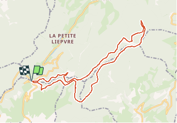
Tocht Mountainbike van 19,2 km beschikbaar op Grand Est, Haut-Rhin, Sainte-Marie-aux-Mines. Deze tocht wordt voorgesteld door tracegps.

Beschrijving

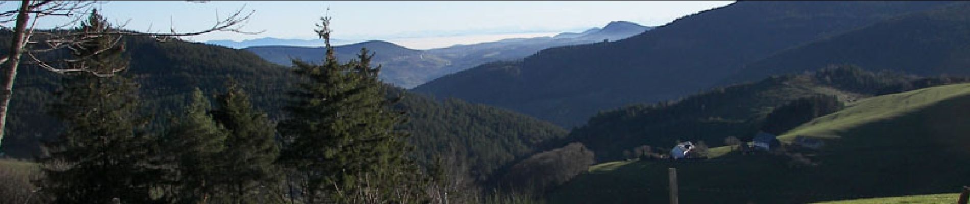
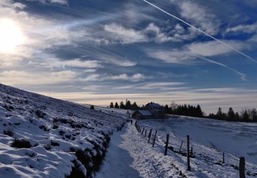
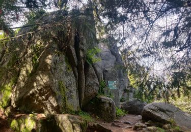
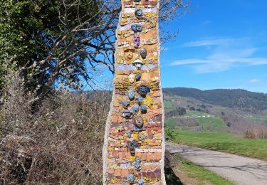
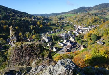
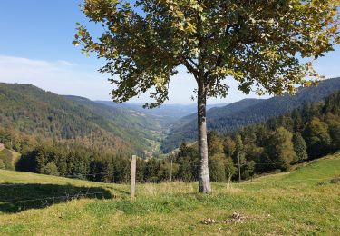
Espace VTT FFC Val d'Argent - Circuit n°7 - Le Tour du Brézouard Circuit officiel labellisé par la Fédération Française de Cyclisme. Départ du Col des Bagenelles (903m). Tout le bonheur du circuit du Rehberg intensifié : paysages, ambiance, dénivelé, distance… que demander de plus… si ce n’est de l’énergie pour finir ce circuit mémorable!! Une bonne partie de ces circuits emprunte les pistes de ski de fond que vous propose la station des Bagenelles durant l’hiver. Cette petite station conviviale compte 44 km de piste de fond, 4 itinéraires raquettes ainsi que 3 pistes de ski alpin dont l’une des plus pentues du massif !

Hoogteprofiel

Foto's

Plaatsbepaling

Land:
France
Regio :
Grand Est
Departement/Provincie :
Haut-Rhin
Gemeente :
Sainte-Marie-aux-Mines
Locatie:
Unknown
Vertrek:(Dec)
Vertrek:(UTM)
359837 ; 5339428 (32U) N.

Wandeltochten in de omgeving

Tocht Stappen Le Bonhomme - Le Bonhomme - Circuit du village - Photo
Stappen
GUIDE
Desrumaux

Stappen

Gemakkelijk
(1)
Le Bonhomme, Grand Est, Haut-Rhin, France
3 km | 5,3 km-effort
1h 30min
Ja
Tocht Stappen Sainte-Marie-aux-Mines - 2021-02-14 Marche Bagenelles Brezouard Fuste de Etoile - Photo
Stappen
GUIDE
holtzv

Stappen

Zeer moeilijk
Sainte-Marie-aux-Mines, Grand Est, Haut-Rhin, France
17,1 km | 27 km-effort
6h 6min
Ja
Tocht Stappen Lapoutroie - 2020-07-19 Marche Étang du Devin Col Calvaire Tête des Faux - Photo
Stappen
GUIDE
holtzv

Stappen

Heel gemakkelijk
Lapoutroie, Grand Est, Haut-Rhin, France
14,2 km | 22 km-effort
3h 27min
Ja
Tocht Stappen Ban-de-Laveline - 20130508 - Photo
Stappen
pida

Stappen

Heel gemakkelijk
(1)
Ban-de-Laveline, Grand Est, Vogezen, France
7,6 km | 11,1 km-effort
2h 19min
Ja
Tocht Stappen Fréland - CVL - Rando 25/03/2024 - Col de Chamont - Photo
Stappen
Hub6877

Stappen

Medium
Fréland, Grand Est, Haut-Rhin, France
6,6 km | 9,5 km-effort
2h 15min
Ja
Tocht Te voet Sainte-Marie-aux-Mines - Le Haïcot - Le Petit Brézouard - Le Haïcot - Photo
Te voet
patrickbeyrath

Te voet

Gemakkelijk
(2)
Sainte-Marie-aux-Mines, Grand Est, Haut-Rhin, France
7,1 km | 10,5 km-effort
2h 23min
Ja
Tocht Stappen Lapoutroie - rdpr G3 le bonhomme 230905 - Photo
Stappen
GUIDE
stempfel52

Stappen

Moeilijk
Lapoutroie, Grand Est, Haut-Rhin, France
11,6 km | 16,5 km-effort
4h 12min
Ja
Tocht Stappen Le Bonhomme - Le  Bonhomme-le Brézouard - Photo
Stappen
oscar1

Stappen

Medium
Le Bonhomme, Grand Est, Haut-Rhin, France
15 km | 26 km-effort
4h 34min
Ja
Tocht Stappen Sainte-Marie-aux-Mines - Crête granitique et forêts profondes - Photo
Stappen
VacheKiri67

Stappen

Medium
Sainte-Marie-aux-Mines, Grand Est, Haut-Rhin, France
13,7 km | 22 km-effort
3h 56min
Ja


Sluiten
Mijn abonnementen