Tocht Stappen Queyssac-les-Vignes - Le vin paillé - Photo
 sdroneau
sdroneau

Gebruiker

© OpenStreetMap contributors
Lengte
Lengte
10,4 km
Max. hoogte
Max. hoogte
287 m
Positief hoogteverschil
249 m
Km-Effort
Km-Effort  
13,8 km
Min. hoogte
Min. hoogte
144 m
Negatief hoogteverschil
249 m
Boucle
Boucle
Ja
Datum van aanmaak :
2014-12-10 00:00:00.0
Laatste wijziging :
2014-12-10 00:00:00.0

(1 Bericht)

Stappen
Stappen
2h30
Moeilijkheid : Gemakkelijk

Scan deze QR-code om de tocht te openen in de SityTrail-applicatie

Gratisgps-wandelapplicatie

Logo SityTrail SityTrail

IGN / Geografische instituten

SityTrail uit de App Store downloaden SityTrail uit Google Play downloaden

Logo SityTrail SityTrail World

De wereld gaat voor u open

SityTrail uit de App Store downloaden SityTrail uit Google Play downloaden SityTrail op Huawei AppGallery downloaden

Over ons

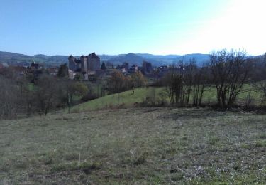
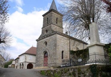
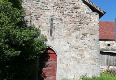
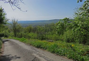
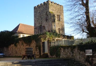
Tocht Stappen van 10,4 km beschikbaar op Nieuw-Aquitanië, Corrèze, Queyssac-les-Vignes. Deze tocht wordt voorgesteld door sdroneau.

Beschrijving

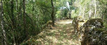
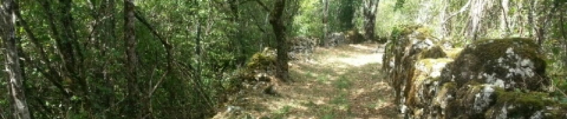
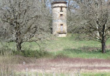
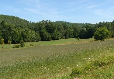
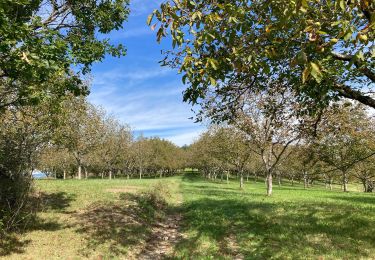
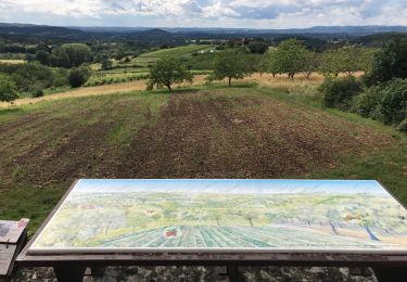
Au départ de Queyssac les Vignes et de sa tour carrée, partez à la découverte du territoire du vin paillé. Du manoir du Battut à la maison bourgeoise de Maldène, des anciennes truffières aux cabanes de vignerons, les murets de pierres sèches bordent cette balade.
         

Hoogteprofiel

Foto's

POI's

POI Végennes - Point 1 - Photo
sdroneau
VÉGENNES 

Plaatsbepaling

Land:
France
Regio :
Nieuw-Aquitanië
Departement/Provincie :
Corrèze
Gemeente :
Queyssac-les-Vignes
Locatie:
Unknown
Vertrek:(Dec)
Vertrek:(UTM)
402116 ; 4981258 (31T) N.

Opmerkingen

Gelieve in te loggen om een commentaar of een beoordeling achter te laten


Une très belle randonnée à découvrir et redécouvrir au fil des saisons. Merci pour ces agréables moments.


Wandeltochten in de omgeving

Tocht Stappen Bilhac - BILLAC - Photo
Stappen
houbart

Stappen

Moeilijk
(1)
Bilhac, Nieuw-Aquitanië, Corrèze, France
10,3 km | 13,3 km-effort
3h 0min
Ja
Tocht Mountainbike Curemonte - Circuit des sentes - Photo
Mountainbike
sdroneau

Mountainbike

Moeilijk
(1)
Curemonte, Nieuw-Aquitanië, Corrèze, France
26 km | 37 km-effort
3h 4min
Ja
Tocht Stappen Queyssac-les-Vignes - Entre vignes et noyers - Queyssac les Vignes - Photo
Stappen
tracegps

Stappen

Medium
(1)
Queyssac-les-Vignes, Nieuw-Aquitanië, Corrèze, France
8 km | 10,7 km-effort
2h 0min
Ja
Tocht Stappen Queyssac-les-Vignes - Fred BC Queyssac-les-Vignes  - Photo
Stappen
arnoultjf

Stappen

Medium
Queyssac-les-Vignes, Nieuw-Aquitanië, Corrèze, France
8,6 km | 11,6 km-effort
2h 48min
Ja
Tocht Stappen Vayrac - Vayrac- Puy d'Issolud - Photo
Stappen
houbart

Stappen

Moeilijk
Vayrac, Occitanië, Lot, France
12,9 km | 17,8 km-effort
4h 1min
Ja
Tocht Stappen Queyssac-les-Vignes - Chemin de la Queyrille - Queyssac les Vignes  - Photo
Stappen
tracegps

Stappen

Medium
Queyssac-les-Vignes, Nieuw-Aquitanië, Corrèze, France
5,4 km | 7,7 km-effort
1h 30min
Ja
Tocht Stappen Branceilles - Branceilles - Curemonte - Photo
Stappen
jpblimond

Stappen

Moeilijk
Branceilles, Nieuw-Aquitanië, Corrèze, France
10,2 km | 13,7 km-effort
3h 6min
Ja
Tocht Mountainbike Queyssac-les-Vignes - Tour de Queyssac - Photo
Mountainbike
sdroneau

Mountainbike

Heel gemakkelijk
Queyssac-les-Vignes, Nieuw-Aquitanië, Corrèze, France
28 km | 39 km-effort
2h 31min
Ja
Tocht Stappen Queyssac-les-Vignes - Queyssac  - Photo
Stappen
Gaillard Isabelle

Stappen

Medium
Queyssac-les-Vignes, Nieuw-Aquitanië, Corrèze, France
6 km | 8,3 km-effort
1h 42min
Ja


Sluiten
Mijn abonnementen