![](/images/other/stat-length.png)
![Tocht Stappen Le Vaudreuil - Le vaudreui-st Etienne - Photo](https://media.geolcdn.com/t/1900/400/ext.pjpeg?maxdim=2&url=https%3A%2F%2Fmedia.geolcdn.com%2Ff%2F6571169a-52b4-40b4-b14a-d60472e3c84f.jpg)
Le vaudreui-st Etienne
bipf
Gebruiker
![Lengte](/images/other/stat-length.png)
Lengte
11,1 km
![Max. hoogte](https://static1.geolcdn.com/siteimages/upload/files/1508320355ic_sort_altitude_max_24dp.png)
Max. hoogte
25 m
![Positief hoogteverschil](https://static1.geolcdn.com/siteimages/upload/files/1508320355ic_sort_den_pos_24dp.png)
Positief hoogteverschil
70 m
![Km-Effort](/images/other/stat-length.png)
Km-Effort
12 km
![Min. hoogte](https://static1.geolcdn.com/siteimages/upload/files/1508320355ic_sort_altitude_min_24dp.png)
Min. hoogte
6 m
![Negatief hoogteverschil](https://static1.geolcdn.com/siteimages/upload/files/1508320355ic_sort_den_neg_24dp.png)
Negatief hoogteverschil
70 m
![Boucle](https://static1.geolcdn.com/siteimages/upload/files/16400158638029165_repeat_loop_refresh_sync_direction_icon.png)
Boucle
Ja
Datum van aanmaak :
2019-05-22 12:45:43.013
Laatste wijziging :
2019-05-22 14:02:22.678
![Stappen](https://static1.geolcdn.com/sitytour/trail-icons/101.png)
2h14
Moeilijkheid : Heel gemakkelijk
![Wegfiets](https://static1.geolcdn.com/sitytour/trail-icons/201.png)
45m
Moeilijkheid : Heel gemakkelijk
![Scan deze QR-code om de tocht te openen in de SityTrail-applicatie](https://capi.geolives.com/qq0zvz2zws4bq2lad0pu/sitytour/trails/2091132/qr.png?size=200)
Gratisgps-wandelapplicatie
Over ons
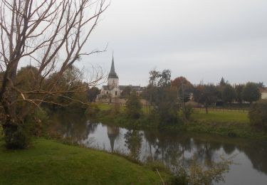
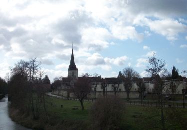
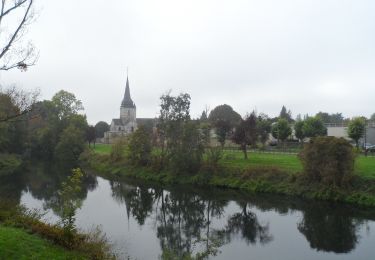
Tocht Stappen van 11,1 km beschikbaar op Normandië, Eure, Le Vaudreuil. Deze tocht wordt voorgesteld door bipf.
Beschrijving
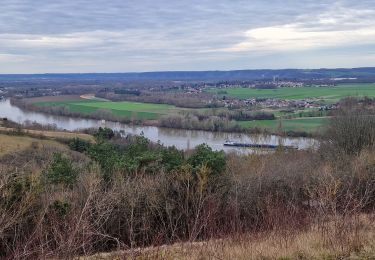
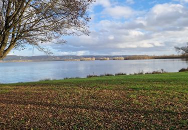
ballade à pied ou à vélo du Vaudreuil à St-Pierre du Vauvray en passant par la voie verte et en revenant par "la zone humide des Pâtures".
Plaatsbepaling
Land:
France
Regio :
Normandië
Departement/Provincie :
Eure
Gemeente :
Le Vaudreuil
Locatie:
Unknown
Vertrek:(Dec)
Vertrek:(UTM)
369277 ; 5457811 (31U) N.
Opmerkingen
Wandeltochten in de omgeving
![Tocht Trail Les Damps - 20190820_135035 - Photo](https://media.geolcdn.com/t/375/260/ext.jpg?maxdim=2&url=https%3A%2F%2Fstatic1.geolcdn.com%2Fsiteimages%2Fupload%2Ffiles%2F1524743154running.jpg)
![Trail Trail](https://static1.geolcdn.com/sitytour/trail-icons/104.png)
20190820_135035
Trail
Heel gemakkelijk
(1)
Les Damps,
Normandië,
Eure,
France
![](/images/other/stat-length.png)
10,9 km | 12,5 km-effort
Onbekend
![](https://static1.geolcdn.com/siteimages/upload/files/16400158638029165_repeat_loop_refresh_sync_direction_icon.png)
Ja
![Tocht Stappen Herqueville - Daniel - Photo](https://media.geolcdn.com/t/375/260/ext.jpg?maxdim=2&url=https%3A%2F%2Fstatic1.geolcdn.com%2Fsiteimages%2Fupload%2Ffiles%2F1553511878bg_sport_marche.png)
![Stappen Stappen](https://static1.geolcdn.com/sitytour/trail-icons/101.png)
Daniel
Stappen
Heel gemakkelijk
(2)
Herqueville,
Normandië,
Eure,
France
![](/images/other/stat-length.png)
9,8 km | 11,2 km-effort
2h 40min
![](https://static1.geolcdn.com/siteimages/upload/files/16400158638029165_repeat_loop_refresh_sync_direction_icon.png)
Ja
![Tocht Stappen Saint-Pierre-du-Vauvray - Saint-Pierre-du-Vauvray - Les côtes de Vauvray - Photo](https://media.geolcdn.com/t/375/260/ext.jpg?maxdim=2&url=https%3A%2F%2Fstatic1.geolcdn.com%2Fsiteimages%2Fupload%2Ffiles%2F1553511878bg_sport_marche.png)
![Stappen Stappen](https://static1.geolcdn.com/sitytour/trail-icons/101.png)
Saint-Pierre-du-Vauvray - Les côtes de Vauvray
Stappen
Medium
(1)
Saint-Pierre-du-Vauvray,
Normandië,
Eure,
France
![](/images/other/stat-length.png)
10,7 km | 13,8 km-effort
2h 57min
![](https://static1.geolcdn.com/siteimages/upload/files/16400158638029165_repeat_loop_refresh_sync_direction_icon.png)
Ja
![Tocht Stappen Louviers - 20240402-louviers - Photo](https://media.geolcdn.com/t/375/260/ext.jpg?maxdim=2&url=https%3A%2F%2Fmedia.geolcdn.com%2Ff%2F6a35ce40-ff63-4e27-a298-b4e4e37bda03.JPG)
![Stappen Stappen](https://static1.geolcdn.com/sitytour/trail-icons/101.png)
20240402-louviers
Stappen
Gemakkelijk
Louviers,
Normandië,
Eure,
France
![](/images/other/stat-length.png)
7,8 km | 9,7 km-effort
2h 14min
![](https://static1.geolcdn.com/siteimages/upload/files/16400158638029165_repeat_loop_refresh_sync_direction_icon.png)
Ja
![Tocht Stappen Saint-Pierre-du-Vauvray - 20240215-St Pierre du Vauvray - Photo](https://media.geolcdn.com/t/375/260/ext.jpg?maxdim=2&url=https%3A%2F%2Fmedia.geolcdn.com%2Ff%2F02c016ec-c185-4c3d-8524-4a9998bc8ab6.jpg)
![Stappen Stappen](https://static1.geolcdn.com/sitytour/trail-icons/101.png)
20240215-St Pierre du Vauvray
Stappen
Medium
Saint-Pierre-du-Vauvray,
Normandië,
Eure,
France
![](/images/other/stat-length.png)
12,8 km | 15,6 km-effort
3h 2min
![](https://static1.geolcdn.com/siteimages/upload/files/16400158638029165_repeat_loop_refresh_sync_direction_icon.png)
Ja
![Tocht Stappen Les Damps - 20231212-Les Damps - Photo](https://media.geolcdn.com/t/375/260/ext.jpg?maxdim=2&url=https%3A%2F%2Fmedia.geolcdn.com%2Ff%2F9b98702f-b952-4d47-95e5-e5dc435553fd.jpg)
![Stappen Stappen](https://static1.geolcdn.com/sitytour/trail-icons/101.png)
20231212-Les Damps
Stappen
Medium
Les Damps,
Normandië,
Eure,
France
![](/images/other/stat-length.png)
9,5 km | 11,1 km-effort
2h 39min
![](https://static1.geolcdn.com/siteimages/upload/files/16400158638029165_repeat_loop_refresh_sync_direction_icon.png)
Ja
![Tocht Stappen Léry - 20231031-lery - Photo](https://media.geolcdn.com/t/375/260/ext.jpg?maxdim=2&url=https%3A%2F%2Fmedia.geolcdn.com%2Ff%2F4a9957e5-d192-465f-9a34-04c6d10f07bd.JPG)
![Stappen Stappen](https://static1.geolcdn.com/sitytour/trail-icons/101.png)
![Tocht Stappen Les Damps - 20230314-Les Damps Cool - Photo](https://media.geolcdn.com/t/375/260/ext.jpg?maxdim=2&url=https%3A%2F%2Fmedia.geolcdn.com%2Ff%2F66a384da-9b45-4eb0-9688-563e50ec9d59.JPG)
![Stappen Stappen](https://static1.geolcdn.com/sitytour/trail-icons/101.png)
20230314-Les Damps Cool
Stappen
Gemakkelijk
Les Damps,
Normandië,
Eure,
France
![](/images/other/stat-length.png)
9,4 km | 10,8 km-effort
2h 27min
![](https://static1.geolcdn.com/siteimages/upload/files/16400158638029165_repeat_loop_refresh_sync_direction_icon.png)
Ja
![Tocht Stappen Léry - 20221004-Léry Cool - Photo](https://media.geolcdn.com/t/375/260/ext.jpg?maxdim=2&url=https%3A%2F%2Fmedia.geolcdn.com%2Ff%2F3bf331e2-d9d9-489c-816e-53f717637275.JPG)
![Stappen Stappen](https://static1.geolcdn.com/sitytour/trail-icons/101.png)
20221004-Léry Cool
Stappen
Gemakkelijk
Léry,
Normandië,
Eure,
France
![](/images/other/stat-length.png)
8,2 km | 8,7 km-effort
2h 8min
![](https://static1.geolcdn.com/siteimages/upload/files/16400158638029165_repeat_loop_refresh_sync_direction_icon.png)
Ja