Tocht Stappen Long - Une randonnée rythmée par les étangs. - Photo

Une randonnée rythmée par les étangs.

 Luc Gengoux
Luc Gengoux

Gebruiker

© OpenStreetMap contributors
Lengte
Lengte
6,7 km
Max. hoogte
Max. hoogte
15 m
Positief hoogteverschil
33 m
Km-Effort
Km-Effort  
7,1 km
Min. hoogte
Min. hoogte
4 m
Negatief hoogteverschil
34 m
Boucle
Boucle
Neen
Datum van aanmaak :
2020-07-13 08:40:25.952
Laatste wijziging :
2020-07-18 10:49:36.524

(0 Bericht)

Stappen
Stappen
1h53
Moeilijkheid : Heel gemakkelijk

Scan deze QR-code om de tocht te openen in de SityTrail-applicatie

Gratisgps-wandelapplicatie

Logo SityTrail SityTrail

IGN / Geografische instituten

SityTrail uit de App Store downloaden SityTrail uit Google Play downloaden

Logo SityTrail SityTrail World

De wereld gaat voor u open

SityTrail uit de App Store downloaden SityTrail uit Google Play downloaden SityTrail op Huawei AppGallery downloaden

Over ons

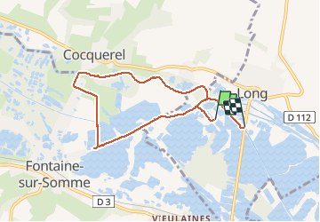
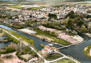
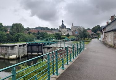
Tocht Stappen van 6,7 km beschikbaar op Hauts-de-France, Somme, Long. Deze tocht wordt voorgesteld door Luc Gengoux.

Beschrijving

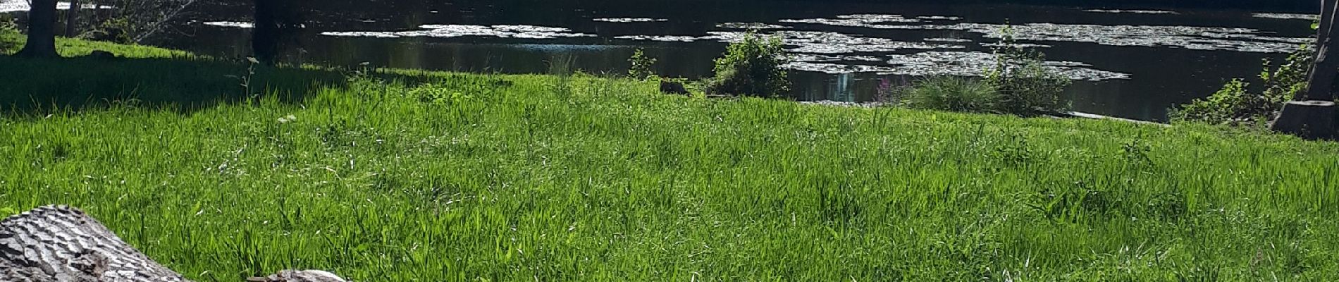
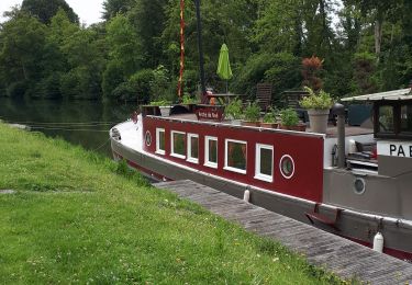
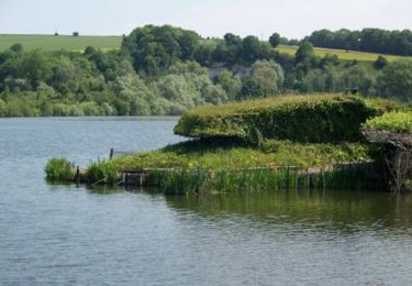
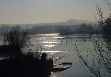
Plus une balade qu'une randonnée, à chaque étang une découverte. La faune et la flore nous en font voir de toutes les couleurs.

Hoogteprofiel

Foto's

Plaatsbepaling

Land:
France
Regio :
Hauts-de-France
Departement/Provincie :
Somme
Gemeente :
Long
Locatie:
Unknown
Vertrek:(UTM)
426403 ; 5543128 (31U) N.

Wandeltochten in de omgeving

Tocht Stappen Long - L'écluse et la centrale hydroélectrique  -  Long - Photo
Stappen
tracegps

Stappen

Gemakkelijk
(1)
Long, Hauts-de-France, Somme, France
2,4 km | 2,6 km-effort
30min
Ja
Tocht Stappen Long - long bleue 9km - Photo
Stappen
fif59280

Stappen

Medium
Long, Hauts-de-France, Somme, France
9,4 km | 10,2 km-effort
2h 3min
Neen
Tocht Te voet Condé-Folie - Les Marais de Condé-Folie - Photo
Te voet
PRO

Te voet

Gemakkelijk
Condé-Folie, Hauts-de-France, Somme, France
5,4 km | 5,7 km-effort
1h 18min
Ja
Tocht Te voet Longpré-les-Corps-Saints - Le Circuit des Cours d'Eau - Photo
Te voet
PRO

Te voet

Gemakkelijk
Longpré-les-Corps-Saints, Hauts-de-France, Somme, France
4,9 km | 5,2 km-effort
1h 11min
Ja
Tocht Te voet Long - Les Bords de Somme - Photo
Te voet
PRO

Te voet

Gemakkelijk
Long, Hauts-de-France, Somme, France
7,9 km | 8,4 km-effort
1h 54min
Ja
Tocht Te voet Fontaine-sur-Somme - Les Hauts de Long - Photo
Te voet
PRO

Te voet

Gemakkelijk
Fontaine-sur-Somme, Hauts-de-France, Somme, France
9,1 km | 11 km-effort
2h 29min
Ja
Tocht Stappen Pont-Remy - chemin de hallage et crête.  - Photo
Stappen
Luc Gengoux

Stappen

Heel gemakkelijk
Pont-Remy, Hauts-de-France, Somme, France
9,8 km | 11,6 km-effort
2h 34min
Ja
Tocht Stappen Longpré-les-Corps-Saints - Le circuit des cours d'eau - Longpré les Corps Saints - Photo
Stappen
tracegps

Stappen

Medium
(1)
Longpré-les-Corps-Saints, Hauts-de-France, Somme, France
4,9 km | 5,2 km-effort
1h 30min
Ja
Tocht Mountainbike Long - Circuit autour de Long - Photo
Mountainbike
tracegps

Mountainbike

Moeilijk
Long, Hauts-de-France, Somme, France
30 km | 35 km-effort
3h 0min
Ja


Sluiten
Mijn abonnementen