![](/images/other/stat-length.png)
![Tocht Stappen Riemst - tour de la montagne st pierre - Photo](https://media.geolcdn.com/t/1900/400/ext.pjpeg?maxdim=2&url=https%3A%2F%2Fmedia.geolcdn.com%2Ff%2F43431adf-15c0-40cb-a5fb-eb5e33a91152.jpg)
tour de la montagne st pierre
stef789
Gebruiker
![Lengte](/images/other/stat-length.png)
Lengte
13,9 km
![Max. hoogte](https://static1.geolcdn.com/siteimages/upload/files/1508320355ic_sort_altitude_max_24dp.png)
Max. hoogte
170 m
![Positief hoogteverschil](https://static1.geolcdn.com/siteimages/upload/files/1508320355ic_sort_den_pos_24dp.png)
Positief hoogteverschil
310 m
![Km-Effort](/images/other/stat-length.png)
Km-Effort
18 km
![Min. hoogte](https://static1.geolcdn.com/siteimages/upload/files/1508320355ic_sort_altitude_min_24dp.png)
Min. hoogte
26 m
![Negatief hoogteverschil](https://static1.geolcdn.com/siteimages/upload/files/1508320355ic_sort_den_neg_24dp.png)
Negatief hoogteverschil
307 m
![Boucle](https://static1.geolcdn.com/siteimages/upload/files/16400158638029165_repeat_loop_refresh_sync_direction_icon.png)
Boucle
Ja
Datum van aanmaak :
2021-06-01 09:34:49.66
Laatste wijziging :
2021-06-01 13:25:41.292
![Stappen](https://static1.geolcdn.com/sitytour/trail-icons/101.png)
3h49
Moeilijkheid : Heel gemakkelijk
![Scan deze QR-code om de tocht te openen in de SityTrail-applicatie](https://capi.geolives.com/qq0zvz2zws4bq2lad0pu/sitytour/trails/2810098/qr.png?size=200)
Gratisgps-wandelapplicatie
Over ons
Tocht Stappen van 13,9 km beschikbaar op Vlaanderen, Limburg, Riemst. Deze tocht wordt voorgesteld door stef789.
Beschrijving
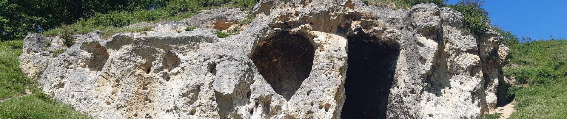
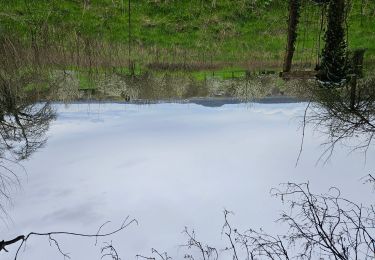
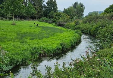
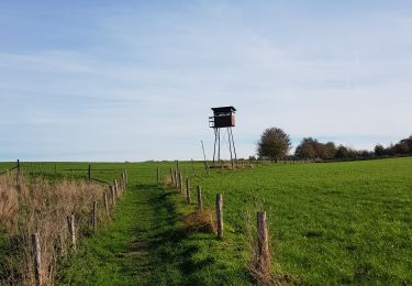
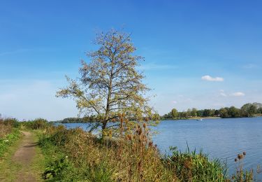
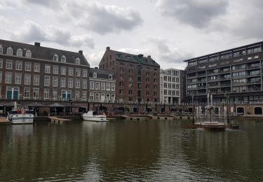
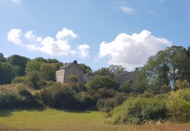
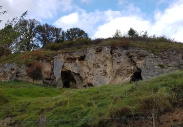
ses chemins sentiers . ses près champs forêts . ses falaises points de vue grottes carrière
Plaatsbepaling
Land:
Belgium
Regio :
Vlaanderen
Departement/Provincie :
Limburg
Gemeente :
Riemst
Locatie:
Kanne
Vertrek:(Dec)
Vertrek:(UTM)
688622 ; 5632589 (31U) N.
Opmerkingen
Wandeltochten in de omgeving
![Tocht Stappen Wezet - montagne saint pierre - Photo](https://media.geolcdn.com/t/375/260/ext.jpg?maxdim=2&url=https%3A%2F%2Fservices.sitytrail.com%2FGeolivesWS%2FDownloadMedia.ashx%3FTrailID%3D308205%26Media%3D20140601165318.jpg)
![Stappen Stappen](https://static1.geolcdn.com/sitytour/trail-icons/101.png)
montagne saint pierre
Stappen
Heel gemakkelijk
(5)
Wezet,
Wallonië,
Luik,
Belgium
![](/images/other/stat-length.png)
16,4 km | 19,4 km-effort
3h 46min
![](https://static1.geolcdn.com/siteimages/upload/files/16400158638029165_repeat_loop_refresh_sync_direction_icon.png)
Ja
![Tocht Stappen Eijsden-Margraten - 2024-01-08_03h28m34_eijsden-margraten-e8-bloesemroute-3 - Photo](https://media.geolcdn.com/t/375/260/ext.jpg?maxdim=2&url=https%3A%2F%2Fmedia.geolcdn.com%2Ff%2F7792b7db-95a9-4b53-8cd5-7eae3fedc6a4.jpg)
![Stappen Stappen](https://static1.geolcdn.com/sitytour/trail-icons/101.png)
2024-01-08_03h28m34_eijsden-margraten-e8-bloesemroute-3
Stappen
Medium
(1)
Eijsden-Margraten,
Limburg,
Onbekend,
Netherlands
![](/images/other/stat-length.png)
14,2 km | 17,1 km-effort
3h 53min
![](https://static1.geolcdn.com/siteimages/upload/files/16400158638029165_repeat_loop_refresh_sync_direction_icon.png)
Ja
![Tocht Stappen Riemst - 2023-08-16_09h58m46_1192.gpx.xml - Photo](https://media.geolcdn.com/t/375/260/ext.jpg?maxdim=2&url=https%3A%2F%2Fmedia.geolcdn.com%2Ff%2F63b86f10-f314-488d-80d4-00787e3a9126.jpg)
![Stappen Stappen](https://static1.geolcdn.com/sitytour/trail-icons/101.png)
2023-08-16_09h58m46_1192.gpx.xml
Stappen
Medium
(1)
Riemst,
Vlaanderen,
Limburg,
Belgium
![](/images/other/stat-length.png)
5,4 km | 6,7 km-effort
1h 30min
![](https://static1.geolcdn.com/siteimages/upload/files/16400158638029165_repeat_loop_refresh_sync_direction_icon.png)
Ja
![Tocht Stappen Eijsden-Margraten - Eijsden - Savelbos - Photo](https://media.geolcdn.com/t/375/260/ext.jpg?maxdim=2&url=https%3A%2F%2Fmedia.geolcdn.com%2Ff%2F1a835e4b-4203-472e-b4f4-bdf046d29220.jpg)
![Stappen Stappen](https://static1.geolcdn.com/sitytour/trail-icons/101.png)
Eijsden - Savelbos
Stappen
Medium
(1)
Eijsden-Margraten,
Limburg,
Onbekend,
Netherlands
![](/images/other/stat-length.png)
14,2 km | 16,3 km-effort
3h 41min
![](https://static1.geolcdn.com/siteimages/upload/files/16400158638029165_repeat_loop_refresh_sync_direction_icon.png)
Neen
![Tocht Stappen Eijsden-Margraten - 2022-11-10_16h33m33_1327 - Photo](https://media.geolcdn.com/t/375/260/ext.jpg?maxdim=2&url=https%3A%2F%2Fmedia.geolcdn.com%2Ff%2F877eed2d-204c-4212-a49e-caf4fc574b56.jpg)
![Stappen Stappen](https://static1.geolcdn.com/sitytour/trail-icons/101.png)
2022-11-10_16h33m33_1327
Stappen
Gemakkelijk
(1)
Eijsden-Margraten,
Limburg,
Onbekend,
Netherlands
![](/images/other/stat-length.png)
11 km | 13,2 km-effort
3h 0min
![](https://static1.geolcdn.com/siteimages/upload/files/16400158638029165_repeat_loop_refresh_sync_direction_icon.png)
Ja
![Tocht Stappen Eijsden-Margraten - Eijsder Beemden - Photo](https://media.geolcdn.com/t/375/260/ext.jpg?maxdim=2&url=https%3A%2F%2Fmedia.geolcdn.com%2Ff%2Fd9738c76-cf4e-4655-a468-717379546ee7.jpg)
![Stappen Stappen](https://static1.geolcdn.com/sitytour/trail-icons/101.png)
Eijsder Beemden
Stappen
Heel gemakkelijk
(1)
Eijsden-Margraten,
Limburg,
Onbekend,
Netherlands
![](/images/other/stat-length.png)
8,7 km | 9,2 km-effort
2h 5min
![](https://static1.geolcdn.com/siteimages/upload/files/16400158638029165_repeat_loop_refresh_sync_direction_icon.png)
Ja
![Tocht Stappen Maastricht - Maastricht - Hoge Fronten & 't Bassin - Photo](https://media.geolcdn.com/t/375/260/ext.jpg?maxdim=2&url=https%3A%2F%2Fmedia.geolcdn.com%2Ff%2F0d1db1de-c9bf-433a-9df4-c07031a55999.jpg)
![Stappen Stappen](https://static1.geolcdn.com/sitytour/trail-icons/101.png)
Maastricht - Hoge Fronten & 't Bassin
Stappen
Gemakkelijk
(1)
Maastricht,
Limburg,
Onbekend,
Netherlands
![](/images/other/stat-length.png)
7,7 km | 8,5 km-effort
2h 3min
![](https://static1.geolcdn.com/siteimages/upload/files/16400158638029165_repeat_loop_refresh_sync_direction_icon.png)
Ja
![Tocht Stappen Maastricht - 2022-07-06_09h30m07_1540 - Photo](https://media.geolcdn.com/t/375/260/ext.jpg?maxdim=2&url=https%3A%2F%2Fmedia.geolcdn.com%2Ff%2F8e415027-26b4-4bc6-9623-75f03f38b59c.jpg)
![Stappen Stappen](https://static1.geolcdn.com/sitytour/trail-icons/101.png)
2022-07-06_09h30m07_1540
Stappen
Gemakkelijk
(1)
Maastricht,
Limburg,
Onbekend,
Netherlands
![](/images/other/stat-length.png)
8,7 km | 10,6 km-effort
2h 24min
![](https://static1.geolcdn.com/siteimages/upload/files/16400158638029165_repeat_loop_refresh_sync_direction_icon.png)
Ja
![Tocht Stappen Maastricht - 2021-10-27_21h23m34_1087 - Photo](https://media.geolcdn.com/t/375/260/ext.jpg?maxdim=2&url=https%3A%2F%2Fmedia.geolcdn.com%2Ff%2F23f3cb69-ec7d-4156-85e2-e9b9420f412b.jpg)
![Stappen Stappen](https://static1.geolcdn.com/sitytour/trail-icons/101.png)
2021-10-27_21h23m34_1087
Stappen
Medium
(1)
Maastricht,
Limburg,
Onbekend,
Netherlands
![](/images/other/stat-length.png)
14,6 km | 18,2 km-effort
4h 8min
![](https://static1.geolcdn.com/siteimages/upload/files/16400158638029165_repeat_loop_refresh_sync_direction_icon.png)
Ja