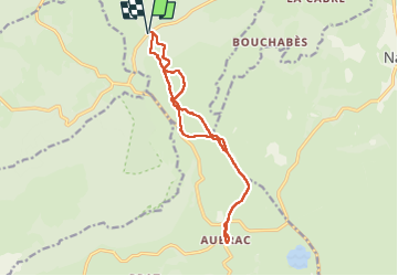
11 km | 15,4 km-effort
Pas de Mathieu Aubrac
antignacs
Gebruiker GUIDE
Lengte
14,4 km
Max. hoogte
1421 m
Positief hoogteverschil
341 m
Km-Effort
19 km
Min. hoogte
1296 m
Negatief hoogteverschil
341 m
Boucle
Ja
Datum van aanmaak :
2022-09-17 08:06:42.0
Laatste wijziging :
2022-09-17 14:07:34.3
4h45
Moeilijkheid : Gemakkelijk
Gratisgps-wandelapplicatie
Over ons
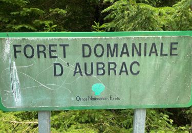
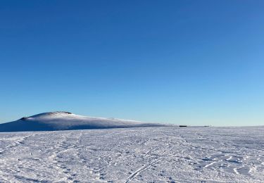
Tocht Stappen van 14,4 km beschikbaar op Auvergne-Rhône-Alpes, Cantal, Saint-Urcize. Deze tocht wordt voorgesteld door antignacs.
Plaatsbepaling
Land:
France
Regio :
Auvergne-Rhône-Alpes
Departement/Provincie :
Cantal
Gemeente :
Saint-Urcize
Locatie:
Unknown
Vertrek:(Dec)
Vertrek:(UTM)
497074 ; 4946073 (31T) N.
Opmerkingen
Wandeltochten in de omgeving
chemin de Saint-Jacques-de-Compostelle pour randonneurs avec animaux (chien, ...
Te voet
Gemakkelijk
Nasbinals,
Occitanië,
Lozère,
France
5,7 km | 7,3 km-effort
1h 38min
Neen
Laguiole - Station de ski
Stappen
Medium
(1)
Laguiole,
Occitanië,
Aveyron,
France
7,1 km | 9,5 km-effort
1h 50min
Ja
Des estives et des croix
Stappen
Gemakkelijk
Saint-Urcize,
Auvergne-Rhône-Alpes,
Cantal,
France
19,8 km | 25 km-effort
5h 19min
Ja
Recoules Bouchabes
Stappen
Heel gemakkelijk
Recoules-d'Aubrac,
Occitanië,
Lozère,
France
14,4 km | 18,6 km-effort
3h 38min
Ja
Carbonade Croix de Goutal
Stappen
Heel gemakkelijk
Saint-Urcize,
Auvergne-Rhône-Alpes,
Cantal,
France
9,5 km | 12,4 km-effort
2h 37min
Ja
Cascade du devèz et fosse à loup
Stappen
Moeilijk
Curières,
Occitanië,
Aveyron,
France
10,8 km | 15 km-effort
4h 7min
Ja
Bouyssou sous la neige
Stappen
Heel gemakkelijk
Laguiole,
Occitanië,
Aveyron,
France
6,3 km | 7,5 km-effort
2h 2min
Ja
Mon plus bel Aubrac
Sneeuwschoenen
Medium
Curières,
Occitanië,
Aveyron,
France
12,4 km | 15,7 km-effort
4h 52min
Ja