


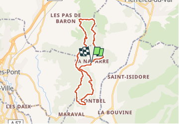

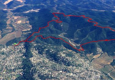
14,3 km | 20 km-effort


Gebruiker


Gratisgps-wandelapplicatie
 SityTrail
IGN / Geografische instituten
SityTrail World
De wereld gaat voor u open
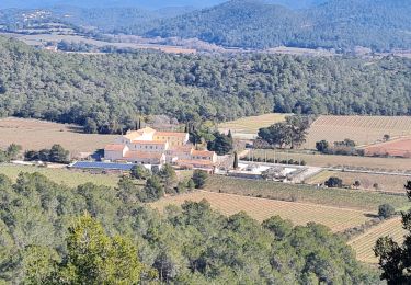
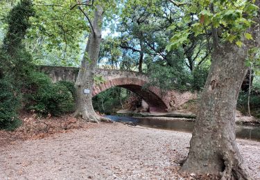
Tocht Stappen van 15,5 km beschikbaar op Provence-Alpes-Côte d'Azur, Var, La Crau. Deze tocht wordt voorgesteld door cdanielrando.
beau circuit sans difficulté particulière qui peut être modifié par l'autre circuit intitulé : la croix de la Navarre: L'oppidum de Montbel ne mérite pas le détour il ne reste que quelques pierres éparpillées


Stappen

Stappen
Stappen

Trail

Stappen
Stappen
Stappen
Stappen

Stappen