![](/images/other/stat-length.png)
#240209 - Bierges, autour du Bois Wilmet** (version courte horlogique)
Randos Ouvertes
Gebruiker
![Lengte](/images/other/stat-length.png)
Lengte
6,4 km
![Max. hoogte](https://static1.geolcdn.com/siteimages/upload/files/1508320355ic_sort_altitude_max_24dp.png)
Max. hoogte
115 m
![Positief hoogteverschil](https://static1.geolcdn.com/siteimages/upload/files/1508320355ic_sort_den_pos_24dp.png)
Positief hoogteverschil
94 m
![Km-Effort](/images/other/stat-length.png)
Km-Effort
7,6 km
![Min. hoogte](https://static1.geolcdn.com/siteimages/upload/files/1508320355ic_sort_altitude_min_24dp.png)
Min. hoogte
55 m
![Negatief hoogteverschil](https://static1.geolcdn.com/siteimages/upload/files/1508320355ic_sort_den_neg_24dp.png)
Negatief hoogteverschil
92 m
![Boucle](https://static1.geolcdn.com/siteimages/upload/files/16400158638029165_repeat_loop_refresh_sync_direction_icon.png)
Boucle
Ja
Datum van aanmaak :
2024-03-19 17:53:40.809
Laatste wijziging :
2024-03-19 17:56:26.035
![Stappen](https://static1.geolcdn.com/sitytour/trail-icons/101.png)
1h44
Moeilijkheid : Medium
![Scan deze QR-code om de tocht te openen in de SityTrail-applicatie](https://capi.geolives.com/qq0zvz2zws4bq2lad0pu/sitytour/trails/3986744/qr.png?size=200)
Gratisgps-wandelapplicatie
Over ons
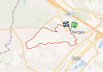
Tocht Stappen van 6,4 km beschikbaar op Wallonië, Waals-Brabant, Waver. Deze tocht wordt voorgesteld door Randos Ouvertes.
Beschrijving
Variante horlogique et raccourcie du circuit #231204
Circuit de 6, 4 km avec 80 m de dénivelé.
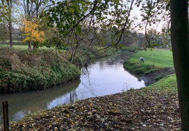
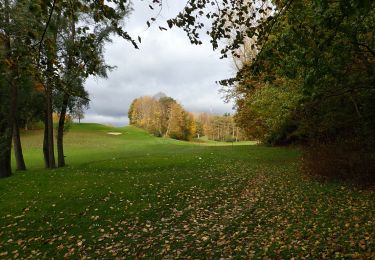
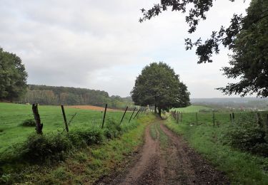
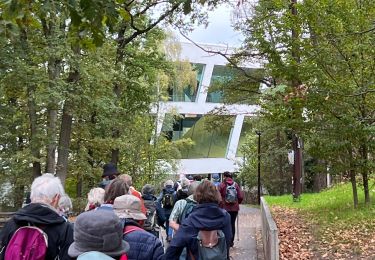
Tour du bois Wilmet, un poumon vert de Bierges.
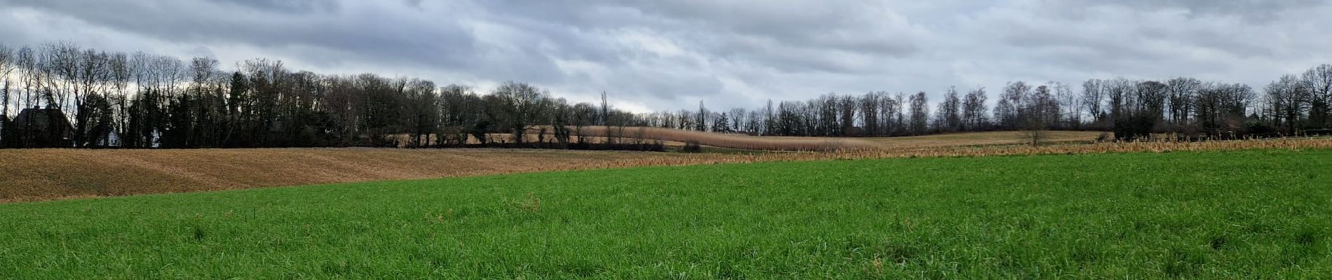
Belles vues
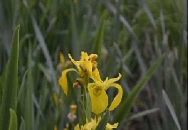
Crédit photos : Béatrice Walsdorff, Corinne van Aubet et Yvette Lallemand
Plaatsbepaling
Land:
Belgium
Regio :
Wallonië
Departement/Provincie :
Waals-Brabant
Gemeente :
Waver
Locatie:
Unknown
Vertrek:(Dec)
Vertrek:(UTM)
611910 ; 5618938 (31U) N.
Opmerkingen
Wandeltochten in de omgeving
![Tocht Stappen Ottignies-Louvain-la-Neuve - Nuit du scoutisme - Louvain-la-Neuve - Photo](https://media.geolcdn.com/t/375/260/ext.jpg?maxdim=2&url=https%3A%2F%2Fmedia.geolcdn.com%2Ff%2Fa66232ef-7471-42b4-b6aa-97b05d528647.jpg)
![Stappen Stappen](https://static1.geolcdn.com/sitytour/trail-icons/101.png)
Nuit du scoutisme - Louvain-la-Neuve
Stappen
Medium
(16)
Ottignies-Louvain-la-Neuve,
Wallonië,
Waals-Brabant,
Belgium
![](/images/other/stat-length.png)
5,7 km | 6,7 km-effort
1h 27min
![](https://static1.geolcdn.com/siteimages/upload/files/16400158638029165_repeat_loop_refresh_sync_direction_icon.png)
Ja
![Tocht Stappen Ottignies-Louvain-la-Neuve - Balade dans le Bois de Lauzelle - Photo](https://media.geolcdn.com/t/375/260/ext.jpg?maxdim=2&url=https%3A%2F%2Fservices.sitytrail.com%2FGeolivesWS%2FDownloadMedia.ashx%3FTrailID%3D652718%26Media%3Dfe46824b-6e61-4100-b5d8-1f34a923c154.jpg)
![Stappen Stappen](https://static1.geolcdn.com/sitytour/trail-icons/101.png)
Balade dans le Bois de Lauzelle
Stappen
Heel gemakkelijk
(1)
Ottignies-Louvain-la-Neuve,
Wallonië,
Waals-Brabant,
Belgium
![](/images/other/stat-length.png)
6,3 km | 8,1 km-effort
1h 44min
![](https://static1.geolcdn.com/siteimages/upload/files/16400158638029165_repeat_loop_refresh_sync_direction_icon.png)
Ja
![Tocht Stappen Rixensart - Balade de Rixensart au lac de Genval - Photo](https://media.geolcdn.com/t/375/260/ext.jpg?maxdim=2&url=https%3A%2F%2Fservices.sitytrail.com%2FGeolivesWS%2FDownloadMedia.ashx%3FTrailID%3D486338%26Media%3D5e34c7a6-42f3-4c4e-bd52-3a98cd84457e.JPG)
![Stappen Stappen](https://static1.geolcdn.com/sitytour/trail-icons/101.png)
Balade de Rixensart au lac de Genval
Stappen
Gemakkelijk
(2)
Rixensart,
Wallonië,
Waals-Brabant,
Belgium
![](/images/other/stat-length.png)
10,8 km | 13,3 km-effort
2h 52min
![](https://static1.geolcdn.com/siteimages/upload/files/16400158638029165_repeat_loop_refresh_sync_direction_icon.png)
Ja
![Tocht Stappen Ottignies-Louvain-la-Neuve - Lauzelle - Circuit Natura 2000, des sites qui valent le détour ! - Bw01 - Photo](https://media.geolcdn.com/t/375/260/ext.jpg?maxdim=2&url=https%3A%2F%2Fmedia.geolcdn.com%2Ff%2F648550f3-d9ef-4b6f-9933-939a57e593f5.JPG)
![Stappen Stappen](https://static1.geolcdn.com/sitytour/trail-icons/101.png)
Lauzelle - Circuit Natura 2000, des sites qui valent le détour ! - Bw01
Stappen
Gemakkelijk
(2)
Ottignies-Louvain-la-Neuve,
Wallonië,
Waals-Brabant,
Belgium
![](/images/other/stat-length.png)
3,8 km | 4,8 km-effort
1h 26min
![](https://static1.geolcdn.com/siteimages/upload/files/16400158638029165_repeat_loop_refresh_sync_direction_icon.png)
Ja
![Tocht Stappen Waver - RB-BW-07 - Des montagnes russes près de Wavre - Photo](https://media.geolcdn.com/t/375/260/ext.jpg?maxdim=2&url=https%3A%2F%2Fservices.sitytrail.com%2FGeolivesWS%2FDownloadMedia.ashx%3FTrailID%3D179582%26Media%3D72f18e5f-b96b-4732-9bbe-457fabd000c2.jpg)
![Stappen Stappen](https://static1.geolcdn.com/sitytour/trail-icons/101.png)
RB-BW-07 - Des montagnes russes près de Wavre
Stappen
Medium
(4)
Waver,
Wallonië,
Waals-Brabant,
Belgium
![](/images/other/stat-length.png)
27 km | 34 km-effort
7h 5min
![](https://static1.geolcdn.com/siteimages/upload/files/16400158638029165_repeat_loop_refresh_sync_direction_icon.png)
Ja
![Tocht Stappen Graven - RB - BW - 6 Gastuche Precrot - Photo](https://media.geolcdn.com/t/375/260/ext.jpg?maxdim=2&url=https%3A%2F%2Fmedia.geolcdn.com%2Ff%2F8e135b36-655e-40fa-adf5-9f1c02cd27a6.JPEG)
![Stappen Stappen](https://static1.geolcdn.com/sitytour/trail-icons/101.png)
RB - BW - 6 Gastuche Precrot
Stappen
Gemakkelijk
(2)
Graven,
Wallonië,
Waals-Brabant,
Belgium
![](/images/other/stat-length.png)
14,5 km | 17,2 km-effort
2h 58min
![](https://static1.geolcdn.com/siteimages/upload/files/16400158638029165_repeat_loop_refresh_sync_direction_icon.png)
Ja
![Tocht Stappen Waver - #201030 - Wavre, Bois ste Anne, Golf, Parc des Saules et Orangerie - Photo](https://media.geolcdn.com/t/375/260/ext.jpg?maxdim=2&url=https%3A%2F%2Fmedia.geolcdn.com%2Ff%2F31b99882-a43b-4241-afb6-782440f970fa.JPG)
![Stappen Stappen](https://static1.geolcdn.com/sitytour/trail-icons/101.png)
#201030 - Wavre, Bois ste Anne, Golf, Parc des Saules et Orangerie
Stappen
Medium
(2)
Waver,
Wallonië,
Waals-Brabant,
Belgium
![](/images/other/stat-length.png)
7,7 km | 9,4 km-effort
1h 57min
![](https://static1.geolcdn.com/siteimages/upload/files/16400158638029165_repeat_loop_refresh_sync_direction_icon.png)
Ja
![Tocht Stappen Huldenberg - #191230a - Ottenburg, Rondebos & St Agatha-Rodebos - Photo](https://media.geolcdn.com/t/375/260/ext.jpg?maxdim=2&url=https%3A%2F%2Fmedia.geolcdn.com%2Ff%2F7a2156a4-b8e9-489d-8f90-42082181dc98.JPG)
![Stappen Stappen](https://static1.geolcdn.com/sitytour/trail-icons/101.png)
#191230a - Ottenburg, Rondebos & St Agatha-Rodebos
Stappen
Medium
(1)
Huldenberg,
Vlaanderen,
Vlaams-Brabant,
Belgium
![](/images/other/stat-length.png)
8,1 km | 10,3 km-effort
2h 13min
![](https://static1.geolcdn.com/siteimages/upload/files/16400158638029165_repeat_loop_refresh_sync_direction_icon.png)
Ja
![Tocht Stappen Ottignies-Louvain-la-Neuve - #180827 - Louvain-la-Neuve de ferme à ferme - Photo](https://media.geolcdn.com/t/375/260/ext.jpg?maxdim=2&url=https%3A%2F%2Fmedia.geolcdn.com%2Ff%2F24657d88-c4db-47d3-9147-bd5856c1db90.jpg)
![Stappen Stappen](https://static1.geolcdn.com/sitytour/trail-icons/101.png)
#180827 - Louvain-la-Neuve de ferme à ferme
Stappen
Medium
(2)
Ottignies-Louvain-la-Neuve,
Wallonië,
Waals-Brabant,
Belgium
![](/images/other/stat-length.png)
6,2 km | 7,1 km-effort
1h 37min
![](https://static1.geolcdn.com/siteimages/upload/files/16400158638029165_repeat_loop_refresh_sync_direction_icon.png)
Ja