![](/images/other/stat-length.png)
![Tocht Stappen Scherpenheuvel-Zichem - S-GR Hageland : Testelt - Aarschot - Photo](https://media.geolcdn.com/t/1900/400/ext.pjpeg?maxdim=2&url=https%3A%2F%2Fmedia.geolcdn.com%2Ff%2F4bbf69b0-9fae-4ef2-92ae-aca7d00c64c3.jpeg)
S-GR Hageland : Testelt - Aarschot
dauzata
Gebruiker
![Lengte](/images/other/stat-length.png)
Lengte
17,8 km
![Max. hoogte](https://static1.geolcdn.com/siteimages/upload/files/1508320355ic_sort_altitude_max_24dp.png)
Max. hoogte
66 m
![Positief hoogteverschil](https://static1.geolcdn.com/siteimages/upload/files/1508320355ic_sort_den_pos_24dp.png)
Positief hoogteverschil
193 m
![Km-Effort](/images/other/stat-length.png)
Km-Effort
20 km
![Min. hoogte](https://static1.geolcdn.com/siteimages/upload/files/1508320355ic_sort_altitude_min_24dp.png)
Min. hoogte
9 m
![Negatief hoogteverschil](https://static1.geolcdn.com/siteimages/upload/files/1508320355ic_sort_den_neg_24dp.png)
Negatief hoogteverschil
193 m
![Boucle](https://static1.geolcdn.com/siteimages/upload/files/16400158638029165_repeat_loop_refresh_sync_direction_icon.png)
Boucle
Neen
Datum van aanmaak :
2024-05-11 08:03:45.0
Laatste wijziging :
2024-05-12 21:01:43.193
![Stappen](https://static1.geolcdn.com/sitytour/trail-icons/101.png)
4h37
Moeilijkheid : Medium
![Scan deze QR-code om de tocht te openen in de SityTrail-applicatie](https://capi.geolives.com/qq0zvz2zws4bq2lad0pu/sitytour/trails/4050305/qr.png?size=200)
Gratisgps-wandelapplicatie
Over ons
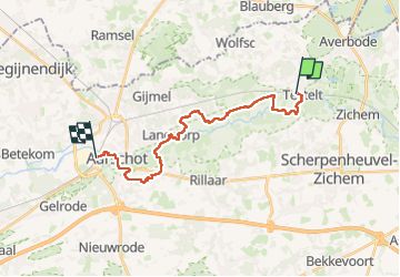
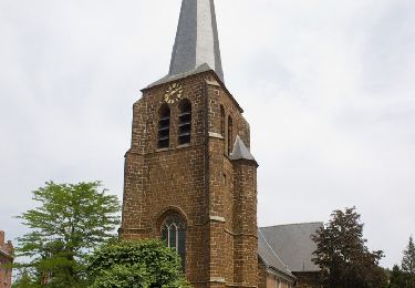
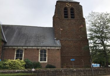
Tocht Stappen van 17,8 km beschikbaar op Vlaanderen, Vlaams-Brabant, Scherpenheuvel-Zichem. Deze tocht wordt voorgesteld door dauzata.
Beschrijving
Départ: Gare de Testelt
Arrivée: Gare d'Aarschot
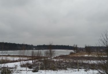
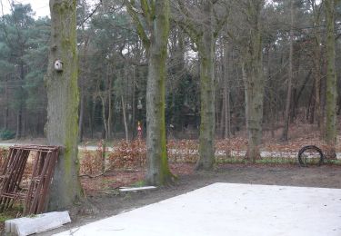
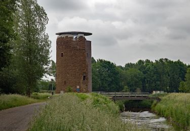
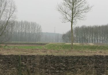
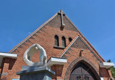
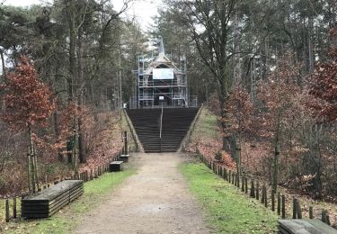
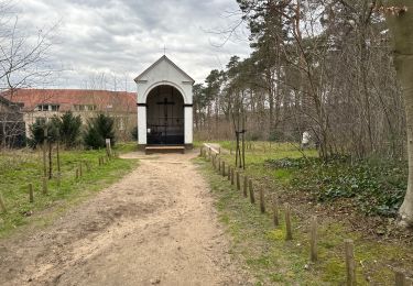
Plaatsbepaling
Land:
Belgium
Regio :
Vlaanderen
Departement/Provincie :
Vlaams-Brabant
Gemeente :
Scherpenheuvel-Zichem
Locatie:
Testelt
Vertrek:(Dec)
Vertrek:(UTM)
636607 ; 5652705 (31U) N.
Opmerkingen
Wandeltochten in de omgeving
![Tocht Stappen Tessenderlo - Averbode Bos en Heide 1 - Photo](https://media.geolcdn.com/t/375/260/ext.jpg?maxdim=2&url=https%3A%2F%2Fmedia.geolcdn.com%2Ff%2F2cde0cd9-375f-4996-9768-b7a1d9d7074b.jpg)
![Stappen Stappen](https://static1.geolcdn.com/sitytour/trail-icons/101.png)
Averbode Bos en Heide 1
Stappen
Gemakkelijk
(2)
Tessenderlo,
Vlaanderen,
Limburg,
Belgium
![](/images/other/stat-length.png)
10,9 km | 12,7 km-effort
2h 30min
![](https://static1.geolcdn.com/siteimages/upload/files/16400158638029165_repeat_loop_refresh_sync_direction_icon.png)
Ja
![Tocht Te voet Aarschot - Heimolenroute - Photo](https://media.geolcdn.com/t/375/260/ext.jpg?maxdim=2&url=https%3A%2F%2Fmedia.geolcdn.com%2Ff%2Fbc91edd0-c1b9-4371-8910-3634b29b6ecb.jpeg)
![Te voet Te voet](https://static1.geolcdn.com/sitytour/trail-icons/100.png)
Heimolenroute
Te voet
Gemakkelijk
Aarschot,
Vlaanderen,
Vlaams-Brabant,
Belgium
![](/images/other/stat-length.png)
6,9 km | 7,8 km-effort
1h 46min
![](https://static1.geolcdn.com/siteimages/upload/files/16400158638029165_repeat_loop_refresh_sync_direction_icon.png)
Ja
![Tocht Te voet Scherpenheuvel-Zichem - Demerbroeken Oranje bol - Photo](https://media.geolcdn.com/t/375/260/ext.jpg?maxdim=2&url=https%3A%2F%2Fmedia.geolcdn.com%2Ff%2F775e052a-ce6f-4462-9c7b-4e4daa1fa011.jpeg)
![Te voet Te voet](https://static1.geolcdn.com/sitytour/trail-icons/100.png)
Demerbroeken Oranje bol
Te voet
Gemakkelijk
Scherpenheuvel-Zichem,
Vlaanderen,
Vlaams-Brabant,
Belgium
![](/images/other/stat-length.png)
5,8 km | 6,4 km-effort
1h 27min
![](https://static1.geolcdn.com/siteimages/upload/files/16400158638029165_repeat_loop_refresh_sync_direction_icon.png)
Ja
![Tocht Te voet Scherpenheuvel-Zichem - Demerbroeken Rode driehoek - Photo](https://media.geolcdn.com/t/375/260/ext.jpg?maxdim=2&url=https%3A%2F%2Fmedia.geolcdn.com%2Ff%2Fb8ba7ae9-c0ac-4a35-8696-65f6c1b52038.jpeg)
![Te voet Te voet](https://static1.geolcdn.com/sitytour/trail-icons/100.png)
Demerbroeken Rode driehoek
Te voet
Gemakkelijk
Scherpenheuvel-Zichem,
Vlaanderen,
Vlaams-Brabant,
Belgium
![](/images/other/stat-length.png)
8,9 km | 10 km-effort
2h 16min
![](https://static1.geolcdn.com/siteimages/upload/files/16400158638029165_repeat_loop_refresh_sync_direction_icon.png)
Ja
![Tocht Te voet Aarschot - Rillaarse Heuvelswandeling - Photo](https://media.geolcdn.com/t/375/260/ext.jpg?maxdim=2&url=https%3A%2F%2Fmedia.geolcdn.com%2Ff%2F2883ed0c-1972-44a3-9264-788ac17d3bac.jpeg)
![Te voet Te voet](https://static1.geolcdn.com/sitytour/trail-icons/100.png)
Rillaarse Heuvelswandeling
Te voet
Gemakkelijk
Aarschot,
Vlaanderen,
Vlaams-Brabant,
Belgium
![](/images/other/stat-length.png)
12,2 km | 14,6 km-effort
3h 18min
![](https://static1.geolcdn.com/siteimages/upload/files/16400158638029165_repeat_loop_refresh_sync_direction_icon.png)
Ja
![Tocht Stappen Scherpenheuvel-Zichem - averbode 16,5 km - Photo](https://media.geolcdn.com/t/375/260/ext.jpg?maxdim=2&url=https%3A%2F%2Fservices.sitytrail.com%2FGeolivesWS%2FDownloadMedia.ashx%3FTrailID%3D1108116%26Media%3D20190209143100.jpg)
![Stappen Stappen](https://static1.geolcdn.com/sitytour/trail-icons/101.png)
averbode 16,5 km
Stappen
Heel gemakkelijk
Scherpenheuvel-Zichem,
Vlaanderen,
Vlaams-Brabant,
Belgium
![](/images/other/stat-length.png)
17,1 km | 19,6 km-effort
4h 15min
![](https://static1.geolcdn.com/siteimages/upload/files/16400158638029165_repeat_loop_refresh_sync_direction_icon.png)
Ja
![Tocht Stappen Scherpenheuvel-Zichem - Averbode Hertberg 17,1 km - Photo](https://media.geolcdn.com/t/375/260/ext.jpg?maxdim=2&url=https%3A%2F%2Fmedia.geolcdn.com%2Ff%2F523f3a4f-54f4-42d3-bdf4-8699c3a9b38a.jpg)
![Stappen Stappen](https://static1.geolcdn.com/sitytour/trail-icons/101.png)
Averbode Hertberg 17,1 km
Stappen
Medium
Scherpenheuvel-Zichem,
Vlaanderen,
Vlaams-Brabant,
Belgium
![](/images/other/stat-length.png)
17,1 km | 19,7 km-effort
4h 52min
![](https://static1.geolcdn.com/siteimages/upload/files/16400158638029165_repeat_loop_refresh_sync_direction_icon.png)
Ja
![Tocht Te voet Scherpenheuvel-Zichem - Demerbroeken Blauwe ruit - Photo](https://media.geolcdn.com/t/375/260/ext.jpg?maxdim=2&url=https%3A%2F%2Fmedia.geolcdn.com%2Ff%2F8dda6c78-a391-4423-b3b3-92d225b48824.jpeg)
![Te voet Te voet](https://static1.geolcdn.com/sitytour/trail-icons/100.png)
Demerbroeken Blauwe ruit
Te voet
Gemakkelijk
Scherpenheuvel-Zichem,
Vlaanderen,
Vlaams-Brabant,
Belgium
![](/images/other/stat-length.png)
3,6 km | 4,2 km-effort
57min
![](https://static1.geolcdn.com/siteimages/upload/files/16400158638029165_repeat_loop_refresh_sync_direction_icon.png)
Ja
![Tocht Stappen Scherpenheuvel-Zichem - Testelt Averbode 24 km - Photo](https://media.geolcdn.com/t/375/260/ext.jpg?maxdim=2&url=https%3A%2F%2Fservices.sitytrail.com%2FGeolivesWS%2FDownloadMedia.ashx%3FTrailID%3D1036218%26Media%3D20180908155010.jpg)
![Stappen Stappen](https://static1.geolcdn.com/sitytour/trail-icons/101.png)
Testelt Averbode 24 km
Stappen
Gemakkelijk
Scherpenheuvel-Zichem,
Vlaanderen,
Vlaams-Brabant,
Belgium
![](/images/other/stat-length.png)
25 km | 28 km-effort
5h 40min
![](https://static1.geolcdn.com/siteimages/upload/files/16400158638029165_repeat_loop_refresh_sync_direction_icon.png)
Ja