Tocht Stappen Serralongue - serralongue Tours de Cabrens_T - Photo

serralongue Tours de Cabrens_T

 force
force

Gebruiker

© OpenStreetMap contributors
Lengte
Lengte
13,3 km
Max. hoogte
Max. hoogte
1313 m
Positief hoogteverschil
635 m
Km-Effort
Km-Effort  
22 km
Min. hoogte
Min. hoogte
698 m
Negatief hoogteverschil
636 m
Boucle
Boucle
Ja
Datum van aanmaak :
2018-03-23 00:00:00.0
Laatste wijziging :
2018-03-23 00:00:00.0

(0 Bericht)

Stappen
Stappen
4h39
Moeilijkheid : Medium

Scan deze QR-code om de tocht te openen in de SityTrail-applicatie

Gratisgps-wandelapplicatie

Logo SityTrail SityTrail

IGN / Geografische instituten

SityTrail uit de App Store downloaden SityTrail uit Google Play downloaden

Logo SityTrail SityTrail World

De wereld gaat voor u open

SityTrail uit de App Store downloaden SityTrail uit Google Play downloaden SityTrail op Huawei AppGallery downloaden

Over ons

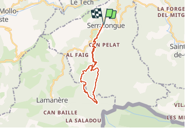
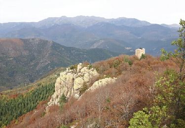
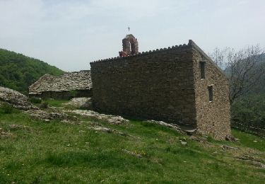
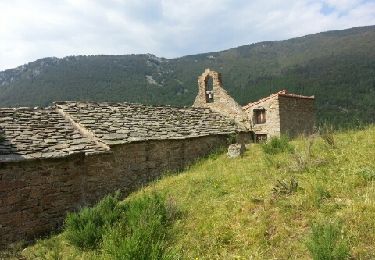
Tocht Stappen van 13,3 km beschikbaar op Occitanië, Pyrénées-Orientales, Serralongue. Deze tocht wordt voorgesteld door force.

Beschrijving

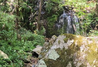
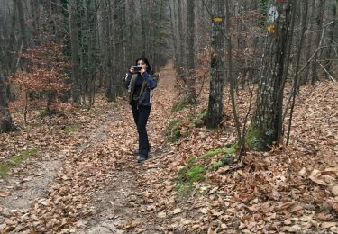
Départ de l'école rando protégée de la tramontane, beaux sous bois

Hoogteprofiel

Foto's

Plaatsbepaling

Land:
France
Regio :
Occitanië
Departement/Provincie :
Pyrénées-Orientales
Gemeente :
Serralongue
Locatie:
Unknown
Vertrek:(Dec)
Vertrek:(UTM)
463333 ; 4693979 (31T) N.

Wandeltochten in de omgeving

Tocht Stappen Le Tech - l,allau st guillem - Photo
Stappen
66Gribouille83

Stappen

Zeer moeilijk
Le Tech, Occitanië, Pyrénées-Orientales, France
12,1 km | 19,5 km-effort
5h 27min
Ja
Tocht Stappen Montferrer - montferer - Photo
Stappen
66Gribouille83

Stappen

Moeilijk
(1)
Montferrer, Occitanië, Pyrénées-Orientales, France
11,8 km | 16,9 km-effort
5h 32min
Ja
Tocht Stappen Le Tech - 3 - Photo
Stappen
ricou1964

Stappen

Gemakkelijk
Le Tech, Occitanië, Pyrénées-Orientales, France
15,1 km | 23 km-effort
4h 21min
Ja
Tocht Stappen Saint-Laurent-de-Cerdans - St laurent de cerdans - Photo
Stappen
peillo

Stappen

Heel gemakkelijk
Saint-Laurent-de-Cerdans, Occitanië, Pyrénées-Orientales, France
10,2 km | 13,9 km-effort
3h 6min
Neen
Tocht Stappen Lamanère - lamanere-coral_T - Photo
Stappen
force

Stappen

Heel gemakkelijk
Lamanère, Occitanië, Pyrénées-Orientales, France
14,9 km | 25 km-effort
5h 18min
Ja
Tocht Stappen Lamanère - Lamanere_PuigDeComaNegra_T - Photo
Stappen
force

Stappen

Heel gemakkelijk
(1)
Lamanère, Occitanië, Pyrénées-Orientales, France
15,9 km | 28 km-effort
5h 48min
Ja
Tocht Stappen Lamanère - Tours de Cabrens - Photo
Stappen
jcmartin

Stappen

Medium
Lamanère, Occitanië, Pyrénées-Orientales, France
12 km | 19,6 km-effort
4h 14min
Ja
Tocht Stappen Le Tech - Col de la roue Saint Guilhem - Photo
Stappen
force

Stappen

Gemakkelijk
(1)
Le Tech, Occitanië, Pyrénées-Orientales, France
15,2 km | 23 km-effort
5h 16min
Ja
Tocht Stappen Le Tech - Ermitage Saint Guilem Puig Del Pastors - Photo
Stappen
force

Stappen

Medium
Le Tech, Occitanië, Pyrénées-Orientales, France
16,7 km | 30 km-effort
6h 16min
Ja


Sluiten
Mijn abonnementen