Tocht Stappen Corneilla-del-Vercol - CORNEILLA-DEL-VERCOL 66 - THEZA - l'Agouille de la Mar - le VERCOL - Photo

CORNEILLA-DEL-VERCOL 66 - THEZA - l'Agouille de la Mar - le VERCOL

 jeff66
jeff66

Gebruiker

© OpenStreetMap contributors
Lengte
Lengte
12,3 km
Max. hoogte
Max. hoogte
20 m
Positief hoogteverschil
56 m
Km-Effort
Km-Effort  
13,1 km
Min. hoogte
Min. hoogte
3 m
Negatief hoogteverschil
56 m
Boucle
Boucle
Ja
Datum van aanmaak :
2015-06-30 00:00:00.0
Laatste wijziging :
2015-06-30 00:00:00.0

(1 Bericht)

Stappen
Stappen
2h12
Moeilijkheid : Gemakkelijk

Scan deze QR-code om de tocht te openen in de SityTrail-applicatie

Gratisgps-wandelapplicatie

Logo SityTrail SityTrail

IGN / Geografische instituten

SityTrail uit de App Store downloaden SityTrail uit Google Play downloaden

Logo SityTrail SityTrail World

De wereld gaat voor u open

SityTrail uit de App Store downloaden SityTrail uit Google Play downloaden SityTrail op Huawei AppGallery downloaden

Over ons

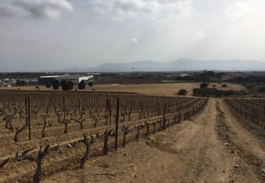
Tocht Stappen van 12,3 km beschikbaar op Occitanië, Pyrénées-Orientales, Corneilla-del-Vercol. Deze tocht wordt voorgesteld door jeff66.

Beschrijving

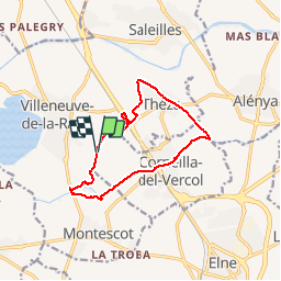
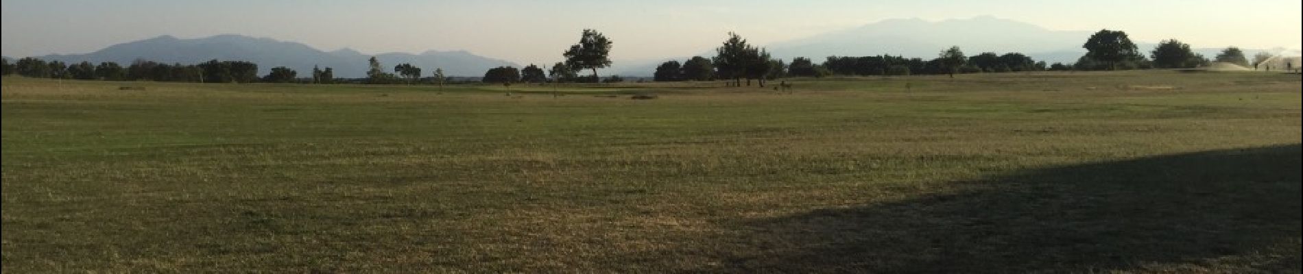
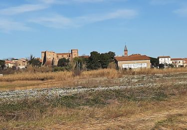
CORNEILLA-DEL-VERCOL 66 - Les Fontetes - Les Closes - bretelle sur N114 - La traces sa  - la Podadora - THEZA - lot. Quinze Olius - mas Sant Joan - l'Oratori - tombe - rue Carolus Magnus - rue du canal - Christ - chemin de Charlemagne - Negabous - mas de la méridienne - le petit mas blanc - l'Agouille de la Mar - station d'épuration - Chapelle du Paradis - parcours sportif - Corneilla del vercol - aires de jeux - cimetière - rue du canal - passage le long de l'agouille sous la RN 114 et la voie ferrée - berges de l'agouille Prairies du Vercol et ALBERES - La Bassetta - Prat del Roc - passages à gués et ponts - allée de mûriers centenaires - mas Bellrich - château d'Avallrich - la Colomina d'en Vidal - golf club de Villeneuve de la Raho - les Rotes - Val Marie

Hoogteprofiel

Foto's

24 fotos in totaal. Klik op een foto om ze allemaal in de galerij weer te geven.

Plaatsbepaling

Land:
France
Regio :
Occitanië
Departement/Provincie :
Pyrénées-Orientales
Gemeente :
Corneilla-del-Vercol
Locatie:
Unknown
Vertrek:(Dec)
Vertrek:(UTM)
494357 ; 4719407 (31T) N.

Opmerkingen

Gelieve in te loggen om een commentaar of een beoordeling achter te laten


Wandeltochten in de omgeving

Tocht Quad Montescot -  Villeneuve-de-la-Raho-Collioure (Septembre/Juin) - Photo
Quad
Quad Ride

Quad

Medium
(1)
Montescot, Occitanië, Pyrénées-Orientales, France
33 km | 40 km-effort
1h 45min
Neen
Tocht Stappen Montescot - 66 VILLENEUVE-DE-LA-RAHO grand tour du lac en Sens horaire  - Photo
Stappen
jeff66

Stappen

Gemakkelijk
(1)
Montescot, Occitanië, Pyrénées-Orientales, France
6,7 km | 7,5 km-effort
1h 4min
Ja
Tocht Stappen Théza - 66 THEZA - CORNEILLA-DEL-VERCOL - Photo
Stappen
jeff66

Stappen

Gemakkelijk
(2)
Théza, Occitanië, Pyrénées-Orientales, France
7 km | 7,5 km-effort
1h 8min
Ja
Tocht Stappen Villeneuve-de-la-Raho - 66 VILLENEUVE-DE-LA-RAHO - grand tour périphérique du lac par les lignes de crêtes  - Photo
Stappen
jeff66

Stappen

Gemakkelijk
(2)
Villeneuve-de-la-Raho, Occitanië, Pyrénées-Orientales, France
10 km | 11,5 km-effort
1h 44min
Ja
Tocht Stappen Saleilles - 66 SALEILLES - St-NAZAIRE, entre FOSSEILLE et REART - Photo
Stappen
jeff66

Stappen

Gemakkelijk
(1)
Saleilles, Occitanië, Pyrénées-Orientales, France
7,3 km | 7,7 km-effort
1h 8min
Ja
Tocht Stappen Corneilla-del-Vercol - thématique mo tescot du 18 02 2023 - Photo
Stappen
66Gribouille83

Stappen

Medium
(1)
Corneilla-del-Vercol, Occitanië, Pyrénées-Orientales, France
8,9 km | 9,4 km-effort
1h 57min
Ja
Tocht Stappen Perpignan - Perpignan  - Photo
Stappen
ombrabella

Stappen

Heel gemakkelijk
Perpignan, Occitanië, Pyrénées-Orientales, France
18 km | 19,9 km-effort
2h 23min
Neen
Tocht Stappen Montescot - 66 VILLENEUVE-DE-LA-RAHO grand tour du lac en Sens horaire  - Photo
Stappen
jeff66

Stappen

Gemakkelijk
Montescot, Occitanië, Pyrénées-Orientales, France
6,7 km | 7,5 km-effort
1h 4min
Ja
Tocht Stappen Perpignan - 66 PERPIGNAN - mas Balande, parc des sports, aviateurs, St Martin, MAV, Vertefeuille - Photo
Stappen
jeff66

Stappen

Gemakkelijk
Perpignan, Occitanië, Pyrénées-Orientales, France
10,6 km | 11,6 km-effort
1h 52min
Ja


Sluiten
Mijn abonnementen