


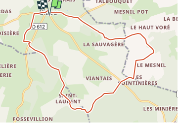

10,6 km | 13,5 km-effort


Gebruiker


Gratisgps-wandelapplicatie
 SityTrail
IGN / Geografische instituten
SityTrail World
De wereld gaat voor u open
Tocht Stappen van 10,1 km beschikbaar op Normandië, Orne, Bizou. Deze tocht wordt voorgesteld door ODDAD78.
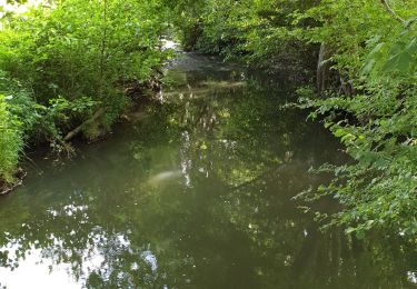
Une variante du PR 'Les Sables du Perche" qui, en contournant la Pannetière emprunte un chemin bordé de très beaux arbres
Les sables du Perche sur Sitytrail :
https://www.sitytrail.com/fr/trails/3673978-bizou--bizou-x-les-sables-du-perche-9x2-kmm/


Stappen
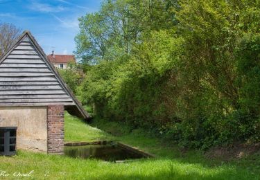
![Tocht Stappen Longny les Villages - [Itinéraire] La Brisardière - Photo](https://media.geolcdn.com/t/375/260/ext.jpg?maxdim=2&url=https%3A%2F%2Fmedia.geolcdn.com%2Ff%2F19108d03-3d8a-43b4-b05b-172408edde68.jpeg)
Stappen
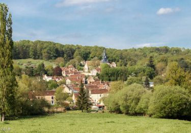
![Tocht Stappen Bizou - [Itinéraire] Les sables du Perche - Photo](https://media.geolcdn.com/t/375/260/ext.jpg?maxdim=2&url=https%3A%2F%2Fmedia.geolcdn.com%2Ff%2F6b586e88-fad3-40df-be07-9b2a61186b9b.jpeg)
Stappen

Te voet
Stappen
Stappen
Stappen
Stappen
Stappen