


3,1 km | 4,9 km-effort
Bezirk Zell am See : Entdecken Sie die besten Touren : 68 zu fuß und 23 wandern. Alle diese Touren, Trails, Routen und Outdoor-Aktivitäten sind in unseren SityTrail-Apps für Smartphones und Tablets verfügbar.
Zu Fuß


• Trail created by Zell am See, Kaprun.
Zu Fuß
• Trail created by Zell am See.
Zu Fuß
• Symbol: violetter Pfeil
Zu Fuß
• Symbol: oranger Pfeil
Zu Fuß
• Symbol: roter Pfeil
Zu Fuß
• Symbol: dunkelblauer Pfeil
Zu Fuß
• Symbol: hellblauer Pfeil
Zu Fuß
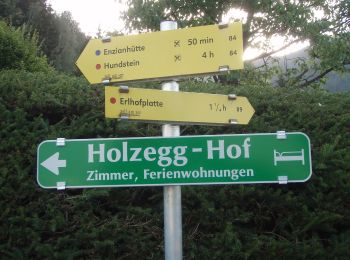
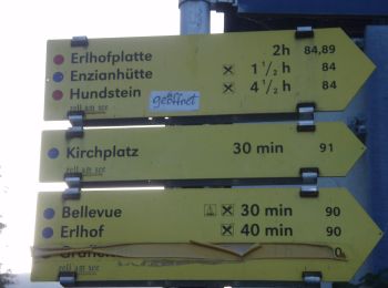
• Symbol: Gelbe Wegweisschilder mit Text und Zahl
Zu Fuß
• Symbol: Gelbe Wegweisschilder mit Text und Zahl
Zu Fuß
• Trail created by OEAV Sektion Lofer. Symbol: Gelbe Wegweisschilder mit Text und Zahl
Zu Fuß
• Symbol: roter Grund weißer Strich
Zu Fuß
• Symbol: rot-weiss-rot 29
Zu Fuß
• http://wiki.openstreetmap.org/index.php?title=WikiProject_Austria/Wanderwege Symbol: rot-weiss-rot 28c
Zu Fuß
• Symbol: rot-weiss-rot 11
Zu Fuß
• http://wiki.openstreetmap.org/index.php?title=WikiProject_Austria/Wanderwege Symbol: rot-weiss-rot 12
Zu Fuß
• Symbol: Gelbe Wegweisschilder mit Text und Zahl
Zu Fuß
• Trail created by OEAV Sektion Warnsdorf/Krimml. http://wiki.openstreetmap.org/index.php?title=WikiProject_Austria/Wa...
Zu Fuß
• Symbol: Weiße Blechschilder mit grünem oberen Rand mit der Aufschrift "Nature.Fitness Park Nordic Walking". In der Mi...
Zu Fuß
• Symbol: Weiße Blechschilder mit grünem oberen Rand mit der Aufschrift "Nature.Fitness Park Nordic Walking". In der Mi...
Zu Fuß
• Trail created by Gerlos. Symbol: Gelbe Blechschilder mit rotem Richtungspfeil und orangem, unteren Rand
20 Angezeigte Touren bei 91
Kostenlosegpshiking-Anwendung
 SityTrail
IGN / Geografische Institute
SityTrail World
Die Welt öffnet sich für Sie