


9,1 km | 17,8 km-effort
La Croix-sur-Roudoule : Entdecken Sie die besten Touren : 2 zu fuß, 20 wandern und 1 pfad. Alle diese Touren, Trails, Routen und Outdoor-Aktivitäten sind in unseren SityTrail-Apps für Smartphones und Tablets verfügbar.

Zu Fuß


• Trail created by Département des Alpes-Maritimes.
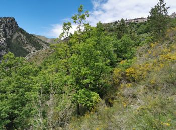
Wandern

Wandern

Wandern

Wandern

Wandern
Wandern

Wandern

Wandern
• Circuit 14 km, + 827 ; Montée par le hameau Amarines et sa chapelle. Crête de Pibossan longue mais bien balisée. Au s...
Wandern
Wandern
• Départ et Arrivée b 233 route de Léouvé Cette randonnée nous conduit aux Amarines, Tête de Pibossan, collet Darmelle,...
Wandern
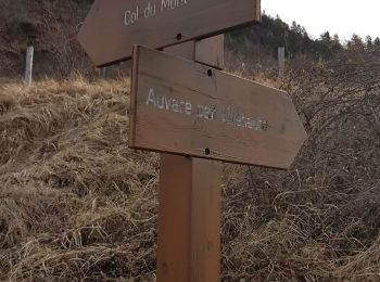
• rando
Wandern
• parking Leouve. 5h. mauvais balisage en haut
Wandern
Wandern
Wandern
Wandern
Wandern

Zu Fuß
Wandern
20 Angezeigte Touren bei 23
Kostenlosegpshiking-Anwendung
 SityTrail
IGN / Geografische Institute
SityTrail World
Die Welt öffnet sich für Sie