


10,1 km | 18,2 km-effort
Templeneiry : Entdecken Sie die besten Touren : 6 zu Fuß. Alle diese Touren, Trails, Routen und Outdoor-Aktivitäten sind in unseren SityTrail-Apps für Smartphones und Tablets verfügbar.
Wandern


•

Wandern
• OPEN MOORE LAND
Wandern
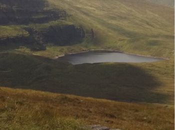
• 5 Lakes view on 6 Mountain peaks in the galtees
Wandern
• 5 Lakes view on 6 Mountain peaks in the galtees
Wandern
• OPEN MOORE LAND
Wandern
6 Angezeigte Touren bei 6
Kostenlosegpshiking-Anwendung
 SityTrail
IGN / Geografische Institute
SityTrail World
Die Welt öffnet sich für Sie