Tour Mountainbike Gacé - Forêt de Chaumont - Gacé - Photo

Forêt de Chaumont - Gacé

 tracegps
tracegps

Benutzer

© OpenStreetMap contributors
Länge
Länge
27 km
Maximale Höhe
Maximale Höhe
315 m
Positive Höhendifferenz
459 m
Km-Effort
Km-Effort  
33 km
Min. Höhe
Min. Höhe
178 m
Negative Höhendifferenz
459 m
Boucle
Boucle
Ja
Erstellungsdatum :
2014-12-10 00:00:00.0
Letzte Änderung :
2014-12-10 00:00:00.0

(0 Nachricht)

Mountainbike
Mountainbike
2h30
Schwierigkeit : Schwierig

Scannen Sie diesen QR-Code, um die Tour in der SityTrail-Anwendung zu öffnen

Kostenlosegpshiking-Anwendung

Logo SityTrail SityTrail

IGN / Geografische Institute

SityTrail aus dem App Store herunterladen SityTrail von Google Play herunterladen

Logo SityTrail SityTrail World

Die Welt öffnet sich für Sie

SityTrail aus dem App Store herunterladen SityTrail von Google Play herunterladen SityTrail auf Huawei AppGallery herunterladen

Über SityTrail

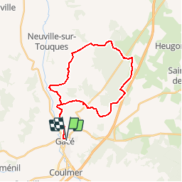
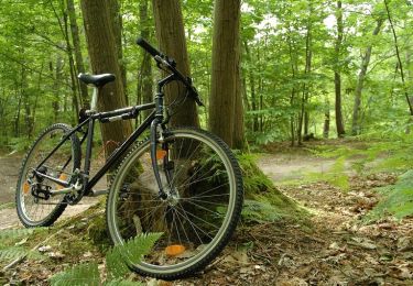
Tour Mountainbike von 27 km verfügbar auf Normandie, Orne, Gacé. Diese Tour wird von tracegps vorgeschlagen.

Beschreibung

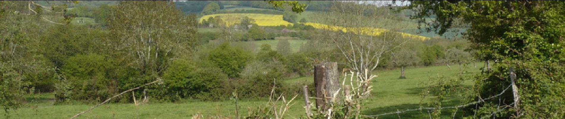
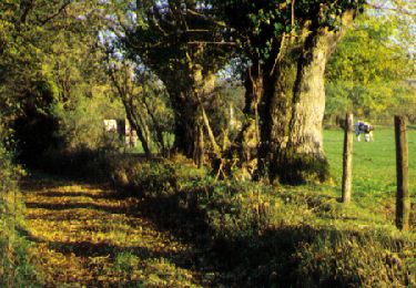
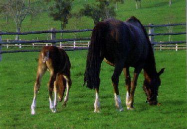
Joli parcours avec des passages aventureux. Une trace nouvelle pour cette région de Gacé dans l'Orne.

Höhenprofil

Foto-Galerie

Ort

Land:
France
Region :
Normandie
Abteilung/Provinz :
Orne
Kommune :
Gacé
Standort:
Unknown
Gehen Sie:(Dec)
Gehen Sie:(UTM)
301521 ; 5408207 (31U) N.

Touren in der Umgebung

Tour Mountainbike Gacé - Espace VTT FFC du Pays d'Auge Ornais- Circuit n°10 - Tour de Résenlieu - Photo
Mountainbike
tracegps

Mountainbike

Medium
Gacé, Normandie, Orne, France
8,3 km | 10,9 km-effort
30min
Ja
Tour Mountainbike Gacé - Espace VTT FFC du Pays d'Auge Ornais- Circuit n°9 - St Evroult de Montfort - Photo
Mountainbike
tracegps

Mountainbike

Medium
Gacé, Normandie, Orne, France
11,1 km | 14,5 km-effort
40min
Ja
Tour Mountainbike Gacé - Espace VTT FFC du Pays d'Auge Ornais- Circuit n°8 - Vallée de la Touques - Photo
Mountainbike
tracegps

Mountainbike

Schwierig
Gacé, Normandie, Orne, France
29 km | 37 km-effort
2h 30min
Ja
Tour 4x4 Orgères - orgere 1 2021 - Photo
4x4
didier76

4x4

Sehr leicht
Orgères, Normandie, Orne, France
38 km | 48 km-effort
3h 15min
Ja
Tour Laufen Ménil-Hubert-en-Exmes - Trail Menil Hubert - Photo
Laufen
sylvain75

Laufen

Medium
Ménil-Hubert-en-Exmes, Normandie, Orne, France
16,4 km | 21 km-effort
Unbekannt
Ja
Tour Wandern Cisai-Saint-Aubin - Cisai St Aubin (boucle) - Photo
Wandern
neitag61

Wandern

Einfach
Cisai-Saint-Aubin, Normandie, Orne, France
5,1 km | 6,8 km-effort
1h 40min
Ja
Tour Wandern Gacé - gace - Photo
Wandern
guy.presier

Wandern

Schwierig
Gacé, Normandie, Orne, France
13,5 km | 16,6 km-effort
3h 50min
Ja
Tour 4x4 Orgères - orgeres  - Photo
4x4
didier76

4x4

Sehr leicht
Orgères, Normandie, Orne, France
44 km | 53 km-effort
3h 7min
Ja
Tour sport Orgères - THN22J1 -200kg ou pilote confirme - Photo
sport
Beaudet Franck

sport

Sehr leicht
Orgères, Normandie, Orne, France
141 km | 170 km-effort
Unbekannt
Ja


Schließen
Meine Abonnements