![](/images/other/stat-length.png)
![Tour Fahrrad Perwez - Alentours de Perwez - Photo](https://media.geolcdn.com/t/1900/400/ext.pjpeg?maxdim=2&url=https%3A%2F%2Fstatic1.geolcdn.com%2Fsiteimages%2Fupload%2Ffiles%2F1524743154velo.jpg)
Alentours de Perwez
jcvroye
Benutzer
![Länge](/images/other/stat-length.png)
Länge
18,3 km
![Maximale Höhe](https://static1.geolcdn.com/siteimages/upload/files/1508320355ic_sort_altitude_max_24dp.png)
Maximale Höhe
167 m
![Positive Höhendifferenz](https://static1.geolcdn.com/siteimages/upload/files/1508320355ic_sort_den_pos_24dp.png)
Positive Höhendifferenz
124 m
![Km-Effort](/images/other/stat-length.png)
Km-Effort
19,9 km
![Min. Höhe](https://static1.geolcdn.com/siteimages/upload/files/1508320355ic_sort_altitude_min_24dp.png)
Min. Höhe
137 m
![Negative Höhendifferenz](https://static1.geolcdn.com/siteimages/upload/files/1508320355ic_sort_den_neg_24dp.png)
Negative Höhendifferenz
124 m
![Boucle](https://static1.geolcdn.com/siteimages/upload/files/16400158638029165_repeat_loop_refresh_sync_direction_icon.png)
Boucle
Ja
Erstellungsdatum :
2014-12-10 00:00:00.0
Letzte Änderung :
2014-12-10 00:00:00.0
![Fahrrad](https://static1.geolcdn.com/sitytour/trail-icons/200.png)
1h10
Schwierigkeit : Medium
![Scannen Sie diesen QR-Code, um die Tour in der SityTrail-Anwendung zu öffnen](https://capi.geolives.com/qq0zvz2zws4bq2lad0pu/sitytour/trails/212955/qr.png?size=200)
Kostenlosegpshiking-Anwendung
Über SityTrail
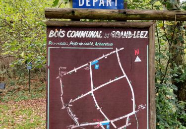
Tour Fahrrad von 18,3 km verfügbar auf Wallonien, Wallonisch-Brabant, Perwez. Diese Tour wird von jcvroye vorgeschlagen.
Beschreibung
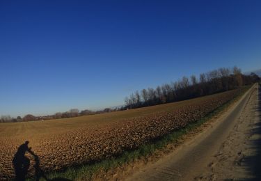
Tour a Vélo familial en famille. 200 M le long de la N91 et retour par rue de Jausselette qui est une mauvaise route pavée
Ort
Land:
Belgium
Region :
Wallonien
Abteilung/Provinz :
Wallonisch-Brabant
Kommune :
Perwez
Standort:
Perwez
Gehen Sie:(Dec)
Gehen Sie:(UTM)
628379 ; 5609572 (31U) N.
Kommentare
Touren in der Umgebung
![Tour Wandern Gembloux - Promenade du bois de Grand-Leez et son étang - Photo](https://media.geolcdn.com/t/375/260/ext.jpg?maxdim=2&url=https%3A%2F%2Fmedia.geolcdn.com%2Ff%2Fba1705cc-caee-4df6-9c00-ffee46de9677.jpg)
![Wandern Wandern](https://static1.geolcdn.com/sitytour/trail-icons/101.png)
Promenade du bois de Grand-Leez et son étang
Wandern
Einfach
(2)
Gembloux,
Wallonien,
Namur,
Belgium
![](/images/other/stat-length.png)
3,1 km | 3,6 km-effort
49min
![](https://static1.geolcdn.com/siteimages/upload/files/16400158638029165_repeat_loop_refresh_sync_direction_icon.png)
Ja
![Tour Wandern Perwez - #230102 - Perwez > Ponceau, dont 4 km du GRP127 - Photo](https://media.geolcdn.com/t/375/260/ext.jpg?maxdim=2&url=https%3A%2F%2Fstatic1.geolcdn.com%2Fsiteimages%2Fupload%2Ffiles%2F1553511878bg_sport_marche.png)
![Wandern Wandern](https://static1.geolcdn.com/sitytour/trail-icons/101.png)
#230102 - Perwez > Ponceau, dont 4 km du GRP127
Wandern
Sehr leicht
(2)
Perwez,
Wallonien,
Wallonisch-Brabant,
Belgium
![](/images/other/stat-length.png)
7,2 km | 8 km-effort
Unbekannt
![](https://static1.geolcdn.com/siteimages/upload/files/16400158638029165_repeat_loop_refresh_sync_direction_icon.png)
Ja
![Tour Mountainbike Perwez - SityTrail - 2608640 - perwez-1 - Photo](https://media.geolcdn.com/t/375/260/ext.jpg?maxdim=2&url=https%3A%2F%2Fmedia.geolcdn.com%2Ff%2F9da5341c-deda-4146-804a-b030fecad022.JPG)
![Mountainbike Mountainbike](https://static1.geolcdn.com/sitytour/trail-icons/202.png)
SityTrail - 2608640 - perwez-1
Mountainbike
Sehr leicht
Perwez,
Wallonien,
Wallonisch-Brabant,
Belgium
![](/images/other/stat-length.png)
37 km | 41 km-effort
Unbekannt
![](https://static1.geolcdn.com/siteimages/upload/files/16400158638029165_repeat_loop_refresh_sync_direction_icon.png)
Ja
![Tour Wandern Perwez - w-belgie-la-balade-de-3-clochers - Photo](https://media.geolcdn.com/t/375/260/ext.jpg?maxdim=2&url=https%3A%2F%2Fstatic1.geolcdn.com%2Fsiteimages%2Fupload%2Ffiles%2F1553511878bg_sport_marche.png)
![Wandern Wandern](https://static1.geolcdn.com/sitytour/trail-icons/101.png)
w-belgie-la-balade-de-3-clochers
Wandern
Sehr leicht
(1)
Perwez,
Wallonien,
Wallonisch-Brabant,
Belgium
![](/images/other/stat-length.png)
7,8 km | 8,9 km-effort
Unbekannt
![](https://static1.geolcdn.com/siteimages/upload/files/16400158638029165_repeat_loop_refresh_sync_direction_icon.png)
Ja
![Tour Wandern Perwez - #221014 - Orbais, balade de La Brigade Piron (Rando Perwez) - Photo](https://media.geolcdn.com/t/375/260/ext.jpg?maxdim=2&url=https%3A%2F%2Fmedia.geolcdn.com%2Ff%2Ff755bfcc-c5f3-4388-9ac4-113fc1caeb9e.JPG)
![Wandern Wandern](https://static1.geolcdn.com/sitytour/trail-icons/101.png)
#221014 - Orbais, balade de La Brigade Piron (Rando Perwez)
Wandern
Medium
(1)
Perwez,
Wallonien,
Wallonisch-Brabant,
Belgium
![](/images/other/stat-length.png)
7,4 km | 8,2 km-effort
1h 51min
![](https://static1.geolcdn.com/siteimages/upload/files/16400158638029165_repeat_loop_refresh_sync_direction_icon.png)
Ja
![Tour Wandern Gembloux - autour de Grand-leez - Photo](https://media.geolcdn.com/t/375/260/ext.jpg?maxdim=2&url=https%3A%2F%2Fmedia.geolcdn.com%2Ff%2Fa183186e-d7dc-481f-9ac2-9beeb32c3da6.jpg)
![Wandern Wandern](https://static1.geolcdn.com/sitytour/trail-icons/101.png)
autour de Grand-leez
Wandern
Einfach
(1)
Gembloux,
Wallonien,
Namur,
Belgium
![](/images/other/stat-length.png)
7 km | 7,7 km-effort
2h 7min
![](https://static1.geolcdn.com/siteimages/upload/files/16400158638029165_repeat_loop_refresh_sync_direction_icon.png)
Ja
![Tour Wandern Gembloux - ELVOBAL-GRAND LEEZ-11 KMS-mai 21. - Photo](https://media.geolcdn.com/t/375/260/ext.jpg?maxdim=2&url=https%3A%2F%2Fstatic1.geolcdn.com%2Fsiteimages%2Fupload%2Ffiles%2F1553511878bg_sport_marche.png)
![Wandern Wandern](https://static1.geolcdn.com/sitytour/trail-icons/101.png)
ELVOBAL-GRAND LEEZ-11 KMS-mai 21.
Wandern
Medium
(1)
Gembloux,
Wallonien,
Namur,
Belgium
![](/images/other/stat-length.png)
11,3 km | 12,4 km-effort
2h 34min
![](https://static1.geolcdn.com/siteimages/upload/files/16400158638029165_repeat_loop_refresh_sync_direction_icon.png)
Ja
![Tour Wandern Ramillies - PR 24.10.14- Petit Rosières - Photo](https://media.geolcdn.com/t/375/260/ext.jpg?maxdim=2&url=https%3A%2F%2Fstatic1.geolcdn.com%2Fsiteimages%2Fupload%2Ffiles%2F1553511878bg_sport_marche.png)
![Wandern Wandern](https://static1.geolcdn.com/sitytour/trail-icons/101.png)
PR 24.10.14- Petit Rosières
Wandern
Sehr leicht
(2)
Ramillies,
Wallonien,
Wallonisch-Brabant,
Belgium
![](/images/other/stat-length.png)
9 km | 9,7 km-effort
2h 10min
![](https://static1.geolcdn.com/siteimages/upload/files/16400158638029165_repeat_loop_refresh_sync_direction_icon.png)
Ja
![Tour Wandern Ramillies - Germpont - Photo](https://media.geolcdn.com/t/375/260/ext.jpg?maxdim=2&url=https%3A%2F%2Fservices.sitytrail.com%2FGeolivesWS%2FDownloadMedia.ashx%3FTrailID%3D244450%26Media%3Dfix__20140124101746.jpg)
![Wandern Wandern](https://static1.geolcdn.com/sitytour/trail-icons/101.png)
Germpont
Wandern
Einfach
Ramillies,
Wallonien,
Wallonisch-Brabant,
Belgium
![](/images/other/stat-length.png)
9,6 km | 10,4 km-effort
2h 4min
![](https://static1.geolcdn.com/siteimages/upload/files/16400158638029165_repeat_loop_refresh_sync_direction_icon.png)
Ja