![](/images/other/stat-length.png)
![Tour Zu Fuß Salz - BlasiusSteig - Photo](https://media.geolcdn.com/t/1900/400/ext.pjpeg?maxdim=2&url=https%3A%2F%2Fmedia.geolcdn.com%2Ff%2F9e2c83da-cd5c-485d-a485-068b8337360d.jpeg)
BlasiusSteig
SityTrail - itinéraires balisés pédestres
Tous les sentiers balisés d’Europe PRO
![Länge](/images/other/stat-length.png)
Länge
19,6 km
![Maximale Höhe](https://static1.geolcdn.com/siteimages/upload/files/1508320355ic_sort_altitude_max_24dp.png)
Maximale Höhe
442 m
![Positive Höhendifferenz](https://static1.geolcdn.com/siteimages/upload/files/1508320355ic_sort_den_pos_24dp.png)
Positive Höhendifferenz
437 m
![Km-Effort](/images/other/stat-length.png)
Km-Effort
25 km
![Min. Höhe](https://static1.geolcdn.com/siteimages/upload/files/1508320355ic_sort_altitude_min_24dp.png)
Min. Höhe
162 m
![Negative Höhendifferenz](https://static1.geolcdn.com/siteimages/upload/files/1508320355ic_sort_den_neg_24dp.png)
Negative Höhendifferenz
446 m
![Boucle](https://static1.geolcdn.com/siteimages/upload/files/16400158638029165_repeat_loop_refresh_sync_direction_icon.png)
Boucle
Ja
Kennzeichnung
Erstellungsdatum :
2022-02-11 20:19:56.62
Letzte Änderung :
2022-02-11 20:19:56.62
![Zu Fuß](https://static1.geolcdn.com/sitytour/trail-icons/100.png)
5h47
Schwierigkeit : Medium
![Scannen Sie diesen QR-Code, um die Tour in der SityTrail-Anwendung zu öffnen](https://capi.geolives.com/qq0zvz2zws4bq2lad0pu/sitytour/trails/3101679/qr.png?size=200)
Kostenlosegpshiking-Anwendung
Über SityTrail
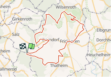
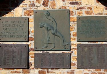
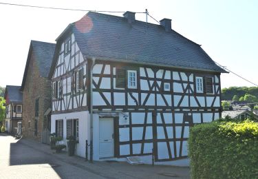
Tour Zu Fuß von 19,6 km verfügbar auf Rheinland-Pfalz, Westerwaldkreis, Salz. Diese Tour wird von SityTrail - itinéraires balisés pédestres vorgeschlagen.
Beschreibung
Trail created by VVV Frickhofen, Dorndorf Thalheim.
Ort
Land:
Germany
Region :
Rheinland-Pfalz
Abteilung/Provinz :
Westerwaldkreis
Kommune :
Salz
Standort:
Unknown
Gehen Sie:(Dec)
Gehen Sie:(UTM)
427390 ; 5594230 (32U) N.
Kommentare
Touren in der Umgebung
![Tour Zu Fuß Limburg a. d. Lahn - Südroute Limburg - Photo](https://media.geolcdn.com/t/375/260/ext.jpg?maxdim=2&url=https%3A%2F%2Fmedia.geolcdn.com%2Ff%2F9b48fb64-2330-4cb9-82e9-adc99cc19a96.jpeg)
![Zu Fuß Zu Fuß](https://static1.geolcdn.com/sitytour/trail-icons/100.png)
Südroute Limburg
Zu Fuß
Einfach
Limburg a. d. Lahn,
Hessen,
Landkreis Limburg-Weilburg,
Germany
![](/images/other/stat-length.png)
11,8 km | 14 km-effort
3h 10min
![](https://static1.geolcdn.com/siteimages/upload/files/16400158638029165_repeat_loop_refresh_sync_direction_icon.png)
Nein
![Tour Zu Fuß Bad Camberg - Rundwanderweg Oberselters 2 - Photo](https://media.geolcdn.com/t/375/260/ext.jpg?maxdim=2&url=https%3A%2F%2Fmedia.geolcdn.com%2Ff%2F93fc9f0c-4f78-4b86-ae2c-ee6e5fd91f0e.jpeg)
![Zu Fuß Zu Fuß](https://static1.geolcdn.com/sitytour/trail-icons/100.png)
Rundwanderweg Oberselters 2
Zu Fuß
Einfach
Bad Camberg,
Hessen,
Landkreis Limburg-Weilburg,
Germany
![](/images/other/stat-length.png)
3,1 km | 4,7 km-effort
1h 4min
![](https://static1.geolcdn.com/siteimages/upload/files/16400158638029165_repeat_loop_refresh_sync_direction_icon.png)
Nein
![Tour Zu Fuß - Köppelweg 2 - Photo](https://media.geolcdn.com/t/375/260/ext.jpg?maxdim=2&url=https%3A%2F%2Fmedia.geolcdn.com%2Ff%2Fe9a4061d-70f3-4651-9683-0790a4820193.jpeg)
![Zu Fuß Zu Fuß](https://static1.geolcdn.com/sitytour/trail-icons/100.png)
Köppelweg 2
Zu Fuß
Einfach
,
Rheinland-Pfalz,
Westerwaldkreis,
Germany
![](/images/other/stat-length.png)
11,4 km | 15,2 km-effort
3h 27min
![](https://static1.geolcdn.com/siteimages/upload/files/16400158638029165_repeat_loop_refresh_sync_direction_icon.png)
Ja
![Tour Zu Fuß Hillscheid - Köppelweg 1 - Photo](https://media.geolcdn.com/t/375/260/ext.jpg?maxdim=2&url=https%3A%2F%2Fmedia.geolcdn.com%2Ff%2Fbd75c0bc-ee28-4d76-9a01-1e7c14d307d0.jpeg)
![Zu Fuß Zu Fuß](https://static1.geolcdn.com/sitytour/trail-icons/100.png)
Köppelweg 1
Zu Fuß
Einfach
Hillscheid,
Rheinland-Pfalz,
Westerwaldkreis,
Germany
![](/images/other/stat-length.png)
11,3 km | 14,7 km-effort
3h 19min
![](https://static1.geolcdn.com/siteimages/upload/files/16400158638029165_repeat_loop_refresh_sync_direction_icon.png)
Nein
![Tour Zu Fuß Montabaur - Köppelweg 3 - Photo](https://media.geolcdn.com/t/375/260/ext.jpg?maxdim=2&url=https%3A%2F%2Fmedia.geolcdn.com%2Ff%2Fe9a4061d-70f3-4651-9683-0790a4820193.jpeg)
![Zu Fuß Zu Fuß](https://static1.geolcdn.com/sitytour/trail-icons/100.png)
Köppelweg 3
Zu Fuß
Einfach
Montabaur,
Rheinland-Pfalz,
Westerwaldkreis,
Germany
![](/images/other/stat-length.png)
13 km | 16,9 km-effort
3h 50min
![](https://static1.geolcdn.com/siteimages/upload/files/16400158638029165_repeat_loop_refresh_sync_direction_icon.png)
Ja
![Tour Zu Fuß Diez - Halfterweg - Photo](https://media.geolcdn.com/t/375/260/ext.jpg?maxdim=2&url=https%3A%2F%2Fmedia.geolcdn.com%2Ff%2F6089030c-7b07-41da-a831-245903a717d7.jpeg)
![Zu Fuß Zu Fuß](https://static1.geolcdn.com/sitytour/trail-icons/100.png)
Halfterweg
Zu Fuß
Medium
Diez,
Rheinland-Pfalz,
Rhein-Lahn-Kreis,
Germany
![](/images/other/stat-length.png)
18,5 km | 24 km-effort
5h 24min
![](https://static1.geolcdn.com/siteimages/upload/files/16400158638029165_repeat_loop_refresh_sync_direction_icon.png)
Nein
![Tour Zu Fuß Girod - Wäller Tour Eisenbachtal - Photo](https://media.geolcdn.com/t/375/260/ext.jpg?maxdim=2&url=https%3A%2F%2Fmedia.geolcdn.com%2Ff%2Fd13878c7-5a2d-4bdf-8a45-ef0868f46f53.jpeg)
![Zu Fuß Zu Fuß](https://static1.geolcdn.com/sitytour/trail-icons/100.png)
Wäller Tour Eisenbachtal
Zu Fuß
Einfach
Girod,
Rheinland-Pfalz,
Westerwaldkreis,
Germany
![](/images/other/stat-length.png)
5,9 km | 7,7 km-effort
1h 44min
![](https://static1.geolcdn.com/siteimages/upload/files/16400158638029165_repeat_loop_refresh_sync_direction_icon.png)
Nein
![Tour Zu Fuß Bad Ems - Wäller Tour Augst - Photo](https://media.geolcdn.com/t/375/260/ext.jpg?maxdim=2&url=https%3A%2F%2Fmedia.geolcdn.com%2Ff%2Fa87a8f15-f0f1-4cc0-938d-807aba38e8d8.jpeg)
![Zu Fuß Zu Fuß](https://static1.geolcdn.com/sitytour/trail-icons/100.png)
Wäller Tour Augst
Zu Fuß
Einfach
Bad Ems,
Rheinland-Pfalz,
Rhein-Lahn-Kreis,
Germany
![](/images/other/stat-length.png)
13,7 km | 19,1 km-effort
4h 20min
![](https://static1.geolcdn.com/siteimages/upload/files/16400158638029165_repeat_loop_refresh_sync_direction_icon.png)
Ja
![Tour Zu Fuß Gackenbach - Wäller Tour Buchfinkenland - Photo](https://media.geolcdn.com/t/375/260/ext.jpg?maxdim=2&url=https%3A%2F%2Fmedia.geolcdn.com%2Ff%2Fab9dec02-ee60-4578-b94d-e196a509639c.jpeg)
![Zu Fuß Zu Fuß](https://static1.geolcdn.com/sitytour/trail-icons/100.png)
Wäller Tour Buchfinkenland
Zu Fuß
Einfach
Gackenbach,
Rheinland-Pfalz,
Westerwaldkreis,
Germany
![](/images/other/stat-length.png)
14,3 km | 19,5 km-effort
4h 25min
![](https://static1.geolcdn.com/siteimages/upload/files/16400158638029165_repeat_loop_refresh_sync_direction_icon.png)
Ja