


Epernon Villiers le Morhier houx

topophil
Benutzer
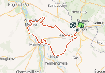

Länge
31 km

Maximale Höhe
162 m

Positive Höhendifferenz
231 m
Km-Effort
34 km

Min. Höhe
96 m

Negative Höhendifferenz
232 m
Boucle
Ja
Erstellungsdatum :
2022-06-02 15:57:42.67
Letzte Änderung :
2022-06-02 18:16:05.42
2h18
Schwierigkeit : Schwierig

Kostenlosegpshiking-Anwendung
 SityTrail
IGN / Geografische Institute
SityTrail Plus
Die Welt öffnet sich für Sie
Über SityTrail
Tour Mountainbike von 31 km verfügbar auf Zentrum-Loiretal, Eure-et-Loir, Épernon. Diese Tour wird von topophil vorgeschlagen.
Ort
Land:
France
Region :
Zentrum-Loiretal
Abteilung/Provinz :
Eure-et-Loir
Kommune :
Épernon
Standort:
Unknown
Gehen Sie:(Dec)
Gehen Sie:(UTM)
401972 ; 5384526 (31U) N.
Kommentare