


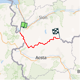
bdr02_Trient_Matterhorn

My Switzerland
Optez pour le retour à la nature GUIDE+

Länge
95 km

Maximale Höhe
4440 m

Positive Höhendifferenz
15024 m
Km-Effort
284 km

Min. Höhe
1123 m

Negative Höhendifferenz
11743 m
Boucle
Nein
Erstellungsdatum :
2014-12-10 00:00:00.0
Letzte Änderung :
2014-12-10 00:00:00.0
67h43
Schwierigkeit : Unbekannt

Kostenlosegpshiking-Anwendung
 SityTrail
IGN / Geografische Institute
SityTrail Plus
Die Welt öffnet sich für Sie
Über SityTrail
Tour Andere Aktivitäten von 95 km verfügbar auf Auvergne-Rhone-Alpen, Hochsavoyen, Vallorcine. Diese Tour wird von My Switzerland vorgeschlagen.


Ort
Land:
France
Region :
Auvergne-Rhone-Alpen
Abteilung/Provinz :
Hochsavoyen
Kommune :
Vallorcine
Standort:
Unknown
Gehen Sie:(Dec)
Gehen Sie:(UTM)
341056 ; 5101709 (32T) N.
Kommentare