Tour Wandern Monchy-Humières - SityTrail - Monchy Humières - Photo

SityTrail - Monchy Humières

 Pachinou
Pachinou

Benutzer

© OpenStreetMap contributors
Länge
Länge
8,7 km
Maximale Höhe
Maximale Höhe
89 m
Positive Höhendifferenz
92 m
Km-Effort
Km-Effort  
9,9 km
Min. Höhe
Min. Höhe
42 m
Negative Höhendifferenz
88 m
Boucle
Boucle
Ja
Erstellungsdatum :
2023-08-05 12:19:52.159
Letzte Änderung :
2023-08-05 12:20:26.902

(1 Nachricht)

Wandern
Wandern
2h15
Schwierigkeit : Medium

Scannen Sie diesen QR-Code, um die Tour in der SityTrail-Anwendung zu öffnen

Kostenlosegpshiking-Anwendung

Logo SityTrail SityTrail

IGN / Geografische Institute

SityTrail aus dem App Store herunterladen SityTrail von Google Play herunterladen

Logo SityTrail SityTrail World

Die Welt öffnet sich für Sie

SityTrail aus dem App Store herunterladen SityTrail von Google Play herunterladen SityTrail auf Huawei AppGallery herunterladen

Über SityTrail

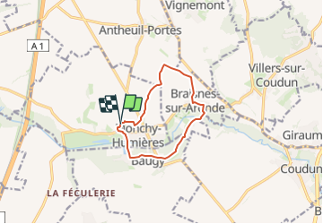
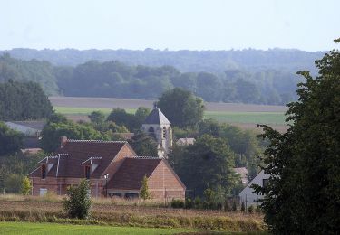
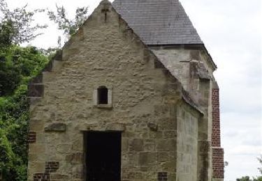
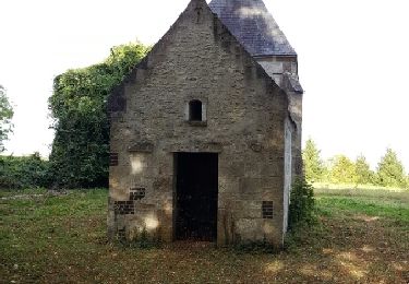
Tour Wandern von 8,7 km verfügbar auf Nordfrankreich, Oise, Monchy-Humières. Diese Tour wird von Pachinou vorgeschlagen.

Höhenprofil

Ort

Land:
France
Region :
Nordfrankreich
Abteilung/Provinz :
Oise
Kommune :
Monchy-Humières
Standort:
Unknown
Gehen Sie:(UTM)
481658 ; 5479983 (31U) N.

Kommentare

Bitte melden Sie sich an, um einen Kommentar oder eine Bewertung zu hinterlassen


Touren in der Umgebung

Tour Zu Fuß Baugy - Circuit du Mont Calvaire - Photo
Zu Fuß
PRO

Zu Fuß

Einfach
Baugy, Nordfrankreich, Oise, France
3,6 km | 4 km-effort
54min
Nein
Tour Wandern Monchy-Humières - Circuit du Mont Calvaire - Monchy Humières - Photo
Wandern
tracegps

Wandern

Medium
Monchy-Humières, Nordfrankreich, Oise, France
10,6 km | 12,5 km-effort
2h 45min
Ja
Tour Wandern Monchy-Humières - mont calvaire - Photo
Wandern
fitz2014

Wandern

Einfach
Monchy-Humières, Nordfrankreich, Oise, France
11,7 km | 13,8 km-effort
2h 54min
Ja
Tour Pferd Vignemont - Circuit de la Fontaine Saint-Pierre - Vignemont - Photo
Pferd
tracegps

Pferd

Medium
Vignemont, Nordfrankreich, Oise, France
4,7 km | 6,1 km-effort
1h 0min
Ja
Tour Mountainbike Vignemont - Circuit de la Fontaine Saint-Pierre - Vignemont - Photo
Mountainbike
tracegps

Mountainbike

Medium
Vignemont, Nordfrankreich, Oise, France
4,7 km | 6,1 km-effort
25min
Ja
Tour Wandern Vignemont - Circuit de la Fontaine Saint-Pierre - Vignemont - Photo
Wandern
tracegps

Wandern

Medium
Vignemont, Nordfrankreich, Oise, France
4,7 km | 6,1 km-effort
1h 15min
Ja
Tour Pferd Villers-sur-Coudun - Villers sur Coudun - Circuit de la Vallée de l'Aronde - Photo
Pferd
tracegps

Pferd

Medium
Villers-sur-Coudun, Nordfrankreich, Oise, France
13,2 km | 15,3 km-effort
2h 0min
Ja
Tour Mountainbike Villers-sur-Coudun - Villers sur Coudun - Circuit de la Vallée de l'Aronde - Photo
Mountainbike
tracegps

Mountainbike

Medium
Villers-sur-Coudun, Nordfrankreich, Oise, France
13,2 km | 15,3 km-effort
1h 15min
Ja
Tour Wandern Villers-sur-Coudun - Villers sur Coudun - Circuit de la Vallée de l'Aronde - Photo
Wandern
tracegps

Wandern

Medium
Villers-sur-Coudun, Nordfrankreich, Oise, France
13,2 km | 15,3 km-effort
3h 15min
Ja


Schließen
Meine Abonnements